 |
ASPB and CIMSS Weekly Report
[ Archive ] |
 |
ASPB AND CIMSS WEEKLY HIGHLIGHTS FOR THE WEEK ENDING FEBRUARY 23, 2007
IN THE PRESS:
ITEMS FOR THE ADMINISTRATOR:
ITEMS FOR THE ASSISTANT ADMINISTRATOR:
ITEMS FOR THE OFFICE DIRECTOR, STAR:
Imager Convective Initiation Algorithm Implementation at EUMETSAT: In
support of aviation Geostationary Operational Environmental Satellite
(GOES)-R Risk Reduction activities, the GOES Imager Convective
Initiation algorithm is currently being implemented by the EUropean
organization for the exploitation of METeorological SATellites
(EUMETSAT, Darmstadt, Germany). This algorithm provides 45-60 minute
lead time for the occurrence of convective initiation (35 dBz radar
return), and is being adapted from the GOES imager to Meteosat Second
Generation (MSG) Spinning Environmental Visible and InfraRedInstrument (SEVIRI) instrument. The algorithm will be run in near
real-time for the Convective Orographic Precipitation Study to be
conducted in southwest Germany in the summer of 2007. (W. Feltz, CIMSS,
608-265-6283, K. Bedka)
PATMOS-x Contributes to BAMS State of Climate Report: A.
Heidinger and A. Evan contributed a section on clouds to the 2006 State
of the Climate report to be published in the Bulletin of the American
Meteorological Society (BAMS). The cloud section discussed the
anomalies of the 2006 distribution cloudiness that were statistically
significant. The cloud data were taken from Advanced Very High
Resolution Radiometer (AVHRR) Pathfinder Atmospheres Extended
(PATMOS-x) climatology developed within NESDIS/STAR and the Cooperative
Institute for Meteorological Satellite Studies (CIMSS).(A. Heidinger,
E/RA2, 608-263-6757, andrew.heidinger@noaa.gov, A. Evan, CIMSS,
608-263-3951)
ITEMS FOR THE DIVISION CHIEF, CoRP:
Advanced Weather Products distributed using Cell Technology: The University of Wisconsin's Space Science and Engineering Center (SSEC) has developed a system for the production and distribution of advance weather displays for presentation on handheld wireless devices. The Personal Digital Assistant (PDA) Animated Weather (PAW) system provides access to a unique set of international products featuring conventional observations blended with satellite derived quantities. Products are specifically formated to be aquired and displayed using off the shelf smartphone technology or any PDA with standard wireless communication. Recently the system demonstrated its potential in Southern Africa during the landfall of tropical Typoon Favio in Mozambique on February 22, 2007. Scientists in South Africa and SSEC collaborated in the design of real-time products that illustrated the position and predicted path of Favio. Images of the cloud field with enhanced satellite derived rain rate were combined with animated streamlines generated form Cloud Drift Wind (CDW) vectors.
(R. Dengel, CIMSS, 608-262-6567)
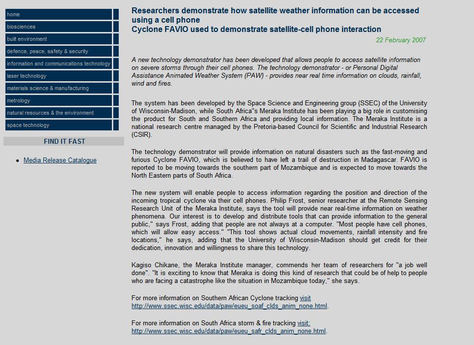 (Click image to enlarge)
Figure caption: Meraka Institute Press Release on the PAW application in South Africa.
Changes to GOES-10 Sounder scanning strategy: On February 18, 2007, the NESDIS Office of Satellite Operations (OSO) implemented a new schedule for Geostationary Operational Environmental Satellite (GOES)-10 sounder scans during house-keeping periods. The change was suggested by Advanced Satellite Products Branch (ASPB) personnel and approved by Central and South American users at a recent telecom. The previous sounder schedule had spatial gaps between the hourly scan sectors during house-keeping outages, while the new sounder schedule allows for continuous north-to-south coverage of the entire South American continent, while making narrower scans. More information can be found at:
http://cimss.ssec.wisc.edu/goes/blog/2007/02/19/changes-to-goes-10-sounder-scanning-strategy/ . (T. Schmit, E/RA2, 608-263-0291, tim.j.schmit@noaa.gov)
Issues Regarding the GOES-12 Imager Calibration: Cooperative Institute for Meteorological Satellite Studies (CIMSS) personnel found that the Geostationary Operational Environmental Satellite (GOES)-12 Imager Cloud Top Pressure product was degraded at approximately 14:00 Universal Coordinated Time (UTC) on February 21, 2007. It turns out that this was due to the fact that at 12:36 UTC, the NESDIS Office of Systems Operations (OSO) began the decontamination of the GOES-12 Imager by turning on the anti-ice heater. A combination of this heating and the calibration mode resulted in different responses from the GOES-12 Imager - especially band 4 (10.7 micrometer), and band 6 (13.3 micrometer) channels. Other products were affected as well. ASPB/CIMSS monitored the calibration and products and showed that the products were 'much improved' at 18:45 UTC after the anti-icing heater was turned off at 12:49 UTC and a calibration mode switch was made at 18:34 UTC on February 22, 2007. T. Schmit participated in a telecon on this issue with NOAA and ITT personnel. (T. Schmit, E/RA2, 608-263-0291, tim.j.schmit@noaa.gov, T. Schreiner, CIMSS, 608-263-6754, J. Nelson, CIMSS, 608-263-6013)
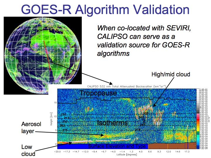
GOES-R Validation Tool Developed: Using newly developed tools, M. Pavolonis and A. Heidinger have begun to analyze Cloud – Aerosol LIDAR (LIght Detection and Ranging) Infrared Pathfinder Satellite Observations (CALIPSO) data from August 2006. CALIPSO, which provides accurate cloud/aerosol boundary and cloud phase information, will be used to validate many of the next generation Geostationary Operational Environmental Satellite (GOES-R) cloud and aerosol retrieval algorithms, including cloud height, phase, and detection. Additional work is underway to integrate space-borne cloud radar data from the Cloud Satellite (CloudSat) into the validation tool. (M. Pavolonis, E/RA2, 608-263-9597, Mike.Pavolonis@noaa.gov, A. Heidinger, E/RA2, 608-263-6757, andrew.heidinger@noaa.gov)
 (Click image to enlarge)
Figure caption: Cloud – Aerosol LIDAR (LIght Detection and Ranging) Infrared Pathfinder Satellite Observations (CALIPSO) (bottom image), which provide an accurate measurement of cloud and aerosol boundaries, can be co-located with Geostationary Operational Environmental Satellite (GOES-R) proxy data, such as that from the Spinning Enhanced Visible and Infrared Imager (SEVIRI) (top image), to evaluate potential GOES-R cloud and aerosol algorithms.
Other Meetings and Telecons:
None.
VISITORS:
NEXT WEEK:
T. Schmit will attend a workshop to develop a NOAA Satellite Recapitalization Plan. This
workshop will be held at National Aeronautics and Space Administration
(NASA) Goddard Space Flight Center (Greenbelt, MD) from Monday,
February 26, through Friday, March 2, 2007. (T. Schmit, E/RA2,
608-263-0291, tim.j.schmit@noaa.gov)
LOOKING AHEAD: