[ Archive ]

 |
ASPB and CIMSS Weekly Report
[ Archive ] |
 |
IN THE PRESS:
Netcast on GOES-R: An interview on Geostationary
Operational Environmental Satellite (GOES)-R for “Weather Brains”,
which is a weekly online netcast, is available at http://weatherbrains.com/weatherbrains/?p=29. The section on GOES-R begins at approximately the 28th minute. (T. Schmit, E/RA2, 608-263-0291, tim.j.schmit@noaa.gov)
ITEMS FOR THE ADMINISTRATOR:
ITEMS FOR THE ASSISTANT ADMINISTRATOR:
Cryosphere Theme Report Approved by IGOS Partners: The report of the Integrated Global Observing Strategy (IGOS) Cryosphere Theme, led by J. Key (NESDIS/STAR), was approved at the 14th Session of the IGOS Partners held at the Intergovernmental Oceanographic Commission of UNESCO (United Nations Educational, Scientific, and Cultural Organization) in Paris on May 30. The report describes an integrated observational strategy for snow, sea ice, freshwater ice, permafrost and seasonally frozen land, glaciers, ice sheets, ice caps, and solid precipitation using satellites, airborne, and in situ measurements. The report is a collection and synthesis of input obtained from approximately 80 scientists in 17 countries primarily through workshops in Canada, Japan, and the Netherlands over the last three years. The next phase is implementation of the report's recommendations. Additional information is available at http://igos-cryosphere.org. (J. Key, E/RA2, 608-263-2605, jeff.key@noaa.gov)
Significance:
The Group on Earth Observations (GEO) Framework Document, 2004, states
that the design approach for the Global Earth Observation System of
Systems (GEOSS) builds on existing systems and data, as well as
existing documentation describing observational needs in these areas.
The IGOS Theme Reports play a primary role in this regard, as indicated
in the GEO 2005 10-Year GEOSS implementation plan: "An integrated
observation strategy (i.e. one that is coordinated, co-designed and
shares data) is both more effective and more efficient than stand-alone
strategies. This principle is exemplified by the work of the Integrated
Global Observing Strategy Partnership (IGOS-P)". The IGOS Cryosphere
Theme will help define an integrated, coordinated, global observing
strategy for the cryosphere. The GEOSS implementation plan reference
document further recommends to "Support implementation of actions
called for in GCOS Implementation Plan and the relevant IGOS-P Theme
Reports". Vice Admiral (Ret.) Lautenbacher is a GEO co-chair.
NOAA Mission Goal:
Understand Climate Variability and Change to Enhance Society's Ability
to Plan and Respond
Serve Society's Needs for Weather and Water Information
Support the Nation's Commerce with Information for Safe, Efficient, and
Environmentally Sound Transportation
NOAA Cross-Cutting Priorities:
Sound, Reliable State-of-the-Art Research
Integrating Global Environmental Observations and Data Management
ITEMS FOR THE OFFICE DIRECTOR, STAR:
Paper on Saharan Dust Monitoring with SEVIRI Published: The manuscript entitled "Quantitative monitoring of a Saharan dust event with SEVIRI on Meteosat-8" has been published in the International Journal Of Remote Sensing. Co-authors are Jun Li (CIMSS), Peng Zhang (NSMC), Timothy J. Schmit (STAR), Johannes Schmetz (EUMETSAT), and W. Paul Menzel (STAR, now CIMSS). Reprints are available on request. (Jun Li, CIMSS, 608-262-3755, Jun.Li@ssec.wisc.edu)
ITEMS FOR THE DIVISION CHIEF, CoRP:
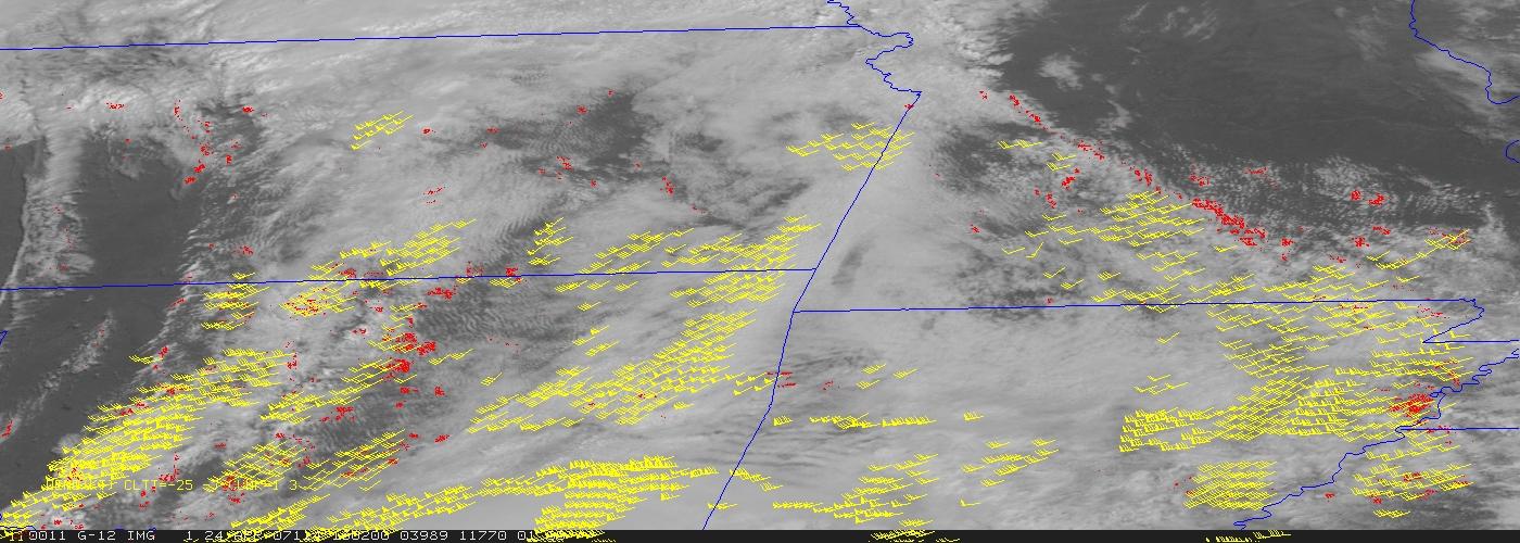
Near Real-Time AVHRR Polar Winds Delivered to UK Met Office: Winds over the polar regions derived from Advanced Very High Resolution Radiometer (AVHRR) Global Area Coverage (GAC, 4 km) data on NOAA-15, -16, -17, and -18 satellites is now being sent to the UK Met Office in near real-time. The Met Office requested the data for testing in their weather forecast system. The AVHRR winds are also sent to the Joint Center for Satellite Data Assimilation. Plots of the data are available at http://stratus.ssec.wisc.edu/products/rtpolarwinds. (J. Key, E/RA2, 608-263-2605, jkey@ssec.wisc.edu; D. Santek, CIMSS, 608-263-7410) (Click image to enlarge)
 (Click image to enlarge)
Other Meetings and Telecons:
None.
VISITORS:
NEXT WEEK:
LOOKING AHEAD:
| Archived Weeklies Page | Submit a report item |