
[ Archive ]

|
ASPB and CIMSS Weekly Report
[ Archive ] |
|
IN THE PRESS:
ITEMS FOR THE ADMINISTRATOR:
ITEMS FOR THE ASSISTANT ADMINISTRATOR:
ITEMS FOR THE OFFICE DIRECTOR, STAR:
High School Student Summer Workshop at CIMSS: The
16th annual Summer Workshop on Atmospheric, Earth, and Space Sciences
was hosted by the Cooperative Institute for Meteorological Satellite
Studies (CIMSS), on the campus of the University of Wisconsin-Madison
(UW), 27-31 July 2008. Eleven students (five out-of-state) were given
presentations, exercises, and field trips by two UW Atmospheric and
Oceanic Sciences (AOS) professors, three NOAA/NESDIS meteorologists,
seven UW scientists, four undergraduate students, and two outreach
specialists. Among the local NOAA staff at CIMSS, T. Schmit presented a
talk on the Geostationary Operational Environmental Satellite (GOES)
program, R. Aune presented a talk on numerical modeling and satellite
data assimilation, and G. S. Wade led the Man computer Interactive Data
Access System (McIDAS) hands-on lab session as well as assisted on
field trips to a local television weather channel, the local National
Weather Service (NWS) Forecast Office (in Sullivan, WI), and a local
state park geology expedition. (G.S. Wade, E/RA2, 608-263-4743,
gary.s.wade@noaa.gov; J. Gerth, CIMSS, 608-263-4942,
jordang@ssec.wisc.edu; M. Mooney, CIMSS, 608-265-2123,
margaret.mooney@ssec.wisc.edu)
CIMSS Participation in the Alaska Environmental Satellite Workshop: S. Bachmeier and K. Strabala from the Cooperative Institute for Meteorological Satellite Studies (CIMSS) participated in a multi-agency Alaska Environmental Satellite Workshop held at Fairbanks, Alaska, 29-31 July 2008. The purpose of the workshop was to establish an Alaska sector of the NOAA Satellite Proving Ground, where resources from within Alaska can be combined with those from external partners to facilitate an end-to-end capture, processing, testing, and evaluation of satellite products to support forecasting in Alaska and the Arctic. CIMSS presentations discussed the Moderate Resolution Imaging Spectroradiometer (MODIS) in Advanced Weather Interactive Processing System (AWIPS) project, and the International MODIS / Atmospheric Infrared Sounder (AIRS) Processing Package (IMAPP) software that MODIS direct broadcast ground stations located in Alaska can utilize to locally create a diverse suite of environmental satellite products. (S. Bachmeier, CIMSS, 608-263-3958, K. Strabala, CIMSS)
ITEMS FOR THE DIVISION CHIEF, CoRP:
Three First Version GOES-R ATBD’s Submitted: Advanced Baseline Imager (ABI) Algorithm Theoretical Basis Documents (ATBD’s) for the volcanic ash, fog, and sulfur dioxide products were submitted to the Geostationary Operational Environmental Satellite (GOES)-R Algorithm Working Group (AWG). These first versions of the ATBD’s will continue to evolve towards full maturity over the course of the next year. (M. Pavolonis, E/RA2, 608-263-9597, Mike.Pavolonis@noaa.gov, C. Calvert, CIMSS, 608-262-1023, J. Sieglaff, CIMSS, 608-265-5357, H. Woolf, CIMSS, 608-262-0986).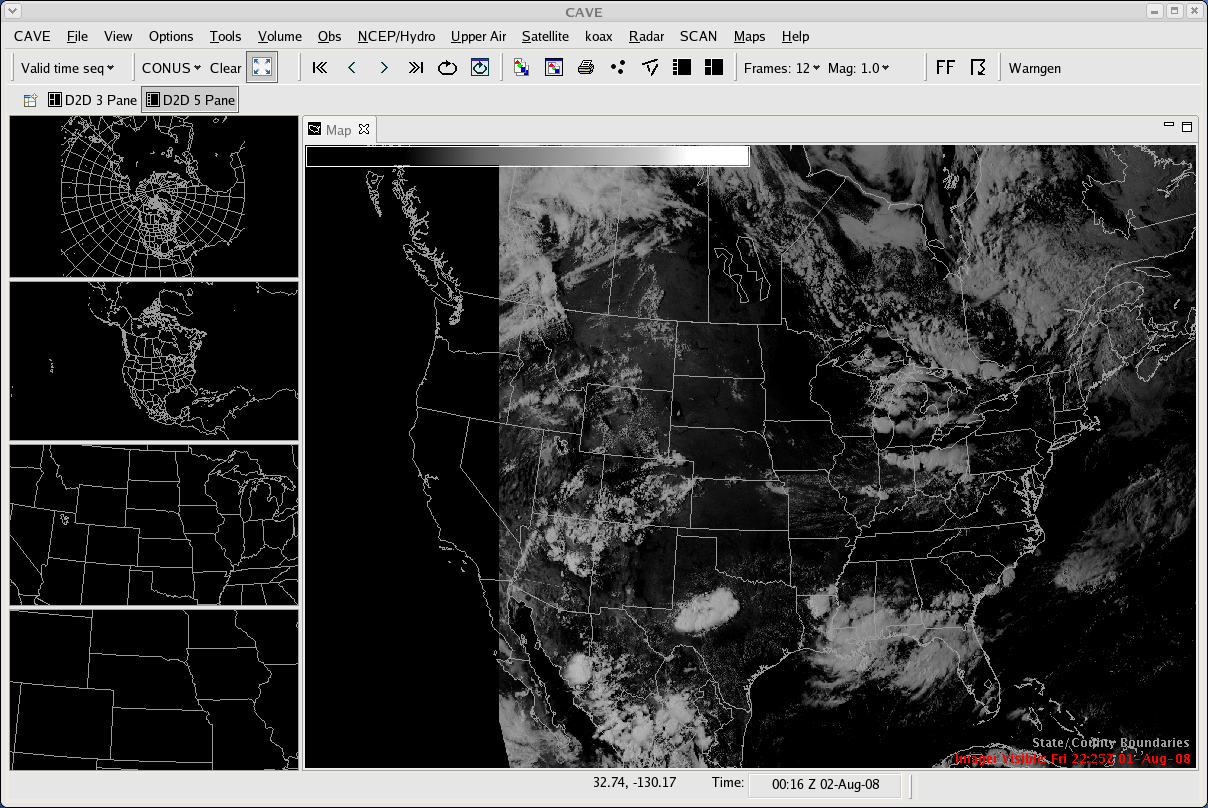 (Click image to enlarge)
Figure caption: A visible satellite image from GOES is displayed in the Common AWIPS Visualization Environment (CAVE), the graphical user interface of AWIPS II.
Other Meetings and Telecons:
None.
VISITORS:
NEXT WEEK:
LOOKING AHEAD:
| Archived Weeklies Page | Submit a report item |