
[ Archive ]

|
ASPB and CIMSS Weekly Report
[ Archive ] |
|
IN THE PRESS:
ITEMS FOR THE ADMINISTRATOR:
ITEMS FOR THE ASSISTANT ADMINISTRATOR:
ITEMS FOR THE OFFICE DIRECTOR, STAR:
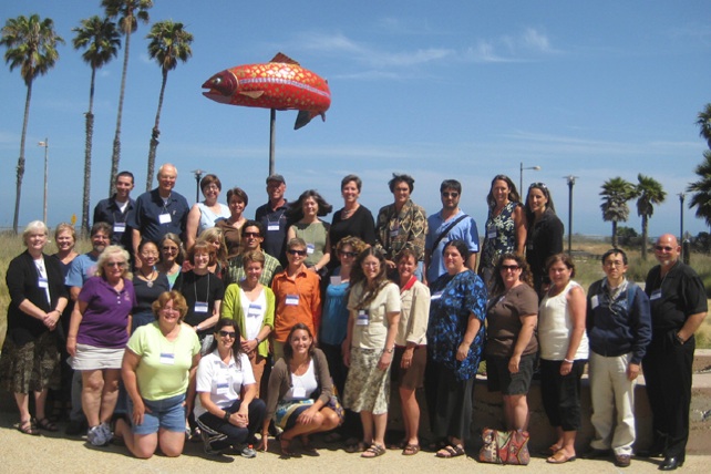
ESIP Teacher Workshop at UCSB: The
Cooperative Institute for Meteorological Satellite Studies (CIMSS)
recruited presenters and participants for a teacher workshop held in
conjunction with the 2009 Federation of Earth System Information
Partners (ESIP) summer conference at the University of California -
Santa Barbara (UCSB). As a unique consortium of over 100 organizations
that collect, interpret and develop applications for remotely sensed
Earth science data, ESIP meetings are a perfect venue to connect K-12
educators with remote sensing scientists. With support from NOAA,
participating G6-12 teachers attended the conference plenary
presentations followed by an afternoon and second full day of workshop
sessions that featured hands-on computer activities demonstrating ways
that data and tools can be used in science classrooms. Sessions were
led by ESIP members from NOAA, CIMSS, NASA, TERC and other ESIP
organizations. CIMSS presenters included Margaret Mooney and Tommy
Jasmin. A total of twenty-nine attendees registered for the teacher
track session of the conference, including coincidently, Peggy
Lubchenco, sister to Dr. Jane Lubchenco. The first twenty G6-12
educators who applied were awarded time and travel stipends funded by
NOAA. All participating educators had their conference registration
fees covered through NOAA support. Evaluations indicate that the
workshop was a success. Seventeen teachers rated the ESIP workshop
experience as “excellent”, the rest checked the next best box of “very
good”.
(M. Mooney, CIMSS/SSEC, 608-265-2123)
 (Click image to enlarge)
Figure caption: ESIP Teacher Workshop Group Photo 7/8/09.
ITEMS FOR THE DIVISION CHIEF, CoRP:
CIMSS Participation in the GOES-R Algorithm Working Group (AWG) and Risk Reduction (R3) meetings: University of Wisconsin / CIMSS (Cooperative Institute for Meteorological Satellite Studies) and NESDIS/Advanced Satellite Products Branch (ASPB) scientists attended and participated in the NOAA GOES-R Algorithm Working Group (AWG) and Risk Reduction (R3) meetings in College Park, MD on 20-24 July 2009. The meetings were to review the operational algorithm development (AWG) and research and development projects (Risk Reduction) for the GOES-R program. CIMSS participated included Chris Velden, Steve Wanzong, Tim Olander (Tropical Cyclones, Winds), Jun Li, Xin Jin, Zhenglong Li (Soundings), Wayne Feltz (Aviation), Chris Schmidt (Fires), Jason Otkin, Allen Huang (Proxy Data, GRAFFIR), Greg Quinn (Algorithm Integration Team, AIT), Jim Jung (Data Assimilation), Tom Rink, Tom Achtor (McIDAS-V), Colleen Mouw (Great Lakes), Ralph Petersen (Soundings), and Hank Revercomb (AWG Technical Advisory Committee, TAC). ASPB participants included Jeff Key (Cryosphere), Tim Schmit (Imagery and Visualization), Andy Heidinger (Clouds), Mike Pavolonis (Clouds and Aviation Weather), and Brad Pierce (Air Quality). CIMSS scientists who participated remotely through tele-conferencing included Mat Gunshor (Proxy Data, GRAFFIR), William Straka (Clouds), Ray Garcia, Graeme Martin, Eva Schiffer (AIT), Chris Rozoff (Tropical Cyclones) and Steve Ackerman (Outreach). (T. Achtor, CIMSS, 608-263-4206)VISITORS:
NEXT WEEK:
LOOKING AHEAD:
| Archived Weeklies Page | Submit a report item |