
[ Archive ]

|
ASPB and CIMSS Weekly Report
[ Archive ] |
|
IN THE PRESS:
ITEMS FOR THE ADMINISTRATOR:
ITEMS FOR THE ASSISTANT ADMINISTRATOR:
ITEMS FOR THE OFFICE DIRECTOR, STAR:
Manuscript Published on impacts of Eastern Pacific Ozone on California Air Quality: A manuscript entitled “Impacts of transported background ozone on California air quality during the ARCTAS-CARB period – a multi-scale modeling study” by Huang, M., Carmichael, G. R., Adhikary, B., Spak, S. N., Kulkarni, S., Cheng, Y. F., Wei, C., Tang, Y., Parrish, D. D., Oltmans, S. J., D'Allura, A., Kaduwela, A., Cai, C., Weinheimer, A. J., Wong, M., Pierce, R. B., Al-Saadi, J. A., Streets, D. G., and Zhang, Q. was published in the journal Atmospheric Chemistry and Physics. The manuscript presents results from numerical experiments using the University of Iowa Sulfur Transport and dEposition Model (STEM) atmospheric chemistry model to analyze the effects of transported background ozone from the eastern Pacific on California air quality during June 2008 California Air Resources Board (CARB) phase of the NASA Arctic Research of the Composition of the Troposphere from Aircraft and Satellites ARCTAS field mission. The results show that the use of Real-time Air Quality Modeling System (RAQMS) lateral boundary conditions, which include assimilation of Microwave Limb Sounder (MLS) stratospheric ozone profiles and Ozone Monitoring Instrument (OMI) total column ozone data, improves the model performance, although biases can be introduced. (R.B. Pierce, E/RA2, 608-890-1892, brad.pierce@noaa.gov).
ITEMS FOR THE DIVISION CHIEF, CoRP:
CIMSS and ASPB Participation at Proving Ground and IGARSS Meetings: T. Schmit, B. Aune, and M. Pavolonis of the Advanced Satellite Products Branch (ASPB), and Wayne Feltz, Jordan Gerth, and Allen Huang of the Cooperative Institute for Meteorological Satellite Studies (CIMSS) participated in the Next Generation Geostationary Operational Environmental Satellite (GOES-R) Proving Ground Meeting and the International Symposium on Geoscience and Remote Sensing (IGARSS), both held in Honolulu, HI during the week of July 25, 2010. At the Proving Ground meeting, presentations on the Advanced Baseline Imager (ABI), the current GOES constellation, convective initiation, assimilation of cloud properties and water vapor into numerical weather prediction models, and GOES-R volcanic ash, fog, cloud phase, and cloud height products, were given to help the Pacific Region of the National Weather Service (NWS) prepare a Proving Ground plan. At the IGARSS meeting, presentations on nearcasting severe convection and volcanic ash cloud property retrievals from current GOES and GOES-R were given. (M. Pavolonis, E/RA2, 608-263-9597, Mike.Pavolonis@noaa.gov; T. Schmit, E/RA2, 608-263-0291, tim.j.schmit@noaa.gov; R. Aune, E/RA2, 608-262-1071, robert.aune@noaa.gov; W. Feltz, CIMSS, 608-265-6283; J. Gerth, CIMSS; Allen Huang, CIMSS)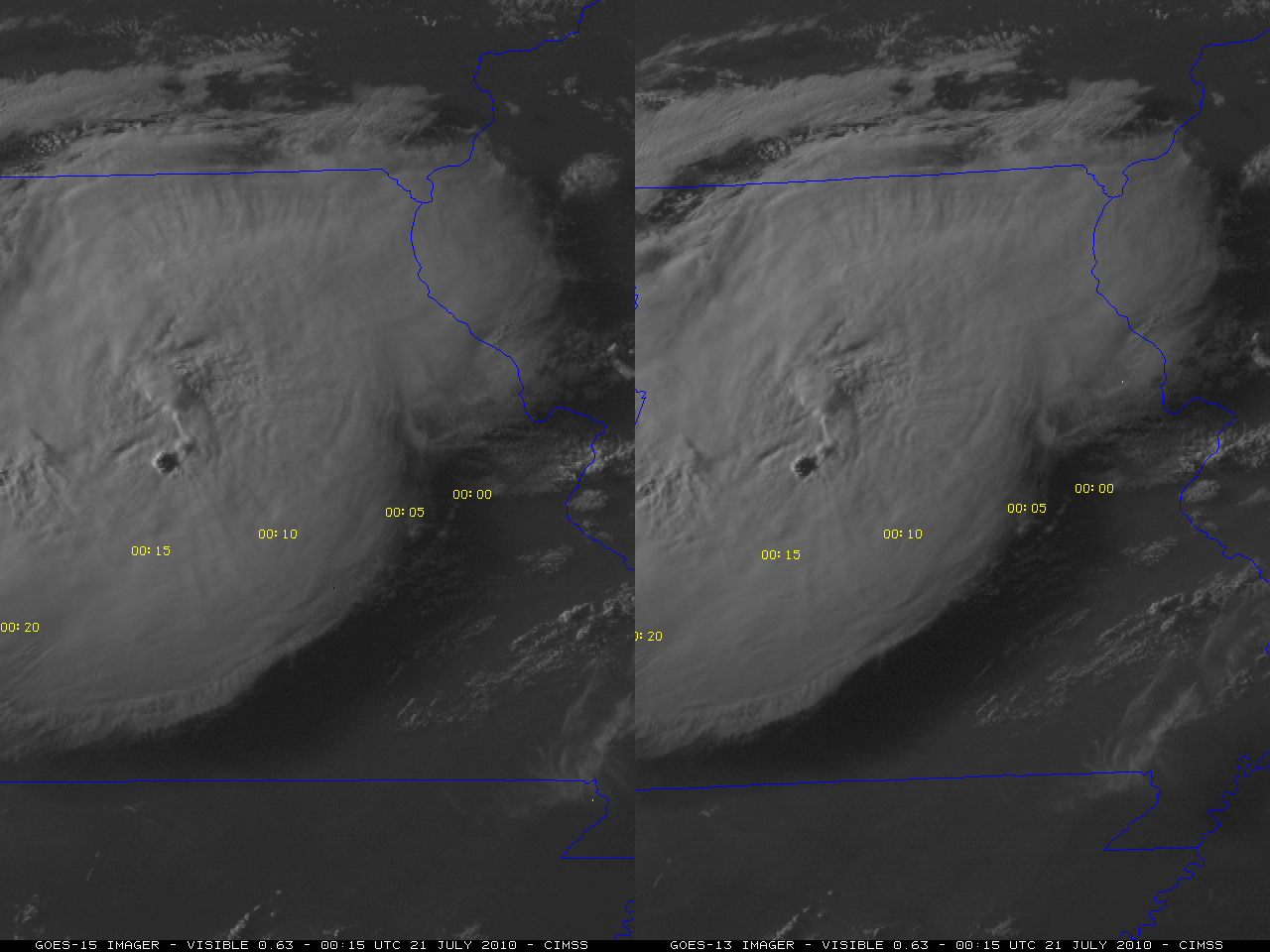 (Click image to enlarge)
VISITORS:
NEXT WEEK:
LOOKING AHEAD:
| Archived Weeklies Page | Submit a report item |