
[ Archive ]

|
ASPB and CIMSS Weekly Report
[ Archive ] |
|
IN THE PRESS:
ITEMS FOR THE ADMINISTRATOR:
ITEMS FOR THE ASSISTANT ADMINISTRATOR:
ITEMS FOR THE OFFICE DIRECTOR, STAR:
GOES Sounder Near-casting Demonstrated at the Hazardous Weather Testbed:
R. Aune and R. Petersen, of the Cooperative Institute for
Meteorological Satellite Studies (CIMSS), supported the Hazardous
Weather Testbed (HWT) at the National Weather Service's Storm Prediction
Center (SPC), Norman, Oklahoma. While there, they assisted
participants with interpreting products generated by the Geostationary
Operational Environmental Satellite (GOES) ) Sounder near-casting model
running at the CIMSS (http://cimss.ssec.wisc.edu/model/nrc/).
The near-casting model, based on GOES Sounder data, was used to
estimate locations in the U.S. where severe convective storms were most
likely to form and were not likely to form, up to nine hours in advance.
Forecasters at the severe convective storms desk, the heavy
precipitation desk, and the convective initiation desk found the
products to be very useful throughout the exercise, citing numerous
cases where the near-casting products added value to the forecast
process. (R. Aune, E/RA2, 608-262-1071, robert.aune@noaa.gov ; R.
Petersen, CIMSS, 608-263-4030, ralph.petersen@ssec.wisc.edu).
Real-time Tracking of Cordon Caulle Volcanic Ash Cloud: The Cordon Caulle volcano in Chile began erupting violently on June 4, disrupting air traffic over South America and beyond. The Center for Satellite Applications and Research (STAR) and the Cooperative Institute for Meteorological Satellite Studies (CIMSS) provided near real-time satellite retrievals of ash cloud height, mass loading, and particle size to the volcanic ash operational and research community, through a web site (http://cimss.ssec.wisc.edu/goes_r/proving-ground/geocat_ash/loops/floater.html). STAR and CIMSS scientists developed the volcanic ash products in preparation for the next generation Geostationary Environmental Operational Satellite (GOES-R). The Spinning Enhanced Visible/Infrared Imager (SEVIRI) was used as a proxy for GOES-R data. (M. Pavolonis, E/RA2, 608-263-9597, Mike.Pavolonis@noaa.gov; J. Sieglaff, CIMSS)
ITEMS FOR THE DIVISION CHIEF, CoRP:
Science on a Sphere Collaborations in Madison Wisconsin: Patrick Rowley, Margaret Mooney and Steve Ackerman from the Cooperative Institute for Meteorological Satellite Studies (CIMSS) attended the opening of the Aldo Leopold Nature Center (ALNC) Climate Change Classroom, Monona, Wisconsin on June 2. Mooney and Rowley have been collaborating with and providing advice to the ALNC staff since January in the development of educator programs and plans for installation of a Science on a Sphere (SOS) exhibit. ALNC Chair, Terry Kelly, acknowledged CIMSS in his opening remarks before cutting the ribbon and ushering supporters into the new 11,000 square foot addition. Throughout the evening, Patrick Rowley staffed a small 3D spherical display system while answering questions about the pending 6-foot sphere soon to inhabit the large silo built specifically for an awe-inspiring SOS exhibit. (M. Mooney, CIMSS, 608-265-2123)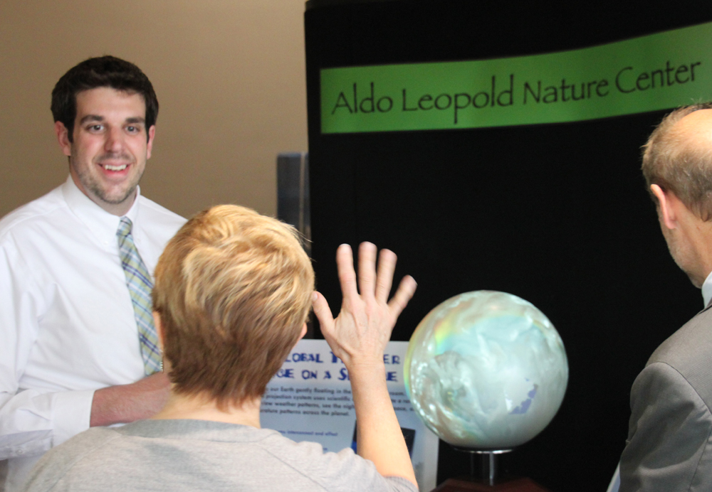 (Click image to enlarge)
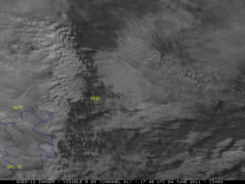 (Click image to enlarge)
VISITORS:
NEXT WEEK:
LOOKING AHEAD:
| Archived Weeklies Page | Submit a report item |