
[ Archive ]

|
ASPB and CIMSS Weekly Report
[ Archive ] |
|
IN THE PRESS:
ITEMS FOR THE ADMINISTRATOR:
ITEMS FOR THE ASSISTANT ADMINISTRATOR:
ITEMS FOR THE OFFICE DIRECTOR, STAR:
Ackerman New Associate Dean for Physical Sciences: Steve
Ackerman has been named the new Associate Dean for the Physical Sciences. He has been in this position on an interim basis since
January 2012. Dr. Ackerman, Director of the Cooperative Institute for
Meteorological Satellite Studies (CIMSS), joined the faculty of the
Atmospheric and Oceanic Sciences (AOS) department in 1992. His research
focus is in the area of satellite meteorology. Ackerman is well known
locally and nationally for his efforts to bring science to the public
through mass media and other channels of outreach. More information is
available at http://www.news.wisc.edu/20661. (J. Key, E/RA2,
608-263-2605, jkey@ssec.wisc.edu)
NASA to Fly Global Hawk Hurricane Missions: The Hurricane and Severe Storm Sentinel (HS3) science and instrument teams held their final planning meeting this week at the Wallops Island (WI) facility. The HS3 is a Global Hawk drone that will base out of Wallops, and fly missions at ~70,000 feet centered on Atlantic tropical disturbances in September. Two Global Hawks should be available; one focusing on the storm environment, and one that will loiter over the storm center. The environmental drone will carry a Scanning-HIS developed at the University of Wisconsin Space Science and Engineering Center (UW-SSEC), among many other remote sensors and dropsondes. The S-HIS combined with other measurements will help define the extent and role of the Saharan Air layer (SAL) on modulating storm intensity. The storm center drone will carry a NASA-built microwave radiometer that will allow high-resolution mapping of the warm core evolution. Scientists at the Cooperative Institute for Meteorological satellite Studies (CIMSS) will collaborate with Principle Investigators from the Jet Propulsion Laboratory (JPL) to investigate the measured warm core structures with those observed from satellites. CIMSS will also provide specialized satellite products in support of mission planning, post-experiment analysis, and GOES-R proving ground activities. (C. Velden, CIMSS, 608-262-9168)
ITEMS FOR THE DIVISION CHIEF, CoRP:
Improving Thunderstorm Forecasts at the Hazardous Weather Testbed: Cooperative Institute for Meteorological Satellite Studies (UW/CIMSS) researcher Justin Sieglaff participated in the 2012 Hazardous Weather Testbed (HWT) as part of the Geostationary Operational Environmental Satellite (GOES)-R Proving Ground in Norman, Oklahoma at the Storm Prediction Center. An experimental GOES-based product, the University of Wisconsin Cloud Top Cooling (UW-CTC) algorithm was demonstrated to National Weather Service (NWS) forecasters as a means to deduce the strength of newly developing thunderstorms. The information from the UW-CTC algorithm was shown to provide lead-time ahead of traditional forecasting tools, such as Next Generation Radar (NEXRAD). For example, in one case the GOES based cloud growth provided over 60 minutes of lead-time prior to a developing thunderstorm producing hail signatures on NEXRAD. Further information related to GOES-R participation at the HWT can be found at (http://goesrhwt.blogspot.com). (J. Sieglaff, CIMSS, 608-265-5357)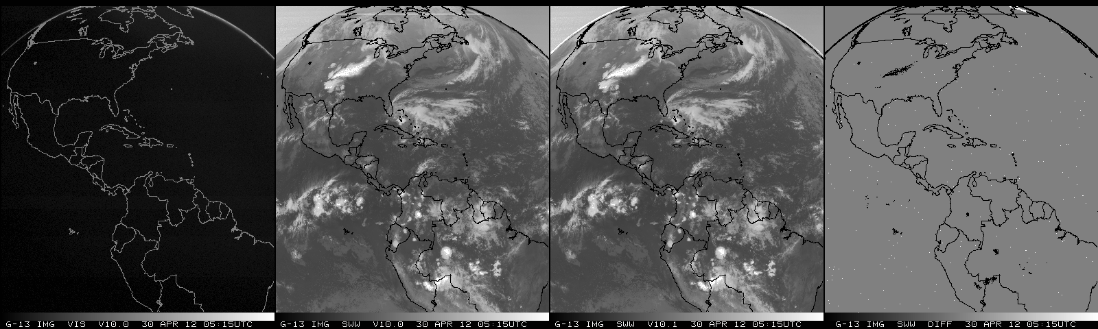 (Click image to enlarge)
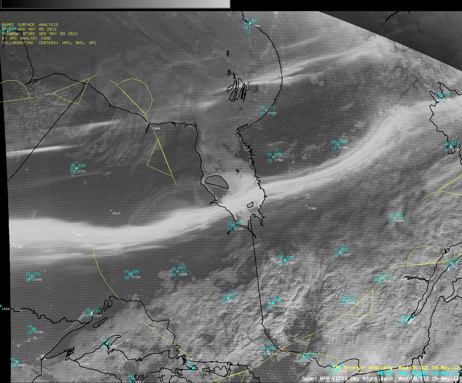 (Click image to enlarge)
Figure caption: Suomi NPP Day/Night Band (DNB) image showing ribbons of the aurora borealis, which showed up as bright west-to-east oriented features on the DNB image over Ontario and Quebec, Canada on May 9, 2012.
Manuscript on Arctic Ozone Depletion Events Submitted: A manuscript entitled "Characteristics of tropospheric ozone depletion events in the Arctic spring: Analysis of the ARCTAS, ARCPAC, and ARCIONS measurements" by J.-H. Koo, Y. Wang, S. Choi, T. P. Kurosu, K. Chance, A. Rozanov, A. Richter, S. J. Oltmans, A. M. Thompson, J. W. Hair, M. A. Fenn, A. J. Weinheimer, T. B. Ryerson, D. MacTavish, A. M. Fjaeraa, L. G. Huey, J. Liao, J. E. Dibb, J. A. Neuman, J. B. Nowak, R. B. Pierce, M. Natarajan, and J. Al-Saadi was submitted to Atmospheric Chemistry and Physics. This manuscript uses airborne and surface chemical measurements from the NASA Arctic Research of the Composition of the Troposphere from Aircraft and Satellites (ARCTAS) and the NOAA Aerosol, Radiation, and Cloud Processes affecting Arctic Climate (ARCPAC) experiments and satellite estimates of tropospheric bromine columns to interpret Arctic tropospheric ozone depletion events during April, 2008 (R.B. Pierce, E/RA2, 608-890-1892, brad.pierce@noaa.gov)
VISITORS:
NEXT WEEK:
LOOKING AHEAD:
| Archived Weeklies Page | Submit a report item |