
[ Archive ]

|
ASPB and CIMSS Weekly Report
[ Archive ] |
|
IN THE PRESS:
NOAA NewsRoom Highlights New Hurricane Forecast Model: The NOAA NewsRoom highlighted a new hurricane forecast model in a story released on 30 May (http://www.noaanews.noaa.gov/stories2012/20120530_eyewall.html). The model has recently become part of the official suite of operational tools available to forecasters at the NOAA National Hurricane Center (NHC). The model development and transition to NHC operations was led by Jim Kossin (NCDC/RSAD) and Matt Sitkowski (CIMSS). (J. Kossin, NCDC/RSAD, 608-265-5356)
ITEMS FOR THE ADMINISTRATOR:
ITEMS FOR THE ASSISTANT ADMINISTRATOR:
ITEMS FOR THE OFFICE DIRECTOR, STAR:
SSEC Satellite Meteorology Timeline: The Space Science and Engineering Center's (SSEC) Schwerdtfeger Library team released the SSEC Satellite Meteorology Timeline, the most recent addition to its collection of digital resources. Thematically, the evolution of satellite meteorology at SSEC is characterized by eras of specific scientific needs and objectives realized by specific scientific programs and technologies; all connected over time. The timeline is available at http://library.ssec.wisc.edu/timeline. (J. Phillips, SSEC, 608-262-8164)
5th WMO Observation Impacts on NWP Workshop: The
5th World Meteorological Organization (WMO) workshop on Observing
System Impacts on Numerical Weather Prediction (NWP) was held May 22-25
in Sedona, Arizona. The invite-only workshop, held every 4 years, was
comprised of international experts in NWP, data assimilation, and global
observing systems. The primary goals are to present updated evidence of
observing system impact in NWP systems, and discuss ways to more
efficiently utilize the limited (and dwindling) resources to insure that
NWP forecasts continue to improve. The working group unanimously
endorses the impact of satellite data, and the importance of maintaining
the global satellite-based observing system. A report summarizing the
meeting's major points and recommendations will be put together by the
scientific organizing committee over the next couple of months, and will
be made available by the WMO. (C. Velden, CIMSS, 608-262-9168)
GOES-R Products Used to Terminate Volcanic Ash Advisory: The next generation Geostationary Operational Environmental Satellite (GOES-R) volcanic ash products were used to help terminate a Volcanic Ash Advisory (VAA) issued by the Washington Volcanic Ash Advisory Center (VAAC) after an eruption of Ruiz in Columbia on May 29, 2012. The advisory was canceled, thereby freeing up airspace, after the GOES-R products indicated that the eruptive cloud was mainly composed of ice crystals and contained little or no volcanic ash. Such a determination is very difficult to make from standard imagery based volcanic ash products. The terminating VAA, where the role of the NOAA/NESDIS/STAR volcanic ash products is noted, can be found at http://www.ssd.noaa.gov/VAAC/ARCH12/RUIZ/2012E291926.html. While these products are not yet routinely available to the Washington VAAC for all volcanoes in their area of responsibility, NOAA/NESDIS/STAR and the Cooperative Institute for Meteorological Satellite Studies (CIMSS) hopes to make them routinely available in the coming months. (M. Pavolonis, E/RA2, 608-263-9597, Mike.Pavolonis@noaa.gov, J. Sieglaff, CIMSS)
ITEMS FOR THE DIVISION CHIEF, CoRP:
VIIRS Direct Broadcast Data Displayed in AWIPS for Alaska NWS Operational Forecasters: A team from the Cooperative Institute for Meteorological Satellite Studies (CIMSS) worked with members of the Geographic Information Network of Alaska (GINA) in Fairbanks, to automate the acquisition, processing and distribution of Suomi National Polar Partnership (NPP) Visible Infrared Imager Radiometer Suite (VIIRS) Direct Broadcast data for display in the Advanced Weather Interactive Processing System (AWIPS) at the National Weather Service (NWS) forecast offices in Alaska. The first step in this process was to install the Community Satellite Processing Package (CSPP) VIIRS Science Data Record (SDR) software at GINA, followed by running a portable tool to remap, rescale and reformat the SDR H5 files into the standard NetCDF files required for display in AWIPS. Distribution to the NWS offices take place using the Unidat Local Data Manager (LDM). The VIIRS data will be useful to the NWS forecasters because it offers new bands (Day/Night Band), a larger swath size (3000 km) and more consistent spatial resolution to the end of the swath than previous polar imagers. (K. Strabala, CIMSS, 608-263-8752, J.Gerth, CIMSS, S. Bachmeier, CIMSS,608-263-3958, R. Garcia, SSEC, D. Hoese, SSEC, W. Straka III, CIMSS, E. Schiffer, SSEC)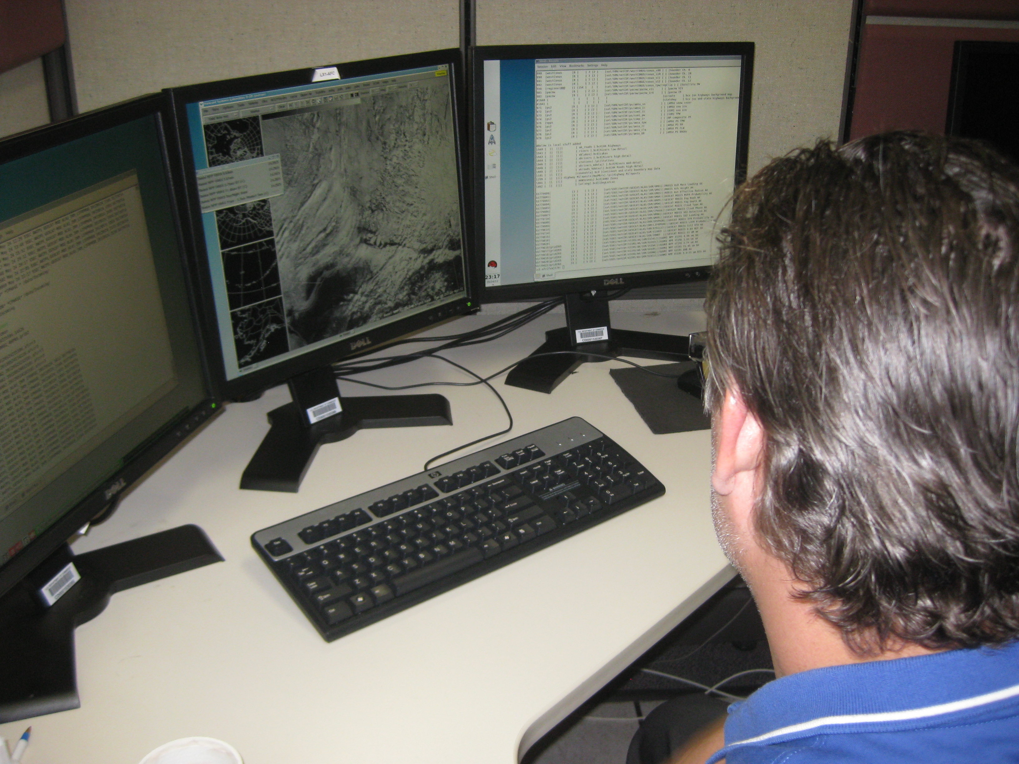 (Click image to enlarge)
VISITORS:
NEXT WEEK:
LOOKING AHEAD:
| Archived Weeklies Page | Submit a report item |