 |
ASPB and CIMSS Weekly Report
[ Archive ] |
 |
ASPB AND CIMSS WEEKLY HIGHLIGHTS FOR THE WEEK ENDING NOVEMBER 17, 2012
IN THE PRESS:
ITEMS FOR THE ADMINISTRATOR:
ITEMS FOR THE ASSISTANT ADMINISTRATOR:
ITEMS FOR THE OFFICE DIRECTOR, STAR:
ITEMS FOR THE DIVISION CHIEF, CoRP:
Manuscript on Dust Height Retrieval over Land from AIRS Published: A manuscript entitled "Asian dust height and infrared optical depth retrievals over land
from hyperspectral longwave infrared radiances" has been published in the Journal of Geophysical Research - Atmosphere (VOL. 117, D19202, doi:10.1029/2012JD017799, 2012). Coauthors are Zhigang Yao, Jun Li (CIMSS), Hyo-Jin Han (SNU of Korea), Allen Huang (CIMSS), B. J. Sohn (SNU of Korea), and Peng Zhang (NSMC of China). (Jun Li, CIMSS, 608-262-3755, Jun.Li@ssec.wisc.edu)
Delivery of Simulated GOES-R ABI Radiance Files: Simulated Advanced Baseline Imager (ABI) files were delivered to the Algorithm Integration Team (AIT) of the Geostationary Operational Environmental Satellite (GOES)-R program. The sectors covered the full disk, Continental U.S. (CONUS), and mesoscale domains. Seven time periods were delivered for the three sectors (all for 16 of the ABI bands). These files can be used for system level testing and to feed into the GOES-R Rebroadcast (GRB) simulator. This will allow for more realistic system tests, given that they are already in the GOES-R Fixed Grid Format (FGF). These GRB files, along with validation files were over 110 GB. (K. Ba, CIMSS, W. Straka III, CIMSS, G. Martin, CIMSS, M. Gunshor, CIMSS, T. Schmit, E/RA2, 608-263-0291, tim.j.schmit@noaa.gov)
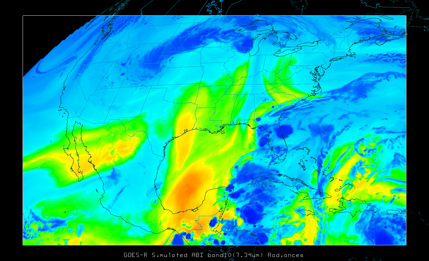 (Click image to enlarge)
Figure caption: Sample Continental U.S. simulated GOES-R ABI water vapor band 10. Image made with McIDAS-V.
Local Satellite Proving Ground Training at NWS-MKX: The Cooperative Institute for Meteorological Satellite Studies (CIMSS) concluded its annual, local, in-person satellite proving ground effort with the National Weather Service (NWS) Forecast Office (FO) in Milwaukee/Sullivan, WI on 13 Nov 2012. In the typical arrangement, where CIMSS satellite experts visit with a NWS forecaster on one of their "research" shifts (when they have no operational duties), K. Strabala and G. S. Wade engaged forecaster M. Kavinsky with training, demonstration, and discussion on new satellite products, produced at CIMSS as part of the Geostationary Operational Environmental Satellite (GOES)-R Proving Ground, and which are made accessible on the NWS AWIPS (Advanced Weather Interactive Processing System). Amongst a variety of products and applications touched upon (http://cimss.ssec.wisc.edu/goes_r/proving-ground/SPC/SPC.html), Strabala and Wade emphasized the new Suomi NPP (National Polar-orbiting Partnership) satellite (with the VIIRS (Visible Infrared Imaging Radiometer Suite) instrument and its day-night band) as well as the proxy GOES-R fog and low cloud products - all available in AWIPS. (K. Strabala, CIMSS, 608-263-8752, kathy.strabala@ssec.wisc.edu; G. S. Wade, E/RA2, 608-263-4743, gary.s.wade@noaa.gov)
VISITORS:
NEXT WEEK:
LOOKING AHEAD: