
[ Archive ]

|
ASPB and CIMSS Weekly Report
[ Archive ] |
|
IN THE PRESS:
CIMSS Satellite Blog Noted in Discover Magazine: The Cooperative Institute for Meteorological Satellite Studies (CIMSS) Satellite Blog (http://cimss.ssec.wisc.edu/goes/blog/) was noted in a Discover Magazine blog. The article, titled "Satellite imagery reveals likely cause of wind shift that killed 19 firefighters" by Tom Yulsman (1 July 2013, http://goo.gl/OTkPQ), described the "critically important post" on the CIMSS Satellite Blog that provided satellite data and analysis for the Yarnell Hill Fire (Arizona) in June 2013. (J. Key, E/RA2, 608-263-2605, jkey@ssec.wisc.edu)
ITEMS FOR THE ADMINISTRATOR:
ITEMS FOR THE ASSISTANT ADMINISTRATOR:
ITEMS FOR THE OFFICE DIRECTOR, STAR:
ITEMS FOR THE DIVISION CHIEF, CoRP:
CoRP Symposium: Planning for the Cooperative Research Program (CoRP) Symposium continues. The Symposium will be held 23-24 July 2013 at the University of Wisconsin-Madison. The final agenda will be posted this coming week. Over 35 people have registered from five organizations. While registration has ended, contact Maria at (maria.vasys@ssec.wisc.edu) for last minute additions. (M. Vasys, CIMSS, 608-263-7435)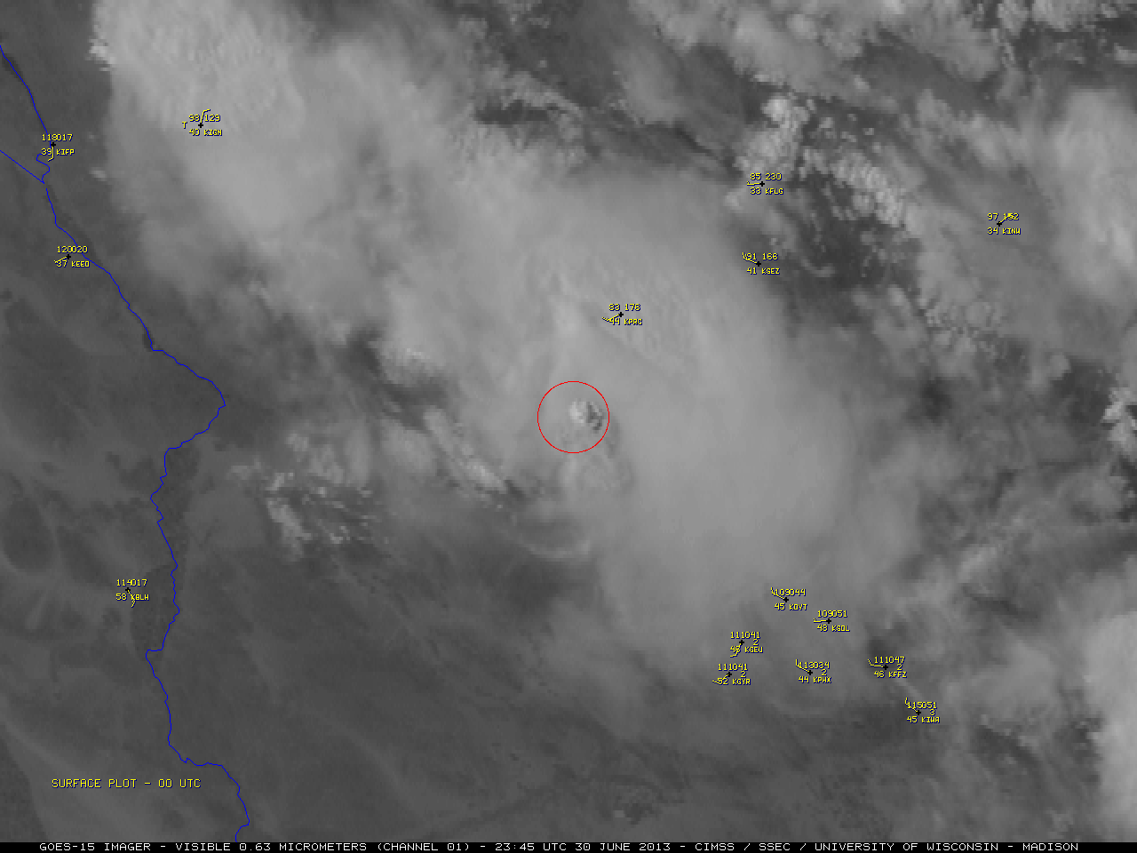 (Click image to enlarge)
VISITORS:
NEXT WEEK:
LOOKING AHEAD:
| Archived Weeklies Page | Submit a report item |