
[ Archive ]

|
ASPB and CIMSS Weekly Report
[ Archive ] |
|
IN THE PRESS:
ITEMS FOR THE ADMINISTRATOR:
ITEMS FOR THE ASSISTANT ADMINISTRATOR:
ITEMS FOR THE OFFICE DIRECTOR, STAR:
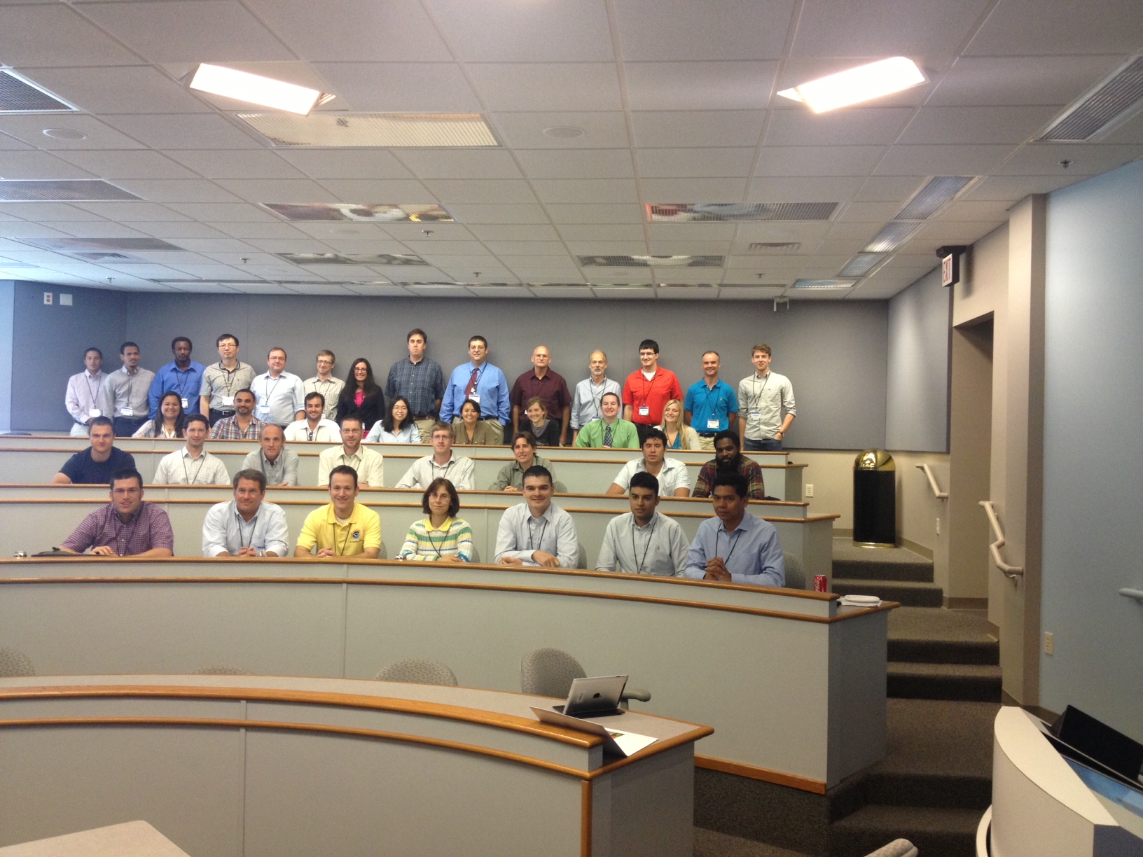
CoRP Symposium a Success: The Cooperative Institute for Meteorological Satellite
Studies (CIMSS) hosted the
2013 Cooperative Research Program (CoRP) Symposium July 23-24, 2013. The Symposium is supported by the NESDIS cooperative institutes: Cooperative Institute for Climate and Satellite (CICS, Maryland and North Carolina), Cooperative Institute for Oceanographic Satellite Studies (CIOSS), Cooperative Institute for Research in the Atmosphere (CIRA), Cooperative Remote Sensing Science and Technology Center (CREST), and CIMSS. The Symposium targets multidisciplinary research with a focus on graduate students and early-career scientists and
is part of a larger strategy to promote federal and academic partnerships and to highlight research and application development within NESDIS and its cooperative institutes. The main audience is comprised of students (graduate and undergraduate) and early career scientists. This year’s theme was “Toward a Weather-Ready Nation and
Resilient Coastal Communities.” In addition to presentations and a
poster reception, the events included panels and a luncheon speaker that
addressed workforce development and career planning. The agenda can be
found at http://cimss.ssec.wisc.edu/corp/2013/agenda.html. Participants included: 6 from the NESDIS Advanced Satellite Products Branch (ASPB); 4 from the National Weather Service (NWS) office in Sullivan, WI; 2 from CICS-MD; 19 from CIMSS; 5 from CIRA; 12 from CREST; 2 from Oregon State and
three international visitors from Taiwan, Korea and Poland. A preliminary analysis of the evaluation forms indicates that the symposium was very successful. For example, of the 31 forms returned (out of 58 participants, including panelists), the overall ratings were 14 "excellent", 12 "very good", and 5 non-responses.
 (Click image to enlarge)
Figure caption: Participants in the 2013 CoRP Symposium sponsored by CIMSS on July 23-24, 2013.
EUMETSAT MTG-IRS Nowcasting Workshop:
Scientists from the Cooperative Institute for Meteorological Satellite
Studies (CIMSS) participated in the European Organisation for the
Exploitation of Meteorological Satellites (EUMETSAT) Meteosat Third
Generation (MTG) Infrared Sounder (IRS) Nowcasting Workshop 25-26 July
in Darmstadt, Germany. More than forty forecasters from the European
Union gave presentations on current nowcasting practices and hopes for
improvement from MTG IRS. CIMSS gave presentations on the information
content from infrared high spectral resolution measurements, nearcasting
the pre-convective environment with current geo-sounders, and
applications with time sequences of polar orbiting sounders. Working
Groups discussed the anticipated nowcasting practices in 2020 and
recommended training programs to prepare to utilization of MTG-IRS. (N.
Smith, R. Petersen, P. Antonelli, and P. Menzel)
ITEMS FOR THE DIVISION CHIEF, CoRP:
JPSS Science Seminar on Hyperspectral Retrieval Applications: Elisabeth Weisz of the Cooperative Institute for Meteorological Satellite Studies (CIMSS) gave a seminar on July 22 titled “JPSS PG Hyperspectral Sounder Applications“ as part of the Joint Polar Satellite System (JPSS) Science Seminar series. She presented an overview of the research, supported by the JPSS Proving Ground (PG) program, on retrievals derived from high spectral resolution infrared satellite measurements and their applications in high latitudes (such as the Alaskan Region) and in severe weather situations (e.g. Moore, Oklahoma Tornado). This briefing was given to stimulate/continue discussion on the operational usage of hyperspectral retrieval products in forecasting applications. (Elisabeth Weisz, CIMSS, 608-265-3954) (Click image to enlarge)
VISITORS:
NEXT WEEK:
LOOKING AHEAD:
| Archived Weeklies Page | Submit a report item |