
[ Archive ]

|
ASPB and CIMSS Weekly Report
[ Archive ] |
|
IN THE PRESS:
ITEMS FOR THE ADMINISTRATOR:
ITEMS FOR THE ASSISTANT ADMINISTRATOR:
ITEMS FOR THE OFFICE DIRECTOR, STAR:
Participation in AMS and EUMETSAT Conference: Approximately 45 people from the Cooperative Institute for Meteorological Satellite Studies (CIMSS) and the Space Science and Engineering Center (SSEC) attended the combined American Meteorological Society and European Organisation for the Exploitation of Meteorological Satellites (EUMETSAT) conference on Satellite Meteorology in Vienna, Austria. Approximately 500 people were in attendance overall. Presentations ranged from data acquisition, analysis visualization systems to cloud research. Several new collaborations were discussed and envisioned and we all look forward to future discussions. Examples included, cloud comparison, water vapor retrieval inter-comparisons, FY-3 data analysis, dust storm detection methodologies and collaborations on satellite climate data records. (S. Ackerman, CIMSS, 608-263-3647)
ITEMS FOR THE DIVISION CHIEF, CoRP:
Epic Outreach: Epic Systems, Verona, WI, invited University of Wisconsin-Madison (UW) science outreach departments to show off their research during the company's annual Users Group Meeting. Patrick Rowley and Tim Schmit presented a display consisting of the Cooperative Institute for Meteorological Satellite Studies (CIMSS) 3-D Globe, education and public outreach brochures, and several large full disk GOES images, including Hurricane Sandy. There were nearly 15,000 people in attendance. A UW story about the event is available at http://www.news.wisc.edu/22140. (P. Rowley, CIMSS, 608-263-1336, T. Schmit, E/RA2, 608-263-0291, tim.j.schmit@noaa.gov)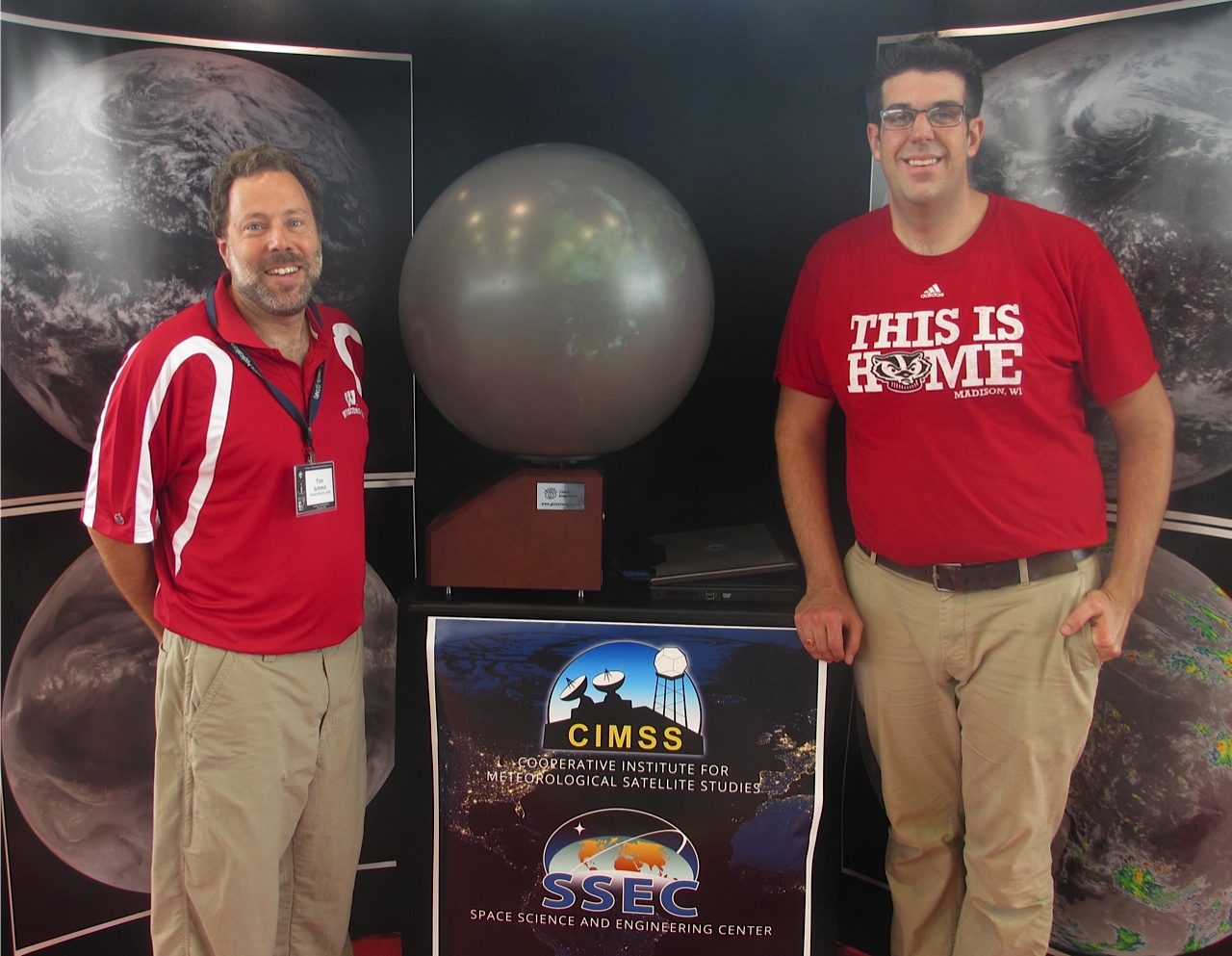 (Click image to enlarge)
 (Click image to enlarge)
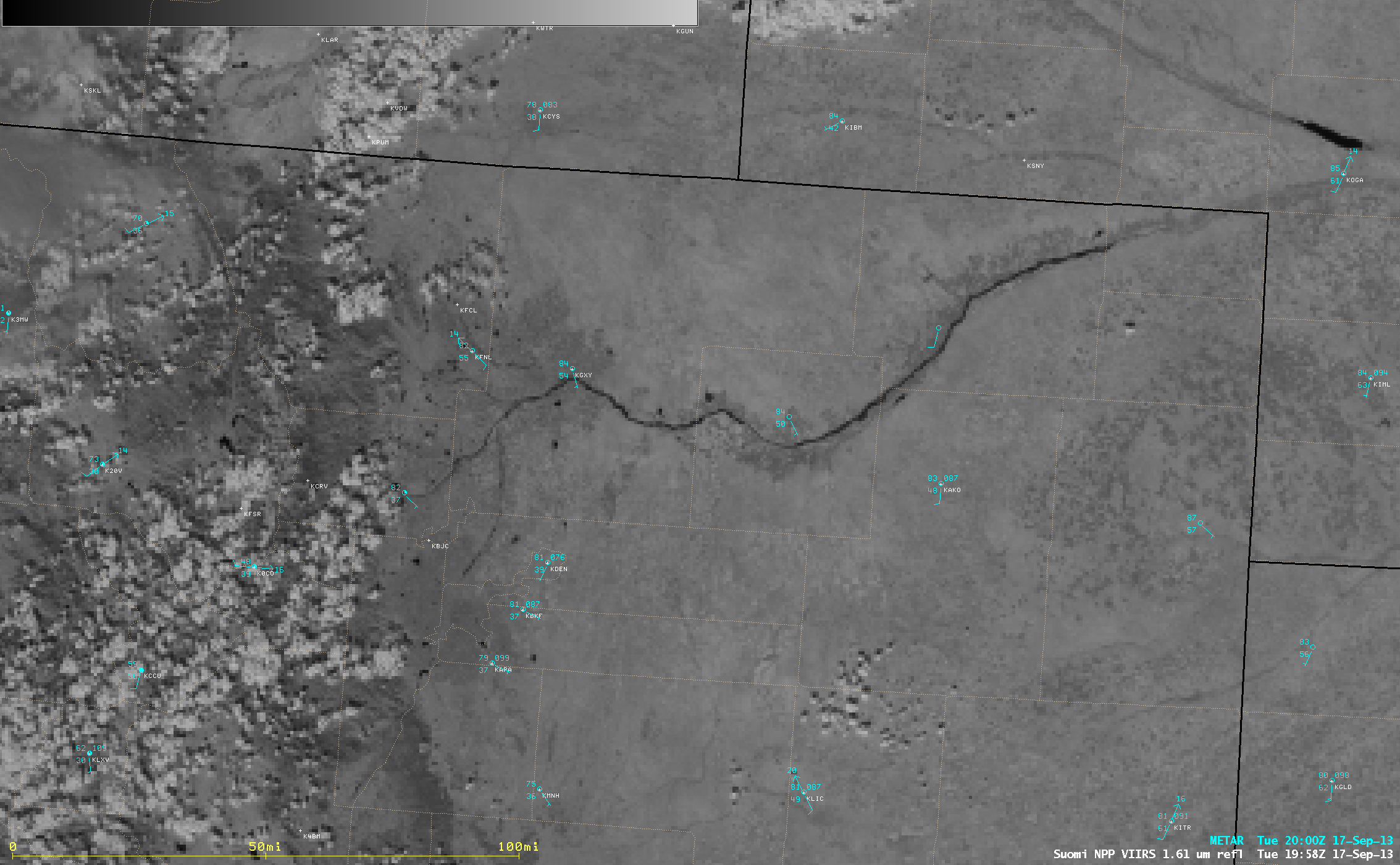 (Click image to enlarge)
Figure caption: AWIPS image of Suomi NPP VIIRS 1.61 µm near-IR channel data showing the dark signature of river flooding along the South Platte River in northeastern Colorado at 19:58 UTC on September 17, 2013.
CIMSS 5-year Review Report Submited: The Cooperative Institute for Meteorological Satellite Studies (CIMSS) is undergoing its 5-year review this fall. CIMSS completed and delivered on time, a report to the review team that addressed the submitted questions by NOAA. The science site visit is October 3-4, 2013. (S. Ackerman, CIMSS, 608-263-3647)
VISITORS:
NEXT WEEK:
LOOKING AHEAD:
| Archived Weeklies Page | Submit a report item |