
[ Archive ]

|
ASPB and CIMSS Weekly Report
[ Archive ] |
|
IN THE PRESS:
ITEMS FOR THE ADMINISTRATOR:
ITEMS FOR THE ASSISTANT ADMINISTRATOR:
ITEMS FOR THE OFFICE DIRECTOR, STAR:
ITEMS FOR THE DIVISION CHIEF, CoRP:
Eruption of the Kelut Volcano in Indonesia: Satellite images of the February 13, 2014 eruption of the Kelut volcano on the island of Java, Indonesia were posted on the Cooperative Institute for Meteorological Satellite Studies (CIMSS) Satellite Blog (http://cimss.ssec.wisc.edu/goes/blog/archives/14910). Multifunctional Transport Satellites (MTSAT) InfraRed imagery showed the rapid expansion of the volcanic cloud, while GOES-R volcanic ash products indicated that the ash reached heights of 22 km. Suomi National Polar-orbiting Partnership (NPP) Visible Infrared Imaging Radiometer Suite (VIIRS) images offered a high-resolution view of the volcanic cloud about 1.5 hours after the eruption. (S. Bachmeier, CIMSS, 608-262-3958, M. Pavolonis, E/RA2, 608-263-9597, mpav@ssec.wisc.edu, W. Straka, CIMSS, 608-262-5128)
ASPB, CIMSS assist in the GOES-13 Sounder drop-out investigation: Representatives from the Advanced Satellite Products Branch (ASPB) and Cooperative Institute for Meteorological Satellite Studies (CIMSS) are assisting in the Geostationary Operational Environmental Satellite (GOES)-13 Sounder drop-out investigation. A correction that re-claims the GOES-13 Sounder previously missing data has been developed by the Office of Satellite and Product Operations (OSPO), working with Exelis and others. These re-claimed data (using Sensor Processing System (SPS) test version 10.4.1) were provided and then qualitatively and quantitatively analyzed. A presentation is available upon request. (T. Schmit, E/RA2, 608-263-0291, tim.j.schmit@noaa.gov; H. Bysal, OSPO, 301-817-4088)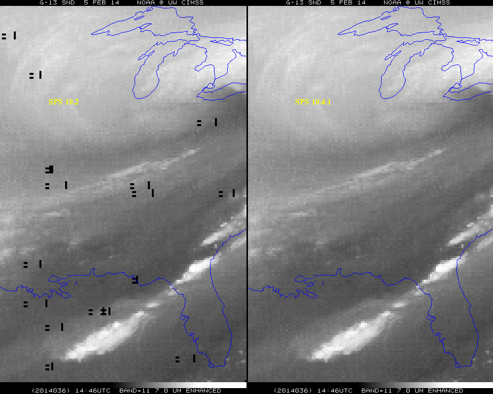 (Click image to enlarge)
 (Click image to enlarge)
VISITORS:
NEXT WEEK:
LOOKING AHEAD:
| Archived Weeklies Page | Submit a report item |