
[ Archive ]

|
ASPB and CIMSS Weekly Report
[ Archive ] |
|
IN THE PRESS:
ITEMS FOR THE ADMINISTRATOR:
ITEMS FOR THE ASSISTANT ADMINISTRATOR:
ITEMS FOR THE OFFICE DIRECTOR, STAR:
Historical GOES Atmospheric Motion Vectors Reprocessing Completed: Researchers at the Space Science and Engineering Center (SSEC) at the University of Wisconsin (UW) have reprocessed Atmospheric Motion Vectors (AMVs) from all GOES satellites in the GOES I-M VARiable (GVAR) data transmission format era (since 1995). Utilizing the latest NOAA/NESDIS operational AMV processing algorithm, full disk (when available) datasets at hourly intervals were produced, quality-controlled, archived, and made available to the user community. Several major reanalysis centers (European Center for Medium-Range Weather Forecasts, Japan Meteorological Agency, NASA-Global Modeling and Assimilation Office) have expressed a keen interest in these datasets for their next global atmospheric reanalysis efforts. The 600,000 datasets (almost 1TB, uncompressed files) are being hosted for dissemination on a server at UW-SSEC. (C. Velden, SSEC-CIMSS, 608-262-9168; D. Santek, SSEC-CIMSS, 608-263-7410; D. Stettner and S. Wanzong, SSEC-CIMSS)
ITEMS FOR THE DIVISION CHIEF, CoRP:
Simulated 137W ABI Dataset Delivered: The Geostationary Environmental Operational Satellite (GOES)-R Imagery and Visualization team at the Cooperative Institute for Meteorological Satellite Studies (CIMSS) delivered simulated Advanced Baseline Imager (ABI) data centered at 137 West longitude to the Geostationary Operational Environmental Satellite (GOES)-R program. This dataset includes 7 time periods for 3 domains (Full Disk, CONtinental United States (CONUS), and Mesoscale) was provided to NOAA's GOES-R Algorithm Working Group (AWG). Images (one per band) for all three domains, created using a script in Man computer Interactive Data Access System (McIDAS)-V, were also provided. These data are anticipated to be used to test the ABI ground system with data centered nominally where GOES-R is currently planned for operations. (T. Schmit, E/RA2, 608-263-0291, tim.j.schmit@noaa.gov, M. Gunshor, CIMSS, 608-263-1146, K. Bah, 608-262-4462).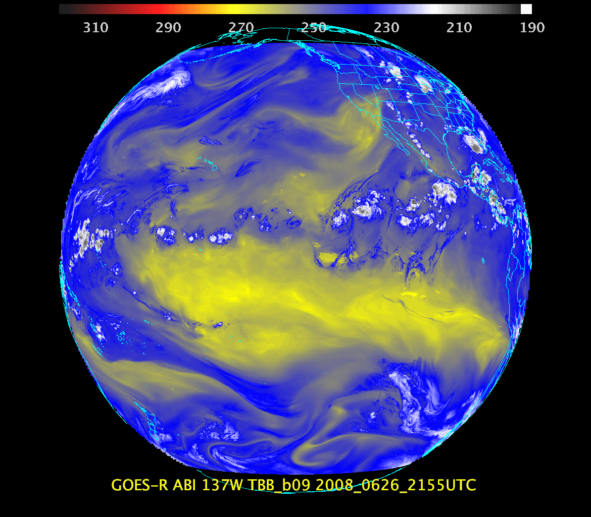 (Click image to enlarge)
VISITORS:
NEXT WEEK:
LOOKING AHEAD:
| Archived Weeklies Page | Submit a report item |