[ Archive ]
| CIMSS-NOAA Weekly Report
[ Archive ] |
IN THE PRESS:
ITEMS FOR THE ADMINISTRATOR:
ITEMS FOR THE ASSISTANT ADMINISTRATOR:
ITEMS FOR THE OFFICE DIRECTOR, STAR:
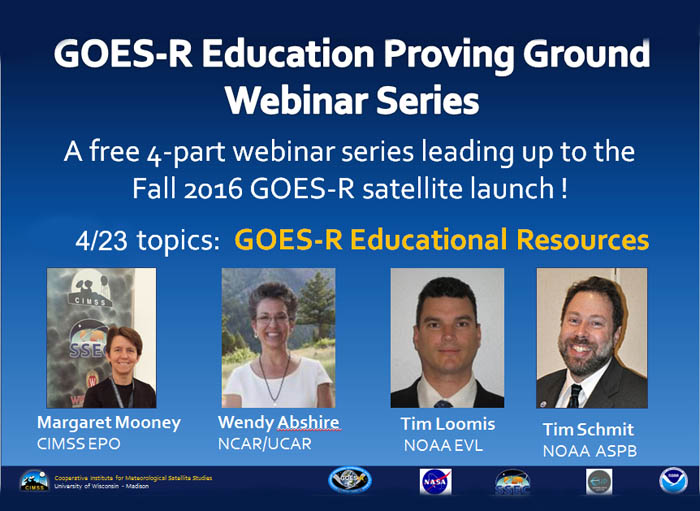
GOES-R Education Proving Ground Webinar Series: The Cooperative Institute for Meteorological Satellite Studies (CIMSS), in collaboration with NOAA’s Advanced Satellite Products Branch (ASPB), has been organizing and delivering special Saturday morning webinars to middle and high school science teachers in preparation for the Geostationary Operational Environmental Satellite (GOES)-R satellite series. The most recent webinar on GOES-R Educational Resources took place on April 23, 2016 and featured four presenters: Margaret Mooney from CIMSS, Wendy Ashbire from University Corporation for Atmospheric Research (UCAR), Tim Loomis from NOAA’s Environmental Visualization Laboratory (EVL), and Tim Schmit from NOAA’s ASPB. Archived versions of each webinar can be found on the GOES-R Education Proving Ground web page at http://cimss.ssec.wisc.edu/education/goesr/, a project dedicated to preparing the education community for new satellite imagery and improved products in the GOES-R era. (M. Mooney, CIMSS, 608-265-2123, margaret,mooney@ssec.wisc.edu, & T. Schmit, E/RA2, 608-263-0291, tim.j.schmit@noaa.gov)
 (Click image to enlarge)
Input Provided for the Decadal Study: A second round Request for Information (RFI) was written and submitted for the Decadal Study for Earth Science and Applications from Space (ESAS). The topic of the white paper was the potential uses of high-spectral resolution infrared sensor, with a high time cadence. More information on the Decadal Study is available athttp://sites.nationalacademies.org/DEPS/esas2017/DEPS_170397. (T. Schmit, E/RA2, 608-263-0291, tim.j.schmit@noaa.gov)
AMS Conference: Seven Cooperative Institute for Meteorological Satellite Studies (CIMSS) scientists from the CIMSS Tropical Cyclone Team (Sarah Griffin, Derrick Herndon, Will Lewis, Tim Olander, Chris Rozoff, Chris Velden, and Tony Wimmers) were authors on more than 20 presentations and posters at the AMS 32nd Conference on Hurricanes and Tropical Meteorology, held in San Juan, Puerto Rico on 17-22 April 2016. In addition to serving as a co-author with CIMSS Tropical Cyclone Team members, Jim Kossin (NOAA/NCEI) was an author on 5 additional presentation and posters. (J. Kossin, NOAA/NCEI, 608-265-5356)
Global Climate Observing System Meeting: The Terrestrial Observation Panel for Climate (TOPC), which is part of the Global Climate Observing System (GCOS) program, held a meeting in Boulder, Colorado, 24-26 April 2016. Jeff Key was invited to speak on the status of the World Meteorological Organization (WMO) Global Cryosphere Watch (GCW) and potential interactions between TOPC and GCW. TOPC was created in order to develop a balanced and integrated system of in situ, air- and space-borne observations of the terrestrial system. Much of the meeting was spent discussing observational requirements and writing updates to the GCOS Implementation Plan. (J. Key, E/RA2, 608-263-2605, jkey@ssec.wisc.edu)
NWS San Juan Ready for New Satellite Imagery: On 25 April 2016, Jordan Gerth and Liam Gumley from the Cooperative Institute for Meteorological Satellite Studies (CIMSS) visited the staff at the National Weather Service (NWS) forecast office in San Juan to talk about the operational benefits of polar-orbiting satellite imagery. From 25 to 27 April, Gerth incorporated Advanced Very High Resolution Radiometer (AVHRR), Moderate resolution Imaging Spectroradiometer (MODIS), and Visible Infrared Imaging Radiometer Suite (VIIRS) spectral band imagery collected with the Mayaguez, Puerto Rico, L/X-band direct broadcast antenna into the NWS San Juan Advanced Weather Interactive Processing System (AWIPS). The Joint Polar Satellite System (JPSS) funded CIMSS to install the antenna in Mayaguez to improve the timely integration of polar-orbiting satellite data into numerical weather prediction models. Meteorologists at NWS San Juan are motivated to apply this imagery to forecast challenges in Puerto Rico as a result of the interaction and the availability of new imagery in AWIPS. (J. Gerth, CIMSS, 608-263-4942)
ITEMS FOR THE DIVISION CHIEF, CoRP:
Special GOES-14 1-minute Data Captures Multiple Storms: The Geostationary Operational Environmental Satellite (GOES)-14 imager special 1-minute rapid scan mode captured many severe storms and other phenomena this week, including the outbreak of April 26, 2016 in the central plains. Several Cooperative Institute for Meteorological Satellite Studies (CIMSS) Satellite Blog posts were generated using the GOES-14 imagery (http://cimss.ssec.wisc.edu/goes/blog/archives/category/goes-14). On-line comments of the 1-minute GOES-14 data were very positive, from “The DETAIL! Can see the dry line, warm front, transverse band clouds, WAA [Warm Air Advection] & supercells!”, “My weather geek meter is pegged”, “HUGE help in the watch decision process” and “GOES-R = awesome!”. These data were also evaluated in the Hazardous Weather Testbed in Norman, OK. The daily schedule information is at http://cimss.ssec.wisc.edu/goes/srsor2016/GOES-14_SRSOR.html. (T. Schmit, E/RA2, 608-263-0291, tim.j.schmit@noaa.gov; S. Bachmeier, CIMSS, 608-263-3958; S. Lindstrom, CIMSS)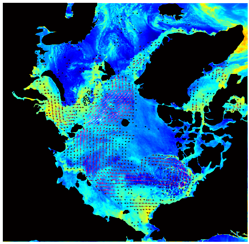 (Click image to enlarge)
VISITORS:
NEXT WEEK:
LOOKING AHEAD:
| Archived Weeklies Page | Submit a report item |