[ Archive ]
| CIMSS-NOAA Weekly Report
[ Archive ] |
IN THE PRESS:
ITEMS FOR THE ADMINISTRATOR:
ITEMS FOR THE ASSISTANT ADMINISTRATOR:
ITEMS FOR THE OFFICE DIRECTOR, STAR:
First International Cloud Working Group Meeting: The first meeting of the International Cloud Working Group (ICWG) was held this week in Lille, France. The ICWG evolved from the series of Cloud Retrieval and Evaluation Workshops which were funded by the European Organization for Meteorological Satellites (EUMETSAT). The goal of the ICWG is to facilitate coordination and collaboration among the operational and scientific cloud remote sensing communities. The results of the ICWG will be reported at the upcoming meeting of the Coordination Group of Meteorological Satellite (CGMS) in June. ICWG CGMS recommendations will include requests for official products for inter-comparisons and for the standardization of channels observed during rapid scan operations for severe weather. Andrew Heidinger was appointed as co-chair of the ICWG. Michael Pavolonis led the severe weather topical breakout group. (A. Heidinger, E/RA2, 608-263-6757, andrew.heidinger@noaa.gov, M. Pavolonis, E/RA2, 608-263-9597, mpav@ssec.wisc.edu)
6th Workshop on the Impact of Various Observing Systems on NWP: The World Meteorological Organization (WMO) 6th Workshop on the Impact of Various Observing Systems on NWP (numerical weather prediction) was held in Shanghai from 10 to 13 May 2016. About 90 experts from ECMWF, China, U.S., Canada, U.K., Germany, Norway, Japan, S. Korea, Australia, etc. attended this workshop. The focus was on the development of integrated, optimized observing systems with high efficiency for improving the numerical weather prediction through impact studies, and to provide evidence for designing the global observing system. Cooperative Institute for Meteorological Satellite Studies (CIMSS) scientists Ralph Petersen, Allen Huang, and Jun Li attended the workshop. Ralph gave a talk on the impact tests of aircraft moisture observations in several global scale NWP systems, Jun Li gave a talk on value-added impact from geostationary hyperspectral IR sounder observations on storm prediction, and Allen Huang gave a poster presentation on an OSSE framework in support of impact analysis of LEO hyperspectral sounder field of view size on forecast performance. (Jun Li, 608-262-3755, Jun.Li@ssec.wisc.edu; Ralph Petersen,Ralph.Petersen@ssec.wisc.edu; Allen Huang, allen.huang@ssec.wisc.edu) 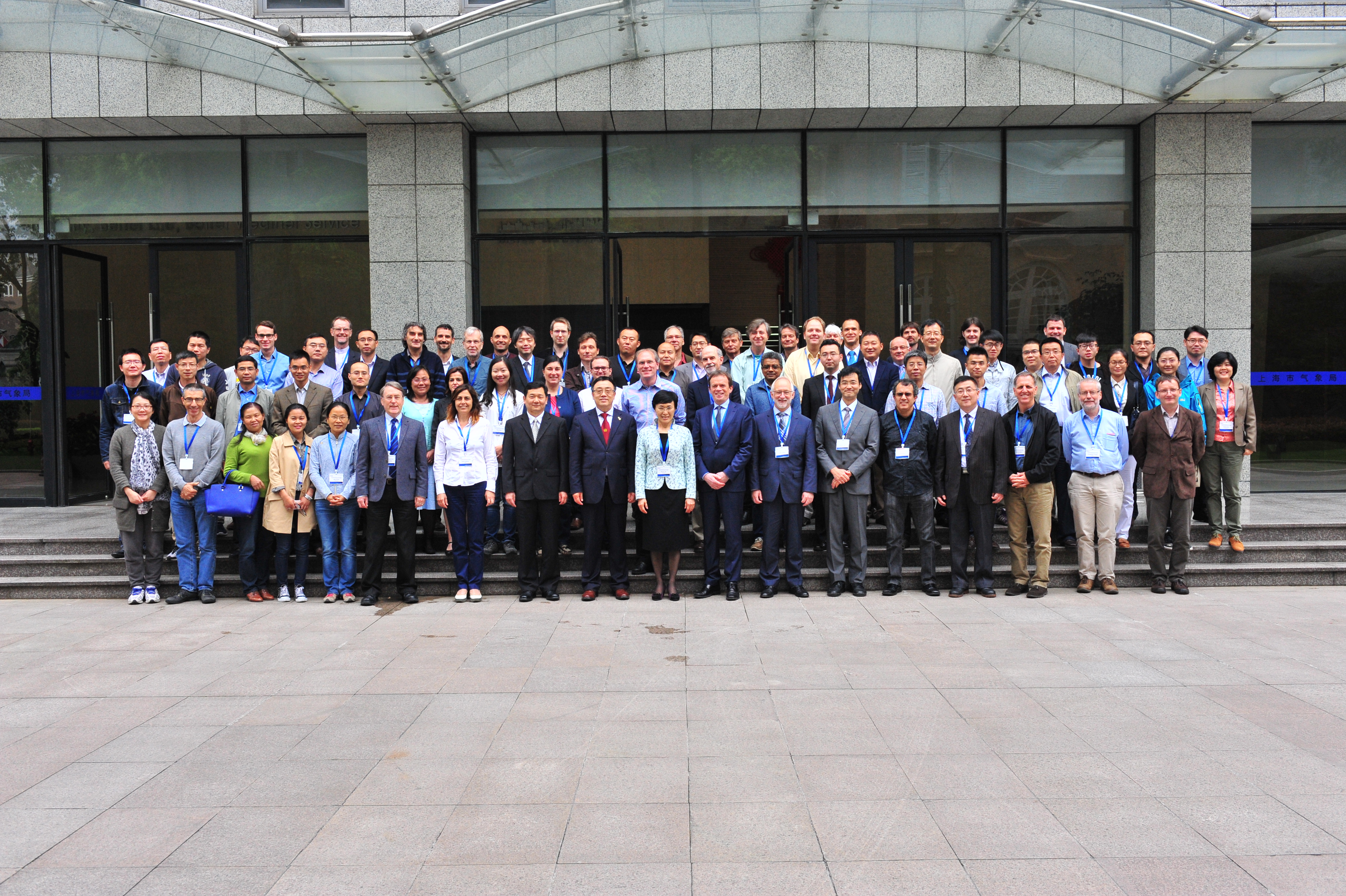 (Click image to enlarge)
ITEMS FOR THE DIVISION CHIEF, CoRP:
CIMSS Contributions to the Latest Operational GDAS/GFS: On 11 May 2016, the National Centers for Environmental Prediction (NCEP) released a significant upgrade to the Global Data Assimilation System/Global Forecast System (GDAS/GFS). Included in the new GDAS are contributions by these NOAA-sponsored Cooperative Institute for Meteorological Satellite Studies (CIMSS) projects: (1) The Joint Center for Satellite Data Assimilation (JCSDA) funded a project to improve the quality control (QC) of satellite-derived winds from polar satellites titled: “MODIS- and AVHRR-derived Polar Winds Experiments using the NCEP GDAS/GFS” (NA10NES4400011; PI: Santek, Co-I: Jung). The updated QC algorithm, the Log Normalized Vector Departure (LNVD), improves on the previous QC method as it’s based on vector departure, rather than wind component speed thresholds, as compared to the background. The forecast impact was generally neutral, except for a statistically significant improvement in the day-4 and day-5 500 hPa Anomaly Correlation Coefficient (ACC) score for a southern hemisphere, autumn 2012 experiment. The LNVD method is now in the operational model and will be used for the Visible Infrared Imaging Radiometer Suite (VIIRS) polar winds, which are currently being monitored. (2) The National Weather Service (NWS) funded a Sandy Supplemental proposal to evaluate the impact of including Aircraft Meteorological Data Relay (AMDAR) moisture observations in the global model, titled: “Quality Control and Impact Assessment of Aircraft Observations in the GDAS/GFS” (NA13NWS4830022; PI: Santek; Co-I: Petersen). By including moisture observations from the commercial aircraft-borne Water Vapor Sensing System version two (WVSS-II) instrument in the GDAS, a statistically significant positive impact on both the moisture and precipitation forecasts at short-range was found in a 2014 warm season experiment. As a result, the WVSS-II moisture observations are now being assimilated in the operational GDAS/GFS. (D. Santek, CIMSS, 608-263-7410; B. Hoover, CIMSS, 608-262-1957; R. Petersen, CIMSS, 608-263-4030; J. Jung, CIMSS, 301-763-8204)
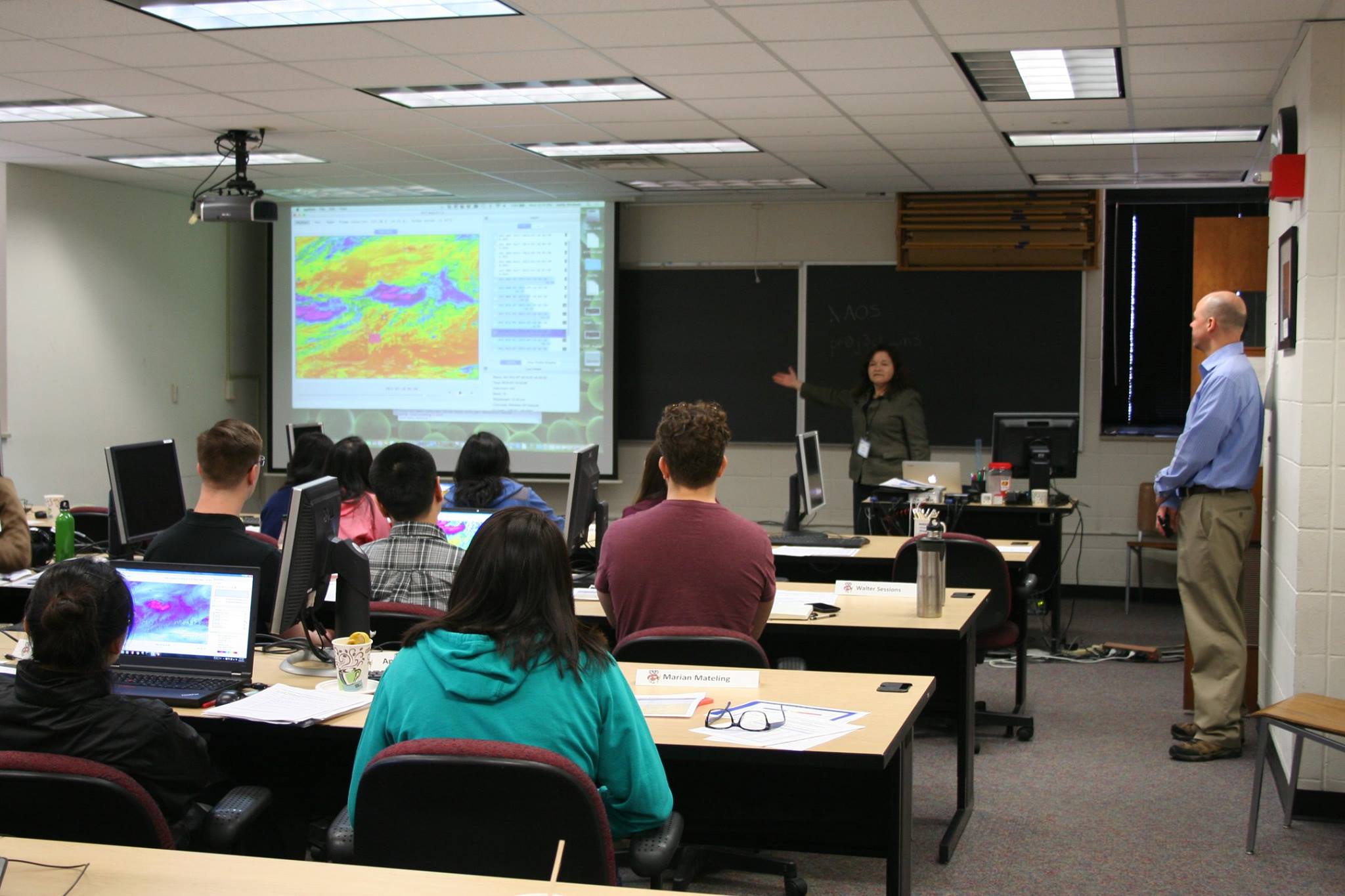
GOES-R Short Course ABI Preview for Students: On May 18, 2016, scientists from the Cooperative Institute for Meteorological Satellite Studies (CIMSS) and the Advanced Satellite Products Branch (ASPB) taught a day-long Geostationary Operational Environmental Satellite (GOES)-R Advanced Baseline Imager (ABI) course to atmospheric science graduate students at the University of Wisconsin-Madison titled "AOSS Short Course: GOES-R ABI Preview for Students." The course was similar in format to short courses sponsored by GOES-R for American Meteorological Society (AMS) meetings, with hands-on material that covered introducing GOES-R, exploiting ABI's multi-spectral capabilities, and an introduction to products. The instructors included Tim Schmit (NOAA/NESDIS), Mat Gunshor, Chris Schmidt, Jordan Gerth, Scott Lindstrom, and Kathy Strabala (CIMSS). There were many positive comments from students, including "thanks for... the wonderful course," "it's really cool to work with the latest satellite data," "this was extremely helpful" and positive comments about the training software used, the Satellite Information Familiarization Tool (SIFT). (M. Gunshor, CIMSS, 608-263-1146, T. Schmit, E/RA2, 608-263-0291, tim.j.schmit@noaa.gov, K. Strabala, CIMSS, S. Lindstrom, CIMSS, C. Schmidt, CIMSS, J. Gerth, CIMSS)
 (Click image to enlarge)
 (Click image to enlarge)
VISITORS:
NEXT WEEK:
LOOKING AHEAD:
| Archived Weeklies Page | Submit a report item |