[ Archive ]
| CIMSS-NOAA Weekly Report [ Archive ] |
ASPB AND CIMSS WEEKLY HIGHLIGHTS FOR THE WEEK ENDING AUGUST 26, 2016
IN THE PRESS:
ITEMS FOR THE ADMINISTRATOR:
ITEMS FOR THE ASSISTANT ADMINISTRATOR:
ITEMS FOR THE OFFICE DIRECTOR, STAR:
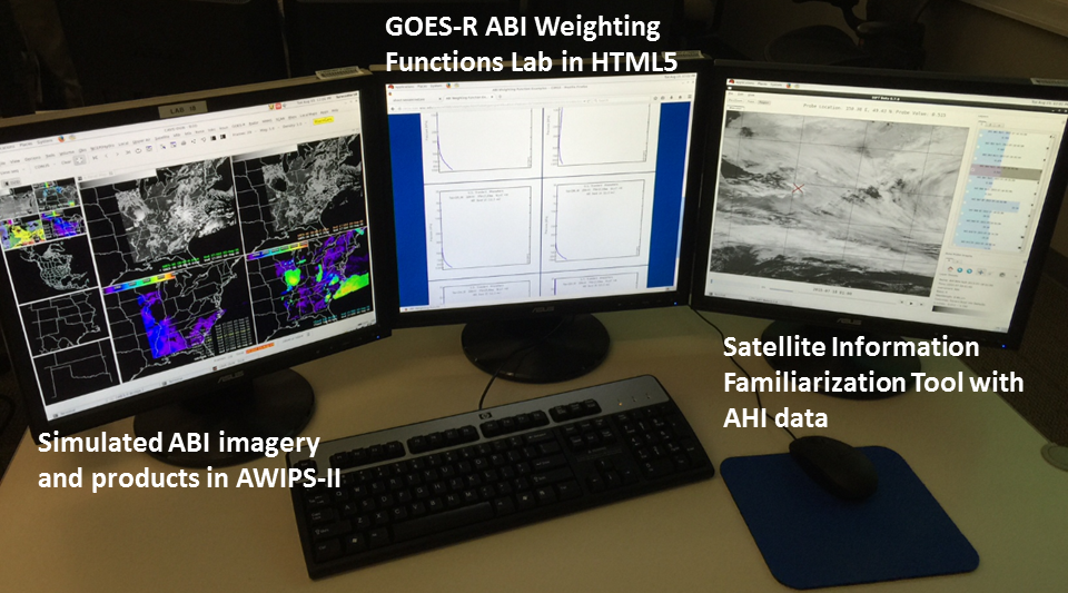
GOES-R at the NWS SOO Development Workshop: Jordan Gerth and Scott Lindstrom, researchers from the Cooperative Institute for Meteorological Satellite Studies (CIMSS), and Tim Schmit of the STAR Advanced Satellite Products Branch (ASPB) presented on operational applications of the Geostationary Operational Environmental Satellite R-Series (GOES-R) as part of a three-week workshop for new National Weather Service (NWS) Science and Operations Officers (SOOs). The GOES-R portion of the workshop was held in Norman, Oklahoma on August 23, 2016, and included both lectures and lab exercises. It included interactive segments such as manipulating simulated GOES-R imagery and products in the Advanced Weather Interactive Processing System (AWIPS), investigating infrared channel weighting functions with a web application, and probing Advanced Himawari Imager (AHI) data with the CIMSS-developed Satellite Information Familiarization Tool (SIFT). (T. Schmit, E/RA2, 608-263-0291, tim.j.schmit@noaa.gov; J. Gerth, CIMSS; S. Lindstrom, CIMSS)
 (Click image to enlarge)
Figure caption: Example of a student’s screen after the three hands-on exercises.
ITEMS FOR THE DIVISION CHIEF, CoRP:
CIMSS Scientist Receives NSF Supercomputing Allocation: Cooperative Institute for Meteorological Satellite Studies (CIMSS) Associate Scientist Leigh Orf was awarded 234 million core hours of computing time on the Blue Waters supercomputer (https://nsf.gov/awardsearch/showAward?AWD_ID=1614973). This two-year allocation will provide access to the machine and provides travel to workshops and conferences. Orf and his collaborators will be using Blue Waters to do extremely high resolution simulations of supercell thunderstorms, including supercells that produce the strongest tornadoes. (L. Orf, CIMSS, 608-890-1983)
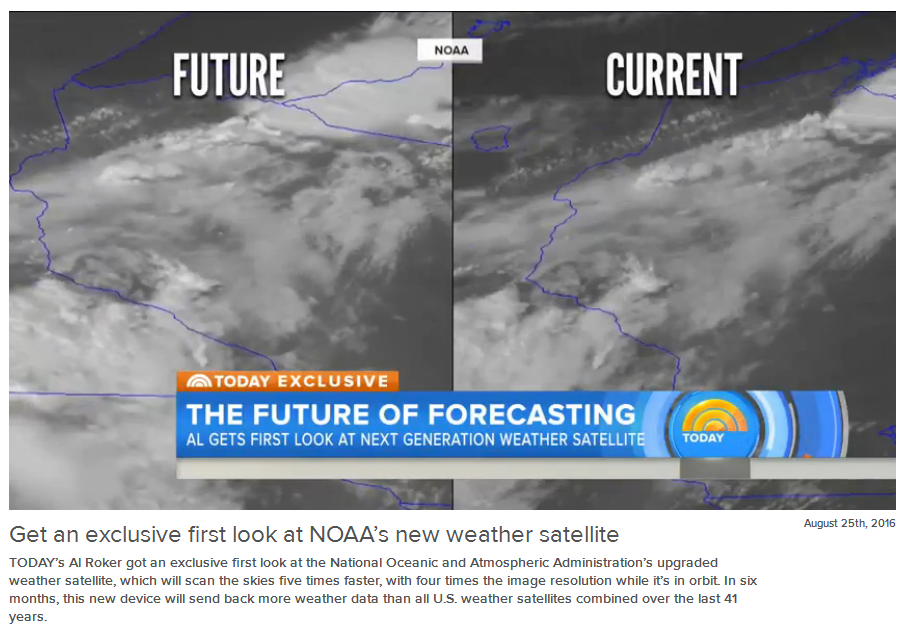
GOES-14 Rapid Scan Data: Supporting the AWT: The GOES-14 1-min rapid scan imagery supported the Aviation Weather Testbed (AWT), among other groups such as the Storm Prediction Center (SPC). To better prepare for the meso-scale sectors on the Advanced Baseline Imager (ABI) on GOES-R, this testbed is demonstrating how rapid-scan imagery can assist aviation interests. Cases include visibility in California and convection in Illinois: http://goesrawt.blogspot.com/2016/08/caws-support-and-1-minute-imagery-this.html. The final location of the daily center point was decided by Tim Schmit, which was then communicated to the satellite operators. Many GOES-14 1-minute cases were developed and hosted on the CIMSS Satellite Blog, including a tropical ‘invest’ case (http://cimss.ssec.wisc.edu/goes/blog/archives/category/goes-14). (T. Schmit, E/RA2, 608-263-0291, tim.j.schmit@noaa.gov; S. Bachmeier, CIMSS, 608-263-3958; S. Lindstrom, CIMSS; SSEC Data Center)
 (Click image to enlarge)
Figure caption: A screen shot from the Today Show video on GOES-R (http://www.today.com/video/get-an-exclusive-first-look-at-noaa-s-new-weather-satellite-750733891982). The image comparison was generated at the University of Wisconsin-Madison with GOES-14 1-minute data.
VISITORS:
NEXT WEEK:
LOOKING AHEAD:
| Archived Weeklies Page | Submit a report item |