[ Archive ]
| CIMSS-NOAA Weekly Report [ Archive ] |
ASPB AND CIMSS WEEKLY HIGHLIGHTS FOR THE WEEK ENDING FEBRUARY 2, 2018
IN THE PRESS:
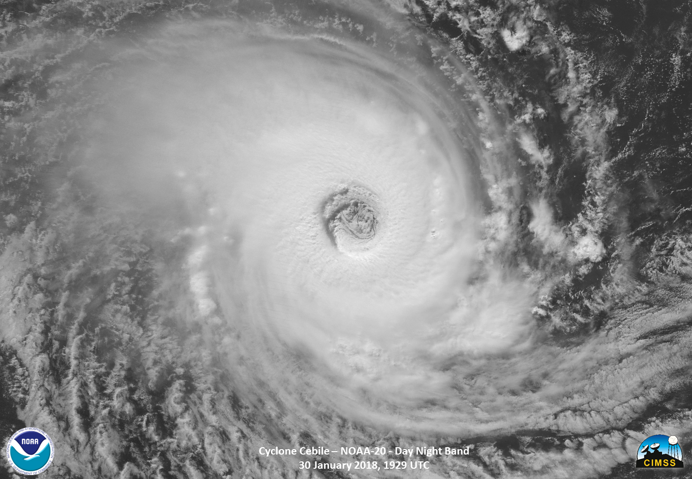
SSEC and CIMSS Scientists in the News: Scientists at the University of Wisconsin-Madison Space Science and Engineering Center (SSEC) and the Cooperative Institute for Meteorological Satellite Studies (CIMSS) provide expert commentary, interviews, and imagery to news media. In the news this week: 1) UW News and SSEC News highlighted SSEC researcher Liam Gumley's work in the area of receiving and processing satellite data for use by everyone from other researchers and meteorologists to the general public, "Freely shared satellite data improves weather forecasting" (https://go.wisc.edu/6v8tdj), and "Shared data, shared discovery with JPSS-1" (https://go.wisc.edu/h7pyc9); 2) SSEC senior scientist Paul Menzel and NOAA scientist Steve Goodman (retired) taught a remote sensing workshop in Madison, "Remote sensing seminar comes home to Madison" (https://go.wisc.edu/2rz20q); 3) Shared on social media, a stunning image from NOAA/CIMSS captured by NOAA-20 showing the well-defined eye of Tropical Cyclone Cebile (https://twitter.com/uwssec); 4) The American Meteorological Society published a biography of Verner Suomi, with authors from NOAA, CIMSS, and SSEC, "Verner Suomi: The Life and Work of the Founder of Satellite Meteorology" (https://go.wisc.edu/fxhkmk). (J. Phillips, SSEC, 608-262-8164)
 (Click image to enlarge)
Figure caption: NOAA-20 observed Tropical Cyclone Cebile, and its well-defined eye, in the Indian Ocean on Jan. 30, 2018. Imagery and data from NOAA-20 are preliminary, until the satellite is declared operational. Credit: NOAA, CIMSS.
ITEMS FOR THE ADMINISTRATOR:
ITEMS FOR THE ASSISTANT ADMINISTRATOR:
ITEMS FOR THE OFFICE DIRECTOR, STAR:
ITEMS FOR THE DIVISION CHIEF, CoRP:
Manuscript Describing Nonlinear Bias Correction Method for All-Sky Satellite Data Assimilation Published: A manuscript entitled “Nonlinear bias correction for satellite data assimilation using Taylor series polynomials” by Jason Otkin et al. was published in the January issue of Monthly Weather Review. This paper described a new bias correction method that uses a Taylor series polynomial expansion of the observation-minus-background departures to remove both linear and nonlinear conditional biases from the observation departures. The results showed that variables sensitive to the cloud top height are effective bias predictors, especially when higher order nonlinear Taylor series terms are used. In addition, the nonlinear bias correction terms were shown to be much more important for removing the bias from cloud-sky observations that they were for clear-sky observations. This indicates that as we move toward all-sky data assimilation that it will be necessary to use higher order nonlinear predictors within operational bias correction methods. (J. Otkin, CIMSS, 608-265-2476)
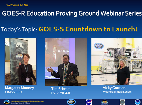
GOES-S Countdown to Launch Webinar for Educators: The Cooperative Institute for Meteorological Satellite Studies (CIMSS) organized a webinar for middle and high school science teachers to galvanize awareness around the March 1, 2018 launch of the Geostationary Operational Environmental Satellite (GOES)–S, the sister satellite to GOES-16. NOAA’s Tim Schmit presented science and technology aspects of the duo satellites before middle school teacher Vicky Gorman outlined resources available for educators. The recorded webinar and presenter slides are featured prominently on the GOES-R Education Proving Ground web page at http://cimss.ssec.wisc.edu/education/goesr/. (M. Mooney, CIMSS, 608-265-2123, T. Schmit, E/RA2, 608-263-0291)
 (Click image to enlarge)
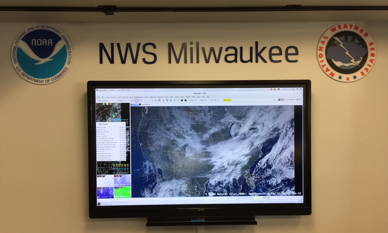
Visits to Local National Weather Service Forecast Office: Jordan Gerth and Scott Lindstrom of the Cooperative Institute for Meteorological Satellite Studies (CIMSS) and Tim Schmit (NOAA NESDIS) visited the National Weather Service (NWS) forecast office in Sullivan, Wisconsin, the week of January 29, 2018. The purpose of these visits was to hold a series of conversations with small groups of operational meteorologists about the benefits of imagery and derived products from the Advanced Baseline Imager (ABI) on the Geostationary Operational Environmental Satellite R-Series (GOES-R), particularly for winter weather forecasting applications. These conversations, aimed at increasing retention of GOES-R series capabilities, supplement conventional training that NWS meteorologists have completed over the past year. (J. Gerth, CIMSS, 608-263-4942, S. Lindstrom, CIMSS; T. Schmit, E/RA2, 608-263-0291)
 (Click image to enlarge)
Figure caption: Natural Color image from GOES-16 as shown in AWIPS (Advanced Weather Interactive Processing System) at the Sullivan Weather Forecast Office (WFO).
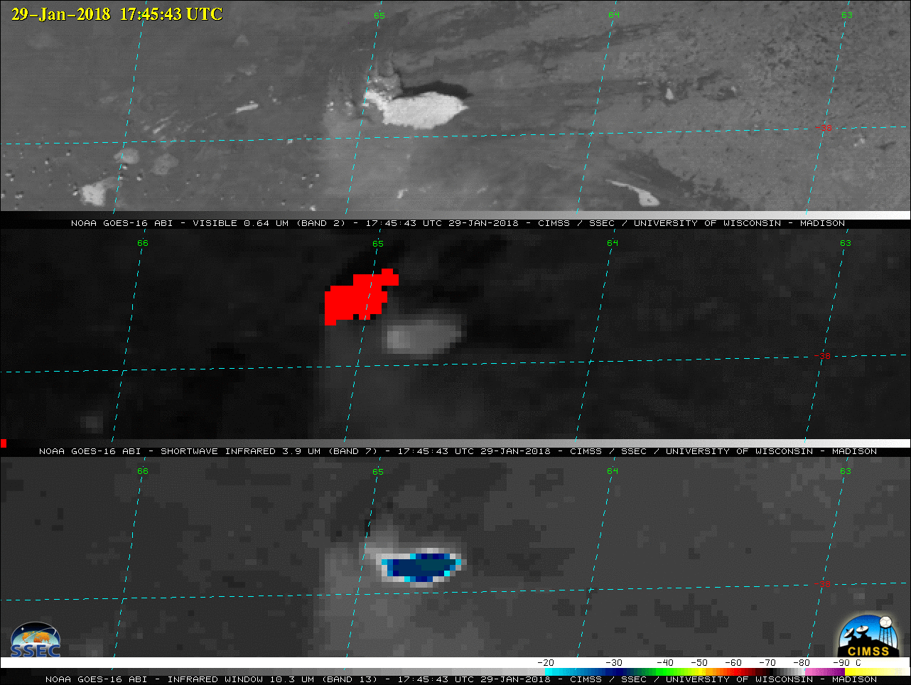
Satellite Observations of a Pyrocumulonimbus Cloud in Argentina: The Cooperative Institute for Meteorological Satellite Studies (CIMSS) PyroCb Blog (http://pyrocb.ssec.wisc.edu/archives/2213) was updated with a post showing Geostationary Operational Environmental Satellite (GOES)-16 and Aqua Moderate Resolution Imaging Spectroradiometer (MODIS) imagery of a pyrocumulonimbus (pyroCb) cloud in central Argentina on January 29, 2018. This is believed to be the first confirmed pyroCb event over the continent of South America. (S. Bachmeier, CIMSS, 608-263-3958)
 (Click image to enlarge)
Figure caption: GOES-16 Visible (0.64 µm, top), Shortwave Infrared (3.9 µm, center) and Infrared Window (10.3 µm, bottom) images showing the smoke plumes, fire thermal anomalies or “hot spots” (red pixels) and cold pyrocumulonimbus cloud-top infrared brightness temperatures, respectively.
VISITORS:
NEXT WEEK:
LOOKING AHEAD:
| Archived Weeklies Page | Submit a report item |