[ Archive ]
| CIMSS-NOAA Weekly Report [ Archive ] |
ASPB AND CIMSS WEEKLY HIGHLIGHTS FOR THE WEEK ENDING MARCH 2, 2018
IN THE PRESS:
ITEMS FOR THE ADMINISTRATOR:
ITEMS FOR THE ASSISTANT ADMINISTRATOR:
ITEMS FOR THE OFFICE DIRECTOR, STAR:
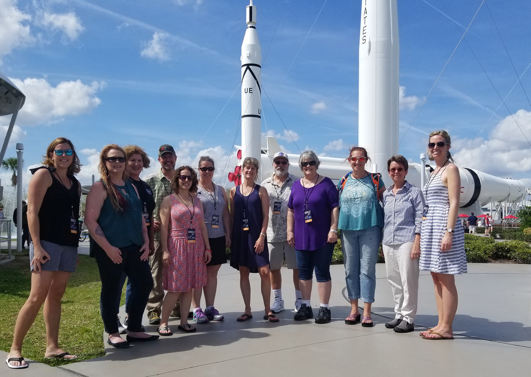
Teachers Gather at the GOES-S Launch: Over a dozen middle and high school science teachers traveled from Colorado and California to attend the March 1st launch of the Geostationary Operational Environmental Satellite (GOES) - S, having received invitations as a result of their participation in the GOES-R Education Proving Ground (http://cimss.ssec.wisc.edu/education/goesr/) and attending a workshop at Lockheed Martin in August 2017. (M. Mooney, CIMSS, (608) 265-2123)
 (Click image to enlarge)
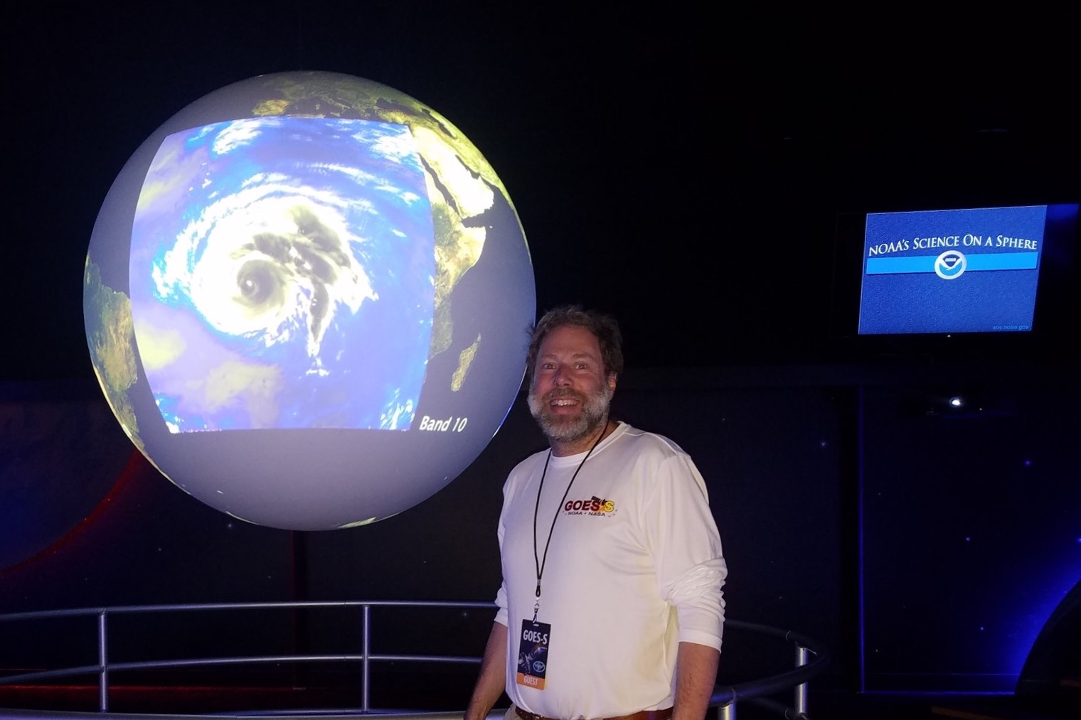
GOES-S Launch Activities: T. Schmit presented at the Geostationary Operational Environmental Satellites (GOES)-S Science meeting on February 28, 2018 in Cape Canaveral, Florida. The presentation was on the current status of GOES-16 imagery and post-launch plans for GOES-S. The meeting was organized by Daniel Lindsey. At the request of NOAA Communications, Schmit gave a short presentation on GOES via the Science on the Sphere to RDML Tim Gallaudet, Assistant Secretary of Commerce for Oceans and Atmosphere. On March 1, 2018 he gave a Science on the Sphere presentation to 40 @NASASocial media participants. (T. Schmit, E/RA2, 608-263-0291)
 (Click image to enlarge)
Figure caption: Science on the Sphere showing GOES-16 ABI imagery at the Kennedy Space Center in Cape Canaveral, Florida. Photo credit: Margaret Mooney, CIMSS.
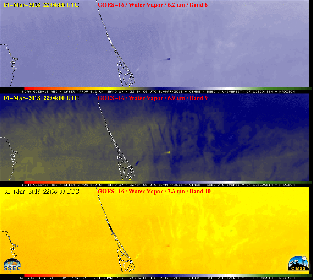
GOES-16 Images Showing Signatures of the GOES-S Launch: The Cooperative Institute for Meteorological Satellite Studies (CIMSS) Satellite Blog (http://cimss.ssec.wisc.edu/goes/blog/archives/27179) was updated with a post showing Geostationary Operational Environmental Satellite (GOES)-16 signatures of the GOES-S launch from Cape Canaveral, Florida on March 1, 2018. A GOES-16 Mesoscale Domain Sector was requested by T. Schmit, which allowed 1-minute image sampling during the launch window. Signatures of both the rocket booster cloud condensation plume and the thermal anomaly from the booster engines could be seen in the GOES-16 images. (S. Bachmeier, CIMSS, 608-263-3958, T. Schmit, E/RA2, 608-263-0291)
 (Click image to enlarge)
Figure caption: GOES-16 (GOES-East) Upper-level (6.2 µm, top), Mid-level (6.9 µm, middle) and Low-level (7.3 µm, bottom) Water Vapor images which show signatures of both the rocket booster cloud condensation plume and the thermal anomaly from the booster engines.
ITEMS FOR THE DIVISION CHIEF, CoRP:
Remote Sensing Exam Delivered for Science Olympiad: On Saturday, 24 February 2018, Jordan Gerth of the Cooperative Institute for Meteorological Satellite Studies (CIMSS) delivered, proctored, and graded the high school division remote sensing exam for the Badger invitational tournament of the Science Olympiad in Madison, Wisconsin. J. Gerth, with the assistance of colleagues, developed the remote sensing exam for the tournament based on resources from the NOAA Science Olympiad web page. Science Olympiad is a national competition to increase K-12 student and teacher participation in science, technology, engineering, and math (STEM) that NOAA sponsors. The exam has been shared with the NOAA Office of Education. (J. Gerth, CIMSS, 608-263-4942)
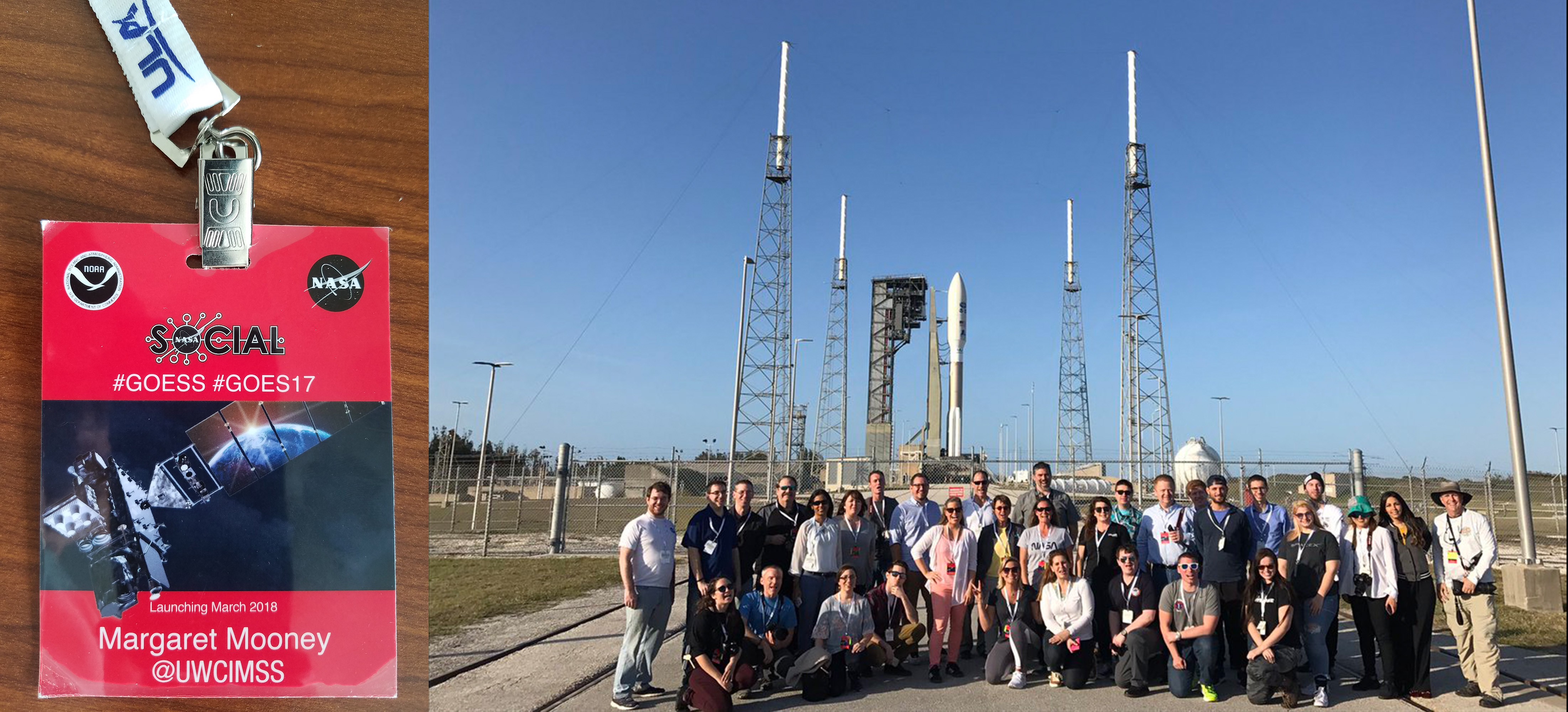
@UWCIMSS Participates in NASA Social at the GOES-S launch: Margaret Mooney, Cooperative Institute for Meteorological Satellite Studies (CIMSS), joined others from around the world at the Geostationary Operational Environmental Satellite (GOES)-S launch for a 2-day NASA Social, a social media event meant to raise the visibility of the historic satellite launch. (M. Mooney, CIMSS, (608) 265-2123)
 (Click image to enlarge)
WMO Meeting on Satellite Utilization and Products: The World Meteorological Organization (WMO) held its fourth meeting of the Inter-Programme Expert Team on Satellite Utilization and Products (IPET-SUP-4), 26-27 February 2018. As chair of the Sustained, Coordinated Processing of Environmental Satellite Data for Nowcasting (SCOPE-Nowcasting) Executive Panel, M. Pavolonis remotely briefed the IPET-SUP on the status of the SCOPE-Nowcasting initiative. The goal of the WMO SCOPE-Nowcasting initiative (http://www.wmo.int/pages/prog/sat/meetings/SCOPE-Nowcasting-EP-1.php) is to demonstrate continuous and sustained provision of consistent, well-characterized satellite products for nowcasting and severe weather risk reduction. Recent SCOPE-Nowcasting activities have focused on the development of new pilot projects aimed at improving the utilization of meteorological satellite measurements for nowcasting rapidly evolving convective weather. In addition, a major international inter-comparison of satellite-derived volcanic ash products is continuing under SCOPE-Nowcasting. NOAA products and services, related to natural hazard detection and forecasting, benefit from the improved international coordination achieved through SCOPE-Nowcasting. The IPET-SUP-4 briefing on SCOPE-Nowcasting is available at http://www.wmo.int/pages/prog/sat/meetings/documents/IPET-SUP-4_Doc_10-01_SCOPE-Nowcasting-ppt.pdf. (M. Pavolonis, E/RA2, 608-263-9597, Mike.Pavolonis@noaa.gov)
VISITORS:
NEXT WEEK:
LOOKING AHEAD:
| Archived Weeklies Page | Submit a report item |