[ Archive ]
| CIMSS-NOAA Weekly Report [ Archive ] |
ASPB AND CIMSS WEEKLY HIGHLIGHTS FOR THE WEEK ENDING APRIL 27, 2018
IN THE PRESS:
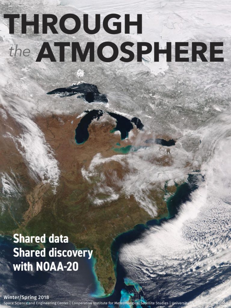
SSEC and CIMSS Scientists in the News: Scientists at the University of Wisconsin-Madison (UW) Space Science and Engineering Center (SSEC) and the Cooperative Institute for Meteorological Satellite Studies (CIMSS) provide expert commentary, interviews, and imagery to news media. This week SSEC Communications published the Winter/Spring 2018 issue of Through the Atmosphere. All of the stories between the covers of the magazine are linked by a guiding philosophy of shared data that leads to shared discovery. Stories in this issue include: 1) Hurricane Maria: Modeling towards resilience and supporting Puerto Rico (featuring S. Hubbard, CIMSS); 2) Ultralight science: Boundary layer measurements from low-flying source (featuring J. Thom, SSEC; A. Desai, G. Petty, and T. L'Ecuyer, AOS), 3) Shared data, Shared discovery: SSEC's continued commitment to open data (featuring L. Gumley, SSEC); 4) Terry Kelly: Visionary of computerized weather, elected Fellow of the AMS; 5) CAMEL: A land surface emissivity upgrade for UK radiative transfer model (featuring E. Borbas, CIMSS). Through the Atmosphere is available at http://www.ssec.wisc.edu/through-the-atmos/. (J. Phillips, SSEC, 608-262-8164)
 (Click image to enlarge)
Figure caption: Through the Atmosphere, Winter/Spring 2018. Credit: SSEC.
ITEMS FOR THE ADMINISTRATOR:
ITEMS FOR THE ASSISTANT ADMINISTRATOR:
ITEMS FOR THE OFFICE DIRECTOR, STAR:
Superior Wisconsin Oil Refinery explosion as viewed from Satellite: An oil refinery in Superior Wisconsin suffered an explosion and fire on 26 April 2018. An entry on the CIMSS Satellite Blog (http://cimss.ssec.wisc.edu/goes/blog/archives/27868) documents the view of the event from GOES-16 and Aqua satellites. A distinct black plume of smoke was apparent. (Scott Lindstrom, CIMSS, 608-263-4425; Scott Bachmeier, CIMSS, scottb@ssec.wisc.edu ; Tim Schmit, NOAA/ASPB/CIMSS, 608-263-0291)
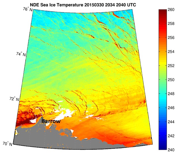
Ice Product Demonstration for ASIP: The JPSS Visible Infrared Imaging Radiometer Suite (VIIRS) Cryosphere Team is finishing a two-week, near-real-time demonstration of VIIRS ice products for the Alaska Sea Ice Program (ASIP, NWS). Enterprise ice products are being generated with VIIRS data and the Enterprise cloud mask from the University of Alaska-Fairbanks direct broadcast system, provided by the Geographic Information Network of Alaska (GINA). The data are processed at the Cooperative Institute for Meteorological Satellite Studies (CIMSS, R. Dworak, A. Letterly, X. Wang, and Y. Liu), converted to GEOTIFF format, and sent to GINA. GINA then posts plots of the data and links to the data files on a website, which are used by the ASIP ice analysts in their day-to-day work. ASIP will provide feedback on the products at the end of the demonstration period. The ice products include ice concentration, ice thickness, ice surface temperature, and ice motion. The first three are NESDIS operational products. Ice motion, which is a blended AMSR2-VIIRS product, is experimental. (J. Key, E/RA2, 608-263-2605, jeff.key@noaa.gov)
 (Click image to enlarge)
Figure caption: Ice surface temperature (IST) north of Alaska from VIIRS.
ITEMS FOR THE DIVISION CHIEF, CoRP:
Provided Geostationary Images for Planetarium Shows: Tim Schmit provided Advanced Himawari Imager (AHI) images of Super Typhoon Debbie for a planetarium show (Expedition Reef) produced by the California Academy of Sciences (https://www.calacademy.org/expedition-reef). He also provided Geostationary Operational Environmental Satellite (GOES) images of Hurricane Dean and fog over California for subsequent productions. (T. Schmit, E/RA2, 608-263-0291, tim.j.schmit@noaa.gov)
VISITORS:
NEXT WEEK:
LOOKING AHEAD:
| Archived Weeklies Page | Submit a report item |