[ Archive ]
| CIMSS-NOAA Weekly Report [ Archive ] |
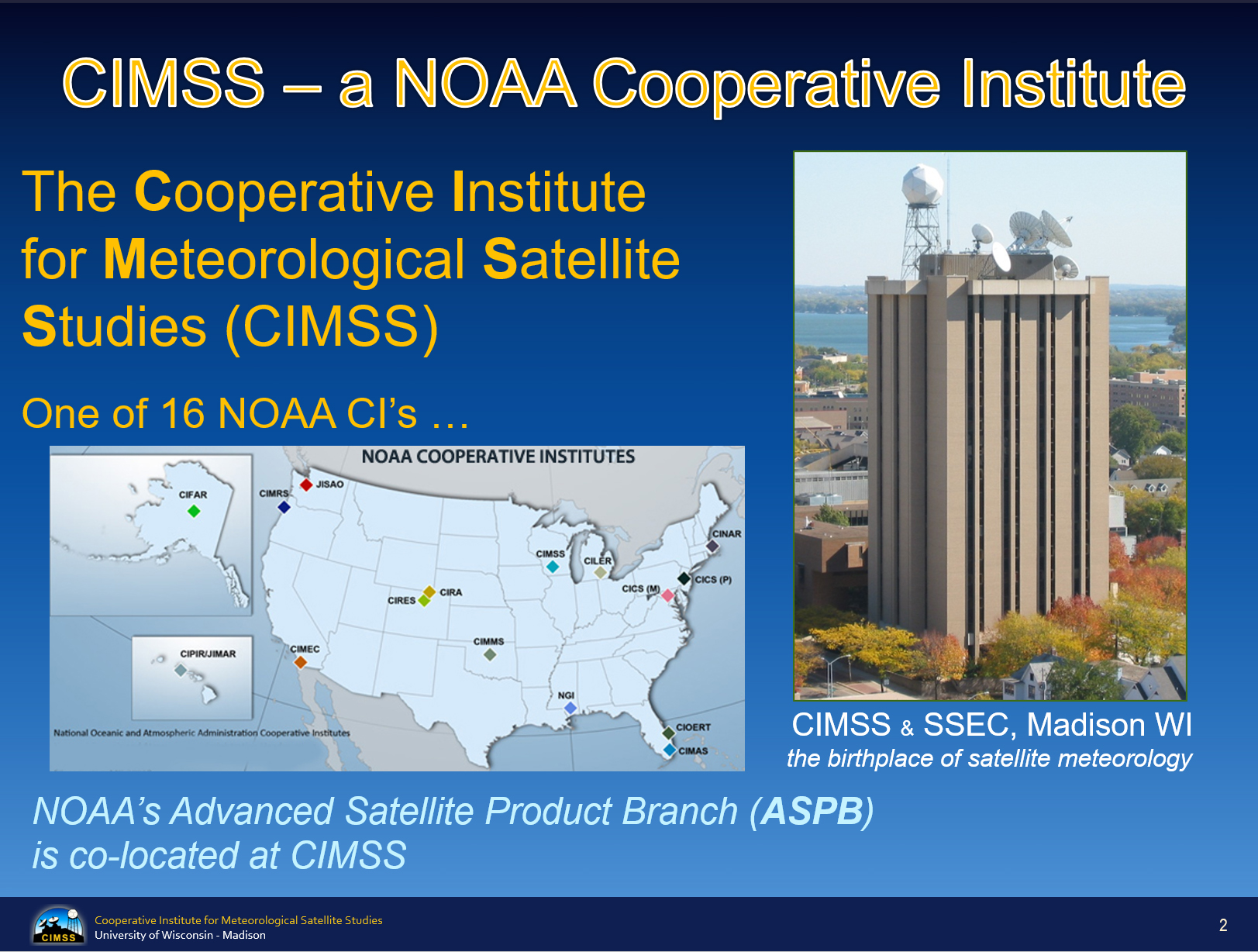
ASPB AND CIMSS WEEKLY HIGHLIGHTS FOR THE WEEK ENDING FEBRUARY 1, 2019
IN THE PRESS:
SSEC and CIMSS Scientists in the News: Scientists at the University of Wisconsin-Madison (UW) Space Science and Engineering Center (SSEC) and the Cooperative Institute for Meteorological Satellite Studies (CIMSS) provide expert commentary, interviews, and imagery to news media and participate in events to promote science. In the news this week: 1) The Wisconsin State Journal published, "A sub-zero 7 a.m. science experiment on Lake Mendota." CIMSS scientists Jordan Gerth and Steve Ackerman were interviewed for the story. (https://go.wisc.edu/a7hb27) 2) CIMSS Satellite blog contributor Scott Bachmeier published posts on the "Paper mill fire in New Jersey" (Jan. 30), "Cold weather outbreak across the Upper Midwest and Great Lakes" (Jan. 30), "Potential Vorticity anomaly over the East Pacific Ocean" (Jan. 29), "Severe thunderstorms in Argentina" (Jan. 25), and "PyroCumulonimbus cloud in Australia" (Jan. 25). Read more at the CIMSS Satellite Blog: http://cimss.ssec.wisc.edu/goes/blog/. 3) CIMSS scientist Jordan Gerth was interviewed on Wisconsin Public Radio's Morning Show to talk about Wisconsin's winter storm. (https://go.wisc.edu/31zzs8) (J. Phillips, SSEC, 608-262-8164, S. Bachmeier, CIMSS, J. Gerth, CIMSS, S. Ackerman, CIMSS)
 (Click image to enlarge)
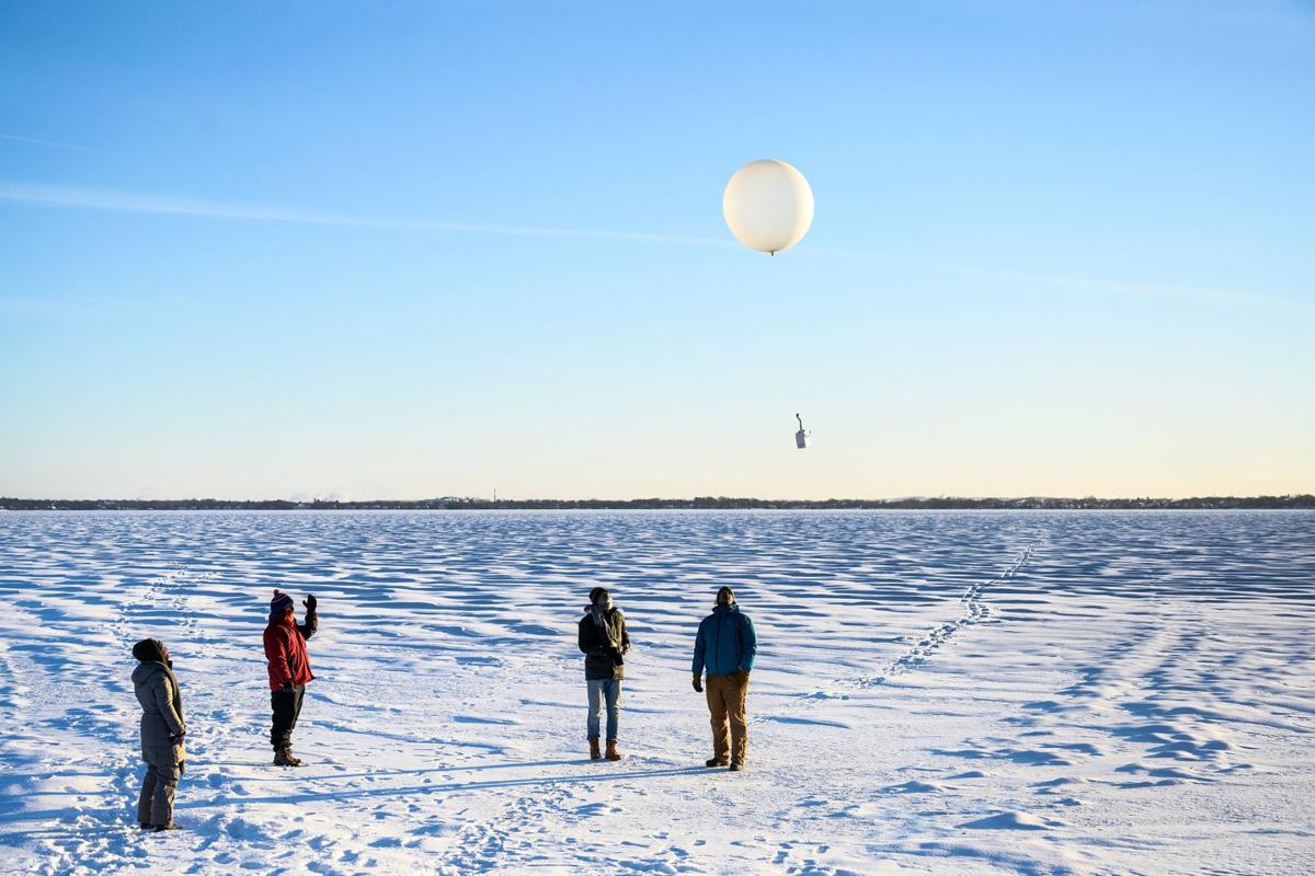
Figure: Weather balloon released as part of "A sub-zero 7 a.m. science experiment on Lake Mendota." Professor Grant Petty arranged the balloon launch. Credit: Jeff Miller, UW-Madison.
 (Click image to enlarge)
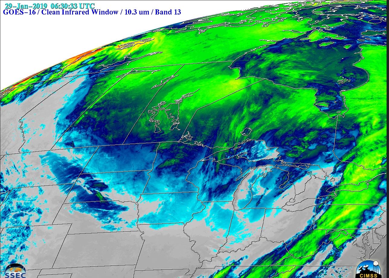
Figure: GOES-16 “Clean” Infrared Window (10.3 µm) images showed the southward expansion of arctic air into the north-central US, 28-30 January 2019. Surface infrared brightness temperatures of -30 to -40ºC (darker blue to green enhancement) covered a large area. Such cold infrared brightness temperatures are normally associated with clouds in the middle to upper troposphere. Surface air temperatures of -20 to -40ºF were widespread, along with wind chill values of -40 to -70ºF. Credit: CIMSS.
ITEMS FOR THE ADMINISTRATOR:
ITEMS FOR THE ASSISTANT ADMINISTRATOR:
ITEMS FOR THE OFFICE DIRECTOR, STAR:
Schmit Becomes AMS Fellow: Tim Schmit recently became a fellow of the American Meteorological Society (AMS). Tim's citation read, "Tim has dedicated his career to scientific support of multiple Geostationary Operational Environmental Satellite (GOES) missions and instruments, including the GOES-16 ABI. His research interests span calibration, visualization, and algorithm development and he is committed to research-to-operations, training others and science communication." More information is available at https://www.ssec.wisc.edu/news/articles/11525. (T. Schmit, E/RA2, 608-263-0291)
 (Click image to enlarge)
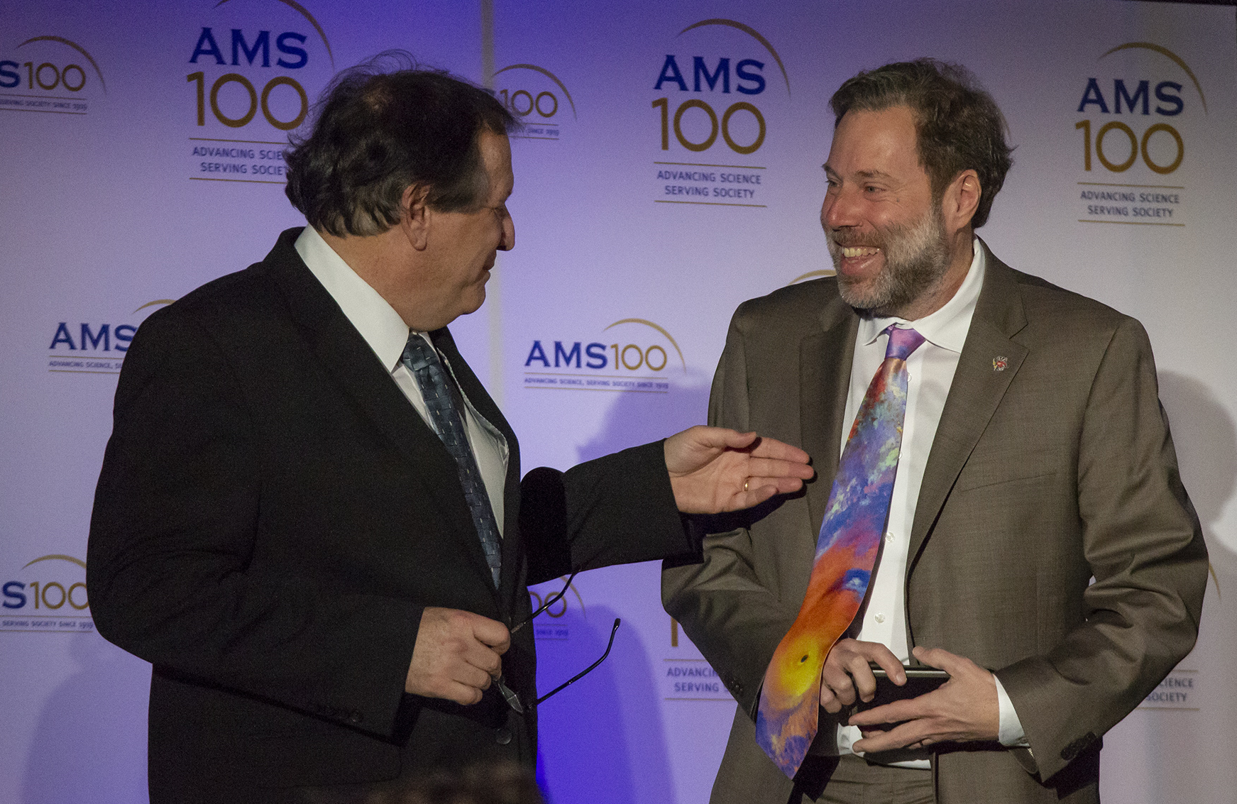
Figure: Recent AMS fellows Mitch Goldberg and Tim Schmit and a (preliminary, non-operational) GOES-17 tie of Hurricane Michael. Photo Credit: Chris Schmidt, CIMSS
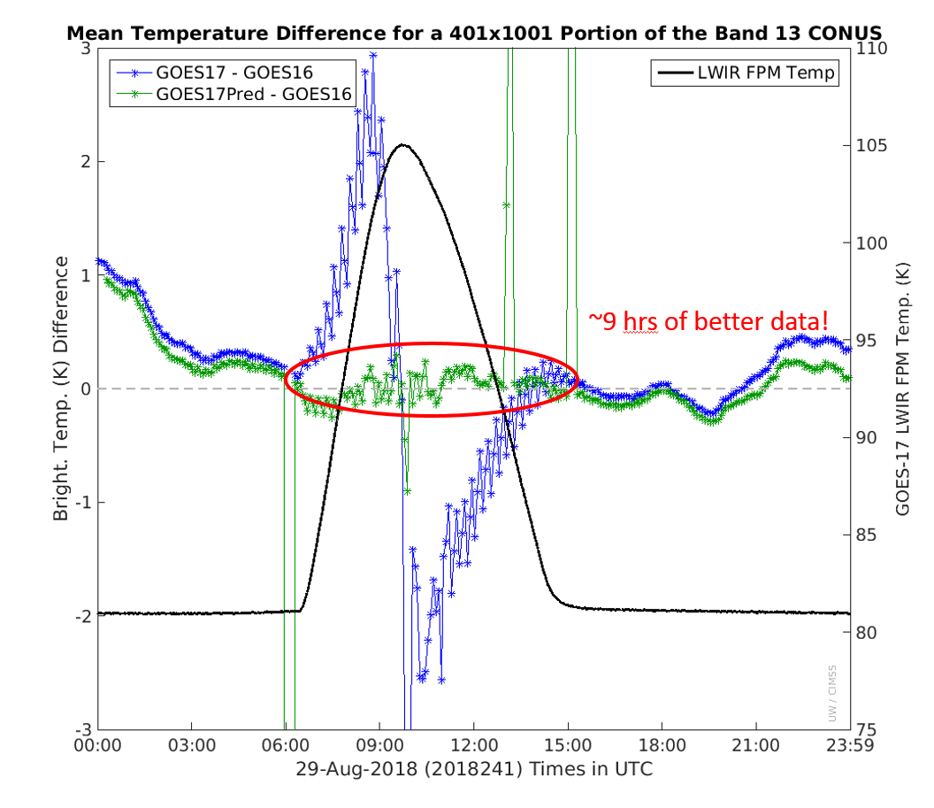
First Look at Improved GOES-17 ABI Calibration: To improve the calibration of Geostationary Operational Environmental Satellite (GOES)-17 Advanced Baseline Imager (ABI) infrared bands, Harris engineers are working on what has been called predictive calibration. During the periods when the detector temperatures change, the assumptions of the standard calibration approach does not work as desired. Cooperative Institute for Meteorological Satellite Studies (CIMSS) and ASPB scientists received sample ABI data to help analyze the predictive calibration approach. Sample data were compared quantitatively to both GOES-16 and original GOES-17 and showed much improvement over the latter in the pre-saturation times; it is likely that this will allow for more hours of higher quality data, reducing negative impacts on users and products during the hours when the ABI detector temperatures rapidly change. Presentations were made to the Calibration Working Group, Product Working Group and the Algorithm Working Group to brief them on the results and more sample data with an improved predictive calibration method are expected soon. (M. Gunshor, CIMSS, 608-263-6754, T. Schmit, E/RA2, 608-263-0291)
 (Click image to enlarge)
Figure: Draft results for ABI band 13 (10.3 um) showing the potential of the predictive calibration approach by comparing it to GOES-16 data.
ITEMS FOR THE DIVISION CHIEF, CoRP:
CIMSS Participation in Australian Focus Group Meeting: Bodo Zeschke of the Australian Bureau of Meteorology led a Regional Focus Group Telecon on southwest Pacific Weather that also discussed stereographic imagery from GOES-16/GOES-17 and from GOES-17/Himawari-8 that were created by Scott Lindstrom, Cooperative Institute for Meteorological Satellite Studies (CIMSS). Scott also participated in the telecon, offering descriptions of how the imagery were created and how they could be used. This telecon was to prep for more stereoscopic imagery from the Korean Meteorological Administration (KMA) GEO-KOMPSAT2A (GK2A) and the Japanese Meteorological Agency (JMA) Himawari-8 when the former becomes operational later this year. (Scott Lindstrom, CIMSS, 608 263 4425)
Wisconsin Fruit and Vegetable Conference : Margaret Mooney from NOAA's Cooperative Institute for Meteorological Satellite Studies (CIMSS) filled a government shutdown gap by stepping up to present at the 2019 Wisconsin Fruit and Vegetable Conference on Monday January 28th. The topic was "Dealing with the Changing Weather." Mooney briefed the audience on our newest weather satellites and the importance of satellite data before sharing climate data from the National Climate Assessment, the Great Lakes Integrated Sciences + Assessments (GLISA) and the Wisconsin Initiative on Climate Change Impacts (WICCI). It was a good opportunity to reach a new audience and promote CIMSS and NOAA resources. (M. Mooney, CIMSS, (608) 265-2123)
 (Click image to enlarge)
GOES-16/17 CONUS Comparisons: The Cooperative Institute for Meteorological Satellite Studies (CIMSS) has added the CONUS (Contiguous US) option to the Geostationary Operational Environmental Satellite (GOES) comparison page (http://cimss.ssec.wisc.edu/goes-r/abi-/band_statistics_imagery.html). Previously only comparisons from the Full Disk scans were computed. This site is critical to assess the Loop Heat Pipe impacts, the Periodic Infrared Calibration Anomaly (PICA) and scan mode. Each image, along with past days, can be found at http://data.ssec.wisc.edu/abi/16band_stats/. (J. Nelson, CIMSS, 608-263-6013, M. Gunshor, CIMSS, T. Schmit, E/RA2, 608-263-0291)
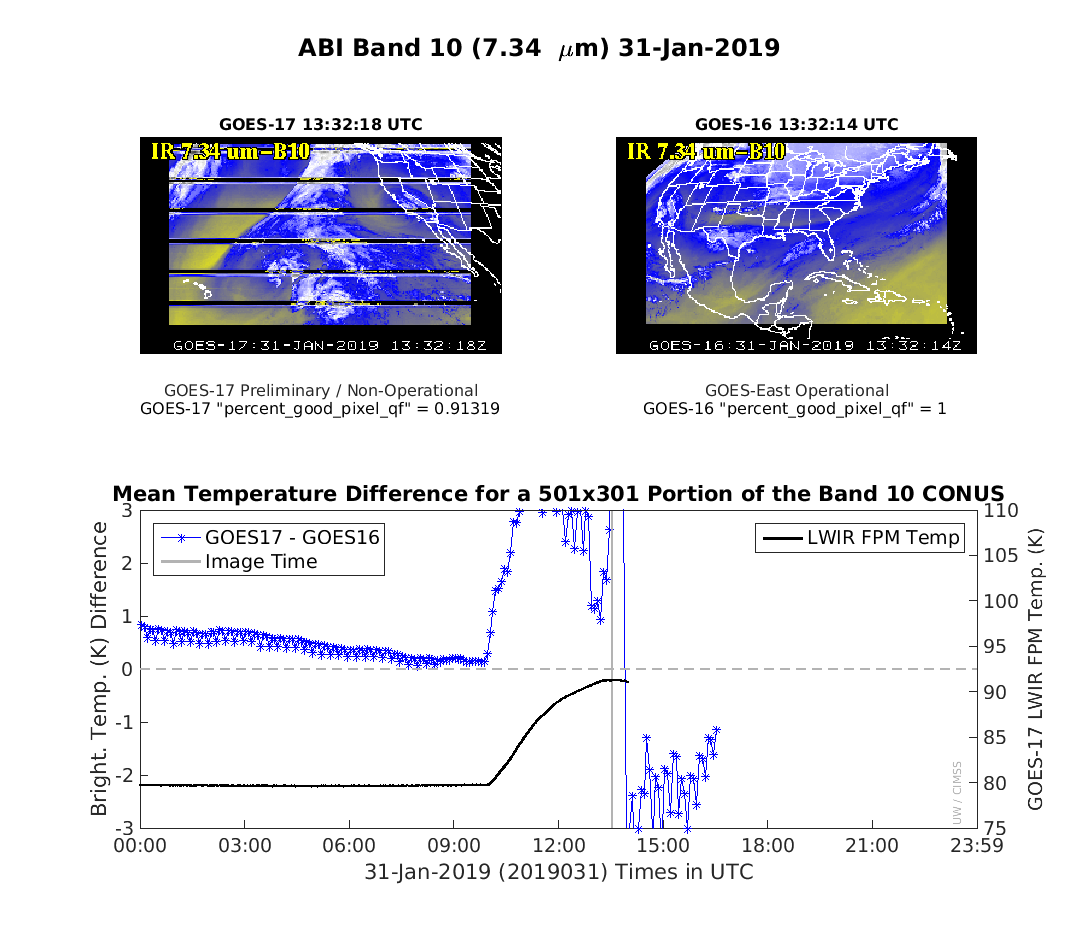 (Click image to enlarge)
Figure: GOES-16/17 mean brightness temperature difference comparisons over part of the CONUS sectors, showing the impact of the Loop Heat Pipe and the Periodic Infrared Calibration Anomaly (PICA). Note that this day was in ABI scan mode 3, a marked improvement wrt PICA is shown when mode 6 ("10-min Full Disk flex mode") is run.
VISITORS:
NEXT WEEK:
LOOKING AHEAD:
| Archived Weeklies Page | Submit a report item |