[ Archive ]
| CIMSS-NOAA Weekly Report [ Archive ] |
ASPB AND CIMSS WEEKLY HIGHLIGHTS FOR THE WEEK ENDING FEBRUARY 8, 2019
IN THE PRESS:
ITEMS FOR THE ADMINISTRATOR:
ITEMS FOR THE ASSISTANT ADMINISTRATOR:
ITEMS FOR THE OFFICE DIRECTOR, STAR:
Manuscript on CubeSat-based sounders published: A manuscript titled "The alternative of CubeSat-based advanced infrared and microwave sounders for high impact weather forecasting" has been published in Atmospheric and Oceanic Science Letters. Coauthors are Zhenglong Li (CIMSS), Jun Li (CIMSS), Tim Schmit (STAR), Pei Wang (CIMSS), Agnes Lim (CIMSS), Jinlong Li (CIMSS), Fred Nagle (CIMSS), Jason Otkin et al. (Jun Li, CIMSS, 608-262-3755, Jun.Li@ssec.wisc.edu)
Paper Listed in Top 25 of 2018: The paper "A Global Slowdown in Tropical Cyclone Translation Speed", published in Nature in June 2018 (https://www.nature.com/articles/s41586-018-0158-3), was listed in the Top 25 Climate Papers of 2018 by CarbonBrief (https://www.carbonbrief.org/analysis-climate-papers-most-featured-in-media-2018). (J. Kossin, NCEI/Center for Weather and Climate, 608-265-5356)
ITEMS FOR THE DIVISION CHIEF, CoRP:
CIMSS Assistance in FDTD GOES-R Webinars: Forecast Decision Training Division (FDTD) GOES-R Webinars are periodic Peer-to-Peer short webinars that highlight novel uses of GOES-R Imagery in forecast offices. Scott Lindstrom, at the Cooperative Institute for Meteorological Satellite Studies (CIMSS), and Dan Bikos, at the Cooperative Institute for Research in the Atmosphere (CIRA), facilitated a presentation this week by Carl Jones, WFO FGF (The Weather Forecast Office in Grand Forks, ND) on how that office uses GOES-16 Data to detect areas of blowing snow. The webinar was recorded and is available at this site: http://rammb.cira.colostate.edu/training/visit/satellite_chat/20190206/. This webinar was attended live by 13 different WFO offices. (Scott Lindstrom, CIMSS, 608 263 4425)
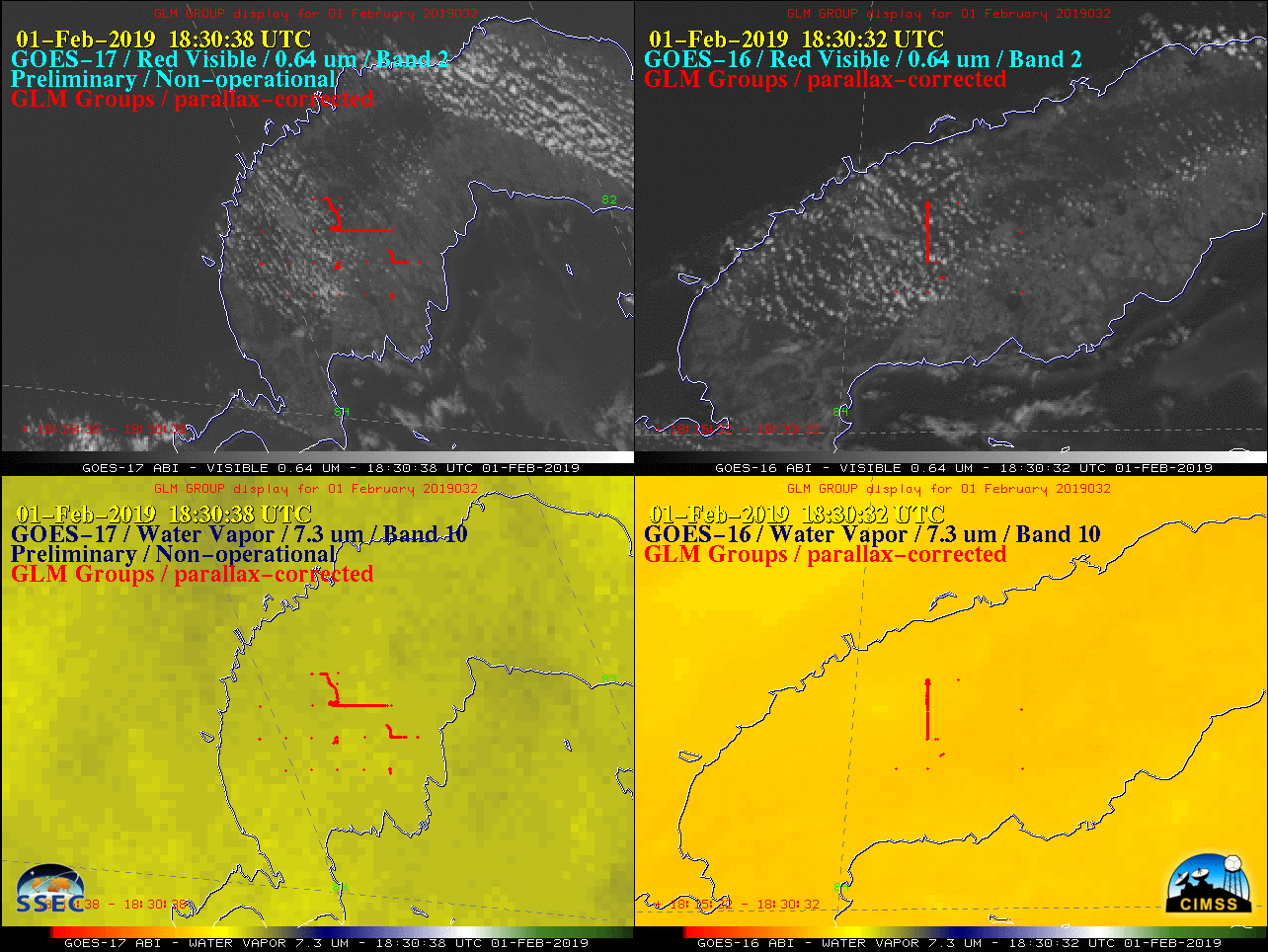
CIMSS Satellite Blog Updates: The Cooperative Institute for Meteorological Satellite Studies (CIMSS) Satellite Blog (http://cimss.ssec.wisc.edu/goes/blog/) was updated with the posts "Meteorite impact in Cuba", "First Geostationary Korea Multi-Purpose Satellite (GEOKOMPSAT)-2A imagery (in stereo view with Himawari-8)", "Cyclogenesis along the US East Coast" and "Cloud-top waves producing turbulence north of Hawai’i". (S. Bachmeier, CIMSS, 608-263-3958, S. Lindstrom, CIMSS, 608-263-4425)
 (Click image to enlarge)
Figure: Visible and Water Vapor images from GOES-17 (left) and GOES-16 (right), with Geostationary Lightning Mapper (GLM) Groups (plotted in red) showing the bright signature of a meteor exploding as it entered the Earth’s atmosphere over Cuba on February 1, 2019.
VISITORS:
NEXT WEEK:
LOOKING AHEAD:
| Archived Weeklies Page | Submit a report item |