[ Archive ]
| CIMSS-NOAA Weekly Report [ Archive ] |
ASPB AND CIMSS WEEKLY HIGHLIGHTS FOR THE WEEK ENDING MAY 31, 2019
IN THE PRESS:
SSEC and CIMSS Scientists in the News: Scientists at the University of Wisconsin-Madison (UW) Space Science and Engineering Center (SSEC) and the Cooperative Institute for Meteorological Satellite Studies (CIMSS) provide expert commentary, interviews, and imagery to news media and participate in events to promote science. In the news this week: 1) The CIMSS Scholarship Committee has selected two Wisconsin high school seniors, Leila Jean Gabrys and Gabriel M. Karr, to receive a $2000 Verner E. Suomi Scholarship. Read more: https://www.ssec.wisc.edu/news/articles/12022. 2) CIMSS scientists Shane Hubbard and Leigh Orf were interviewed by the Wisconsin State Journal about a move by the UW-Madison Faculty Senate that may allow some researchers the opportunity to receive a "research professor" or "teaching professor" title. Read more: https://go.wisc.edu/4rx425. 3) CIMSS Satellite Blog contributor Scott Bachmeier published posts on "Canadian wildfire smoke over the Upper Midwest" (May 30), "Actinoform clouds (or actiniae) in the central Pacific Ocean" (May 30), "30-second GOES-17 images over Oregon/Idaho/Nevada" (May 29), "Severe thunderstorms in Kansas and Missouri" (May 28), "Severe thunderstorms in Indiana and Ohio" (May 27), and "Severe thunderstorms in Oklahoma" (May 25). Read more at the CIMSS Satellite Blog: http://cimss.ssec.wisc.edu/goes/blog/. 4) CIMSS scientists Leigh Orf, Shane Hubbard, and John Cintineo talked with Spectrum News 1 about their research to advance tornado safety. Read more: https://go.wisc.edu/e06q57. (J. Phillips, SSEC, 608-262-8164, Shane Hubbard, CIMSS, S. Bachmeier, CIMSS, Leigh Orf, CIMSS, John Cintineo, CIMSS)
 (Click image to enlarge)
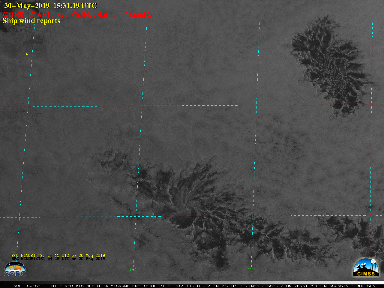
Figure: GOES-17 (GOES-West) images on 30 May 2019 revealed the mesoscale cyclonic circulations of actinoform clouds (or “actiniae“) within the marine boundary layer stratocumulus cloud field over the central Pacific Ocean. This type of cloud feature was originally identified in TIROS-V imagery in 1962, also over the Pacific Ocean. Credit: CIMSS.
 (Click image to enlarge)
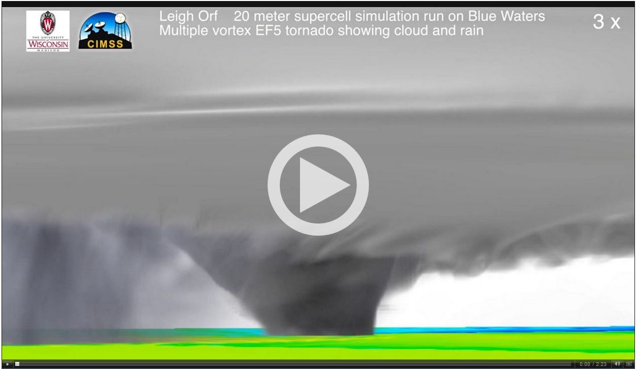
Figure: CIMSS scientists Leigh Orf, Shane Hubbard, and John Cintineo talked with Spectrum News 1 about their research to advance tornado safety: https://go.wisc.edu/e06q57. Credit: CIMSS, Spectrum News1.
ITEMS FOR THE ADMINISTRATOR:
ITEMS FOR THE ASSISTANT ADMINISTRATOR:
ITEMS FOR THE OFFICE DIRECTOR, STAR:
ITEMS FOR THE DIVISION CHIEF, CoRP:
GOES-17 Mesoscale CIMSS/STAR GOES-17 Mesoscale Research Request in support of smoke from Canadian Wildfires: The Cooperative Institute for Meteorological Satellite Studies, in coordination with the GOES-R Aerosol Team at NESDIS/STAR and the High-Resolution Rapid Refresh (HRRR) Smoke modeling Team of the Cooperative Institute for Research in Environmental Sciences (CIRES) at the NOAA Earth System Research Laboratory (ESRL) in Boulder, requested that the Satellite Analysis Branch move one of the Mesoscale domains from GOES-17 such that it was over Montana in order to support the verification of the HRRR smoke model an assist the Aerosol team in validation. In addition, this request also allowed for researchers to prepare for the upcoming Fire Influence on Regional to Global Environments and Air Quality (FIREX-AQ) field campaign which will help further improvements in modeling efforts and assess the efficacy of satellite detections for estimating the emissions from sampled fires. Imagery during this exercise, which was available to all National Weather Service forecast offices and also available to science teams via SSEC's Real Earth website. (W. Straka III, SSEC/CIMSS; R. Dengel, SSEC/CIMSS; S. Kondragunta NESDIS/STAR; R. Ahmadov, CIRES/ESRL)
 (Click image to enlarge)
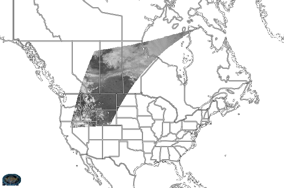
Figure: A screen capture of the visible (0.64um) channel of the Mesoscale 2 domain in RealEarth during the time the research request was in operation.
 (Click image to enlarge)
Figure: An animated GIF from RealEarth showing the true color imagery from 19:59Z to 20:20Z on 30 May 2019. As can be seen, there is a thick cloud of smoke travelling southward from Canada into Montana.
VISITORS:
NEXT WEEK:
LOOKING AHEAD:
| Archived Weeklies Page | Submit a report item |