[ Archive ]
| CIMSS-NOAA Weekly Report [ Archive ] |
ASPB AND CIMSS WEEKLY HIGHLIGHTS FOR THE WEEK ENDING AUGUST 7, 2019
IN THE PRESS:
SSEC and CIMSS Scientists in the News: Scientists at the University of Wisconsin-Madison (UW) Space Science and Engineering Center (SSEC) and the Cooperative Institute for Meteorological Satellite Studies (CIMSS) provide expert commentary, analysis, and imagery to promote satellite science. In the news this week: CIMSS Satellite Blog contributor Scott Bachmeier published posts on the "Natural gas line explosion and fire in Kentucky" (Aug. 1), "GOES-14 is brought out of storage" (July 31), "Hurricane Erick in the East Pacific Ocean" (July 30), and "Milepost 97 Fire in southwestern Oregon" (July 26-27). Read more at the CIMSS Satellite Blog: http://cimss.ssec.wisc.edu/goes/blog/.
 (Click image to enlarge)
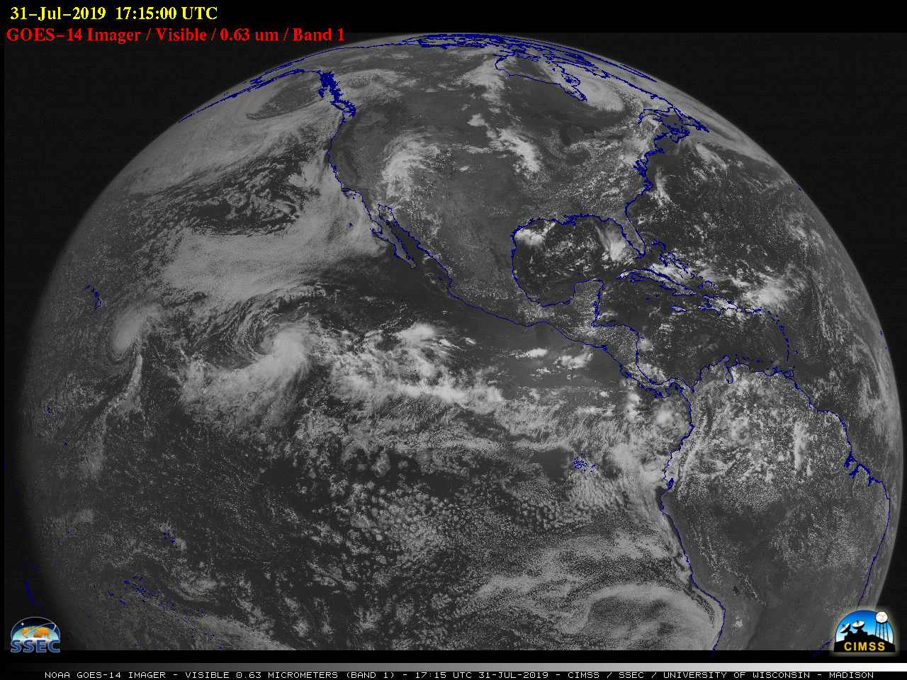
Figure: This animation shows the first few hours of full disk visible (0.63 µm) images from GOES-14 on July 31, 2019. It was brought out of storage for its annual week of image navigation and registration testing and a north/south station-keeping maneuver. Credit: CIMSS.
ITEMS FOR THE ADMINISTRATOR:
ITEMS FOR THE ASSISTANT ADMINISTRATOR:
ITEMS FOR THE OFFICE DIRECTOR, STAR:
Manuscript on Imager and Sounder Data Product Fusion Published: A paper titled “Imager and sounder data fusion to generate sounder retrieval products at an improved spatial and temporal resolution” by E. Weisz and W. P. Menzel has been published in the Journal of Applied Remote Sensing (Volume 13, Issue 3). This is a follow-up to “Fusion of satellite-based imager and sounder data to construct supplementary high spatial resolution narrowband IR radiances”, which won the SPIE 2017 Best Paper award. Here we focus on product fusion, where information from the imager radiances is used to provide temperature and humidity sounder retrievals not only at an improved spatial resolution but also at high temporal resolution when a geostationary imager (e.g., the Advanced Baseline Imager) is combined with a polar orbiting hyperspectral sounder (e.g., the Cross-track Infrared Sounder). The article can be viewed online at http://dx.doi.org/10.1117/1.JRS.13.034506. (Elisabeth Weisz, CIMSS, 608-265-3954)
Manuscript on satellite sampling errors in total precipitable water published: A manuscript titled: "Characteristics of satellite sampling errors in total precipitable water from SSMIS, HIRS, and COSMIC observations" has been published in Journal of Geophysical Research - Atmospheres (https://agupubs.onlinelibrary.wiley.com/doi/epdf/10.1029/2018JD030045). This study quantifies the characteristics of different satellite sampling errors in the time series of total precipitable water (TPW) derived from Constellation System for Meteorology, Ionosphere, and Climate (COSMIC) radio occultation, Special Sensor Microwave Imager Sounder (SSMIS), and High‐resolution Infrared Radiation Sounder (HIRS) during the overlapping time period. It is found that discrepancies in global TPW time series can be mainly attributed to the inherent sampling errors of these three different satellite remote sensing systems. Sampling errors will be reduced and more consistent global TPW time series will be derived by combining the multisensor samplings together. Co-authors are Yunheng Xue (Institute of Atmospheric Physics, Chinese Academy of Sciences, and also CIMSS), Jun Li, W. Paul Menzel, Eva Borbas (CIMSS), Shu-Peng Ho (STAR), Zhenglong Li and Jinlong Li (CIMSS). (Jun Li, CIMSS, 608-262-3755, Jun.Li@ssec.wisc.edu)
Experimental GOES-14 Imager and Sounder Data: Geostationary Operational Environmental Satellite (GOES)-14 recently came out of on-orbit storage for annual testing. In addition to performing a number of spacecraft maneuvers, several test scans will also be performed. Near real-time Sounder imagery can be found under the GOES-14 tabs at http://cimss.ssec.wisc.edu/goes/rt/sounder-dpi.php. For more information a CIMSS Satellite Blog post was created (https://cimss.ssec.wisc.edu/goes/blog/archives/33881). CIMSS and ASPB are providing feedback regarding image quality. The Space Science and Engineering Center (SSEC) Data Services group was able to re-position a spare rooftop satellite dish and ingest the GOES-14 imager and sounder data within 24 hours of the NOAA/NESDIS request. (T. Schmit, E/RA2, 608-263-0291, tim.j.schmit@noaa.gov; S. Bachmeier, CIMSS; J. Robaidek, SSEC; J. Nelson, CIMSS; M. Gunshor, CIMSS)
 (Click image to enlarge)
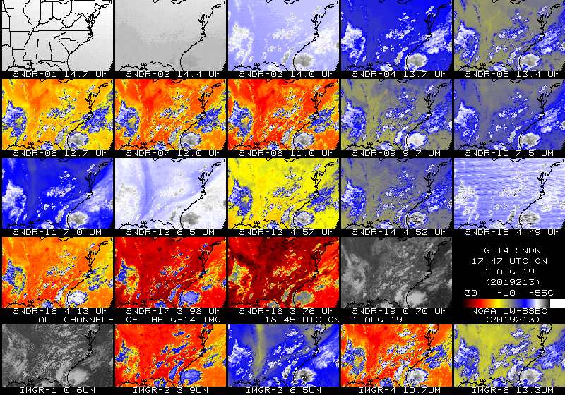
Figure: 19 bands of the Geostationary Operational Environmental Satellite (GOES)-14 Sounder (top 4 rows) and 5 bands of the GOES-14 Imager (lower row) at approximately 18 UTC on 1 August 2019. All the bands have been remapped into the same projection. These were some of the first images after GOES-14 came out of storage. GOES-14 data are captured in real-time at the Space Science and Engineering Center (SSEC) Data Center in Madison, Wisconsin.
ITEMS FOR THE DIVISION CHIEF, CoRP:
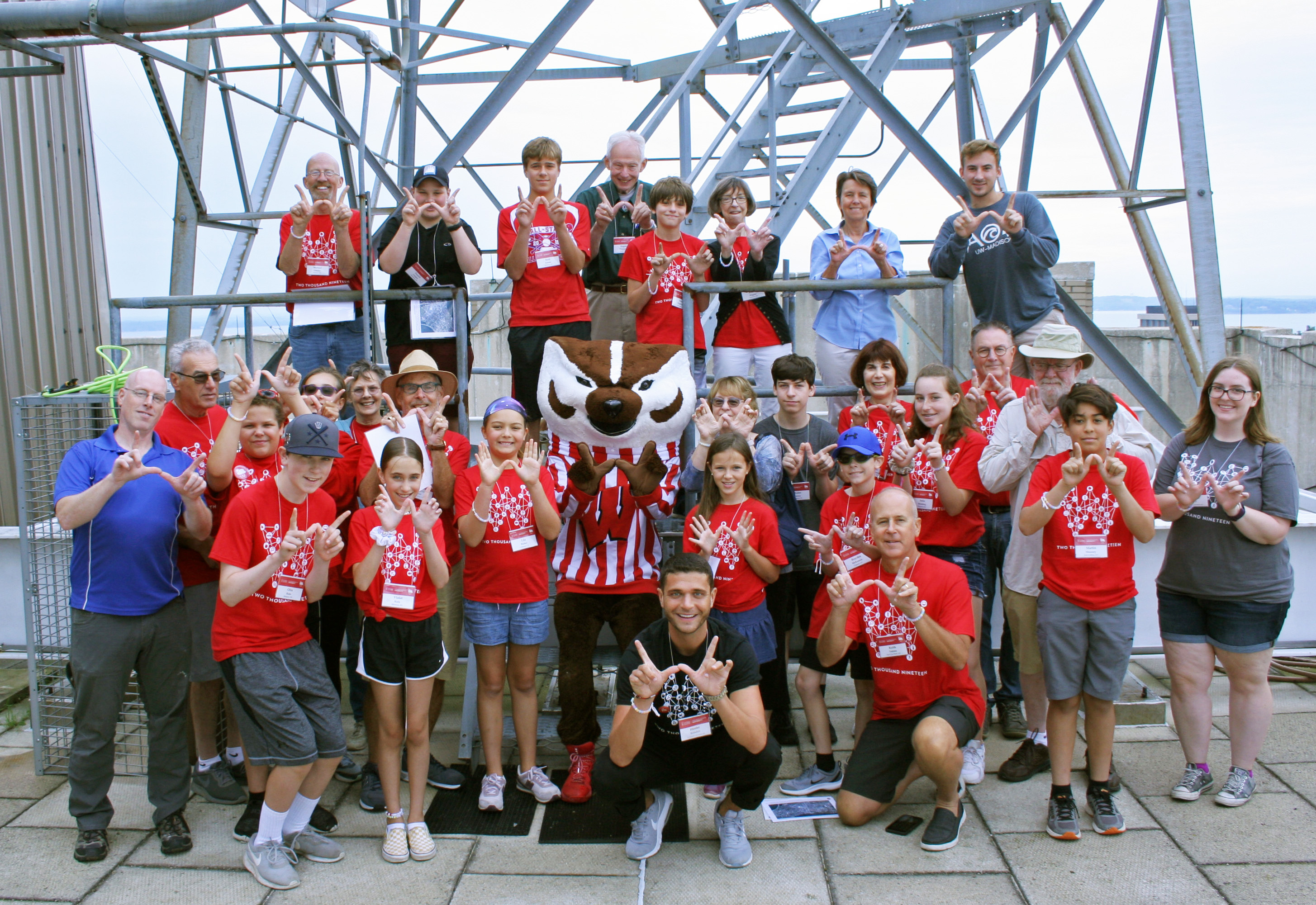
GOES-R featured in the Grandparents University Meteorology Major: NOAA's Cooperative Institute for Meteorological Satellite Studies (CIMSS) and the Space Science and Engineering Center (SSEC) co-hosted the meteorology major for Grandparents University (GPU) at the University of Wisconsin-Madison (UW) on July 25th and 26th. GPU provides a unique opportunity to reach older adults (UW alumni) and pre-college students interested in science and technology. Since Madison is the birthplace of satellite meteorology, weather satellites are featured prominently in the program. In recent years, NOAA's Satellite Applications and Research (STAR) branch, co-located at CIMSS, has helped shine a spotlight on the GOES-R satellite series. (M. Mooney, CIMSS, 608-265-2123, T. Schmit, E/RA2, 608-263-0291, R. Kohrs, SSEC)
 (Click image to enlarge)
Presentation on Past and Future U.S. Hurricane Risk: Jim Kossin (NCEI/CWC) presented a webinar this week to the NOAA Eastern Region Climate Center that summarized results from two recent papers that focus on past and future hurricane risk along the U.S. coast. The talk was recorded and is available at http://www.nrcc.cornell.edu/services/webinars/2019/07/index.html. (J. Kossin, NCEI/CWC, 608-265-5356)
Great Lakes Science and Operations Officers (SOO) Community Meeting Presentations: ASPB personnel gave invited remote presentations at the NOAA NWS 2019 Great Lakes Science and Operations Officers (SOO) Community Meeting held in Grand Rapids, MI. Tim Schmit presented "Various Geostationary Operational Environmental Satellite (GOES) Advanced Baseline Imager (ABI) Topics", while Mark Kulie gave talks entitled "GOES Lake-Effect Quantitative Precipitation Estimation (QPE) Product Development" and "Lake Ice Concentration over the Great Lakes". University of Wisconsin Cooperative Institute for Meteorological Satellite Studies (CIMSS) scientists Kathy Strabala and Scott Lindstrom provided significant input (e.g., numerous NOAA-20 Advanced Technology Microwave Sounder ice retrieval examples) for the final talk listed. (M. Kulie, E/RA2, 608-262-6583, mark.kulie@noaa.gov; T. Schmit, E/RA2, 608-263-0291, tim.j.schmit@noaa.gov; Scott Lindstrom, CIMSS; Kathy Strabala, CIMSS)
NUCAPS training at the Aviation Weather Center: Scott Lindstrom, Cooperative Institute for Meteorological Satellite Studies (CIMSS), was at the National Weather Service Training Center (NWSTC) for a Satellite Applications Workshop this week. While there, he gave a seminar on NOAA-Unique Combined Atmospheric Processing System (NUCAPS) Soundings that are now available in AWIPS to forecasters at the National Weather Service Aviation Weather Center (AWC), collocated with NWSTC. Approximately a dozen forecasters attended this recorded seminar, which was done in coordination with the Science and Operations Officer (SOO) at AWC. (Scott Lindstrom, CIMSS, 608 263 4425)
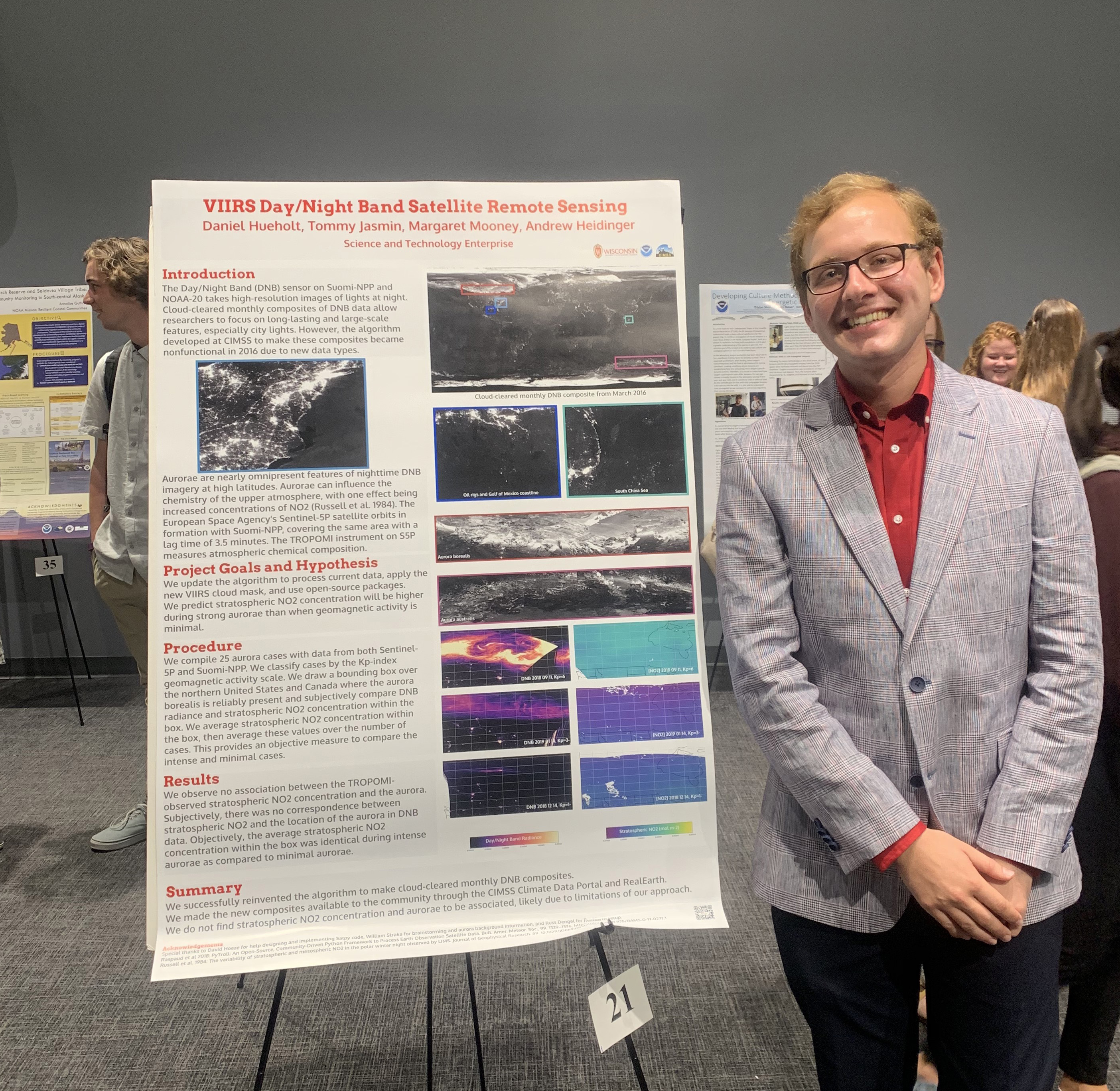
Successful Hollings Scholar Internship: NOAA’s Cooperative Institute for Meteorological Satellite Studies (CIMSS) hosted a Hollings Undergraduate Scholarship for the first time this summer with spectacular results. Daniel Hueholt from North Carolina State worked to update imagery in the CIMSS Climate Data Portal (https://www.ssec.wisc.edu/cdp/main) under the mentorship of Tommy Jasmin and Andrew Heidinger. They also made composite imagery available through RealEarth™ (example at https://re.ssec.wisc.edu/s/E18rgr). Daniel finished his internship in Madison on July 26th and presented his project at a Science and Education Symposium at NOAA Headquarters this past week. (A. Heidinger, E/RA2, 608-263-6757, andrew.heidinger@noaa.gov, T. Jasmin, SSEC, M. Mooney, CIMSS)
 (Click image to enlarge)
Figure: Daniel Hueholt and project poster.
VISITORS:
NEXT WEEK:
LOOKING AHEAD:
| Archived Weeklies Page | Submit a report item |