[ Archive ]
| CIMSS-NOAA Weekly Report [ Archive ] |
ASPB AND CIMSS WEEKLY HIGHLIGHTS FOR THE WEEK ENDING OCTOBER 25, 2019
IN THE PRESS:
SSEC and CIMSS Scientists in the News: Scientists at the University of Wisconsin-Madison (UW) Space Science and Engineering Center (SSEC) and the Cooperative Institute for Meteorological Satellite Studies (CIMSS) provide expert commentary, interviews, and imagery to news media and participate in events to promote science. In the news this week: 1) CIMSS scientist Sarah Griffin and NOAA ASPB scientist Tim Schmit participated in last week's #dayofscience during Science-A-Thon, posting photos on social media of their days, including morning routines, research, projects, and work commute. Science-A-Thon is a five-day celebration of science, engineering, technology, and math (STEM): https://twitter.com/smgriffin00/status/1184939730150068224. 2) CIMSS Satellite Blog contributor Scott Bachmeier published posts on the "Kincade Fire in Northern California" (Oct. 24), "Typhoon Bualoi in the West Pacific Ocean" (Oct. 22), "Severe thunderstorms in the southern US" (Oct. 20), and "Severe thunderstorms in Idaho" (Oct. 19). Read more at the CIMSS Satellite Blog: http://cimss.ssec.wisc.edu/goes/blog/. (S. Griffin, CIMSS, T. Schmit, E/RA2, S. Bachmeier, CIMSS, J. Phillips, SSEC, 608-262-8164)
 (Click image to enlarge)
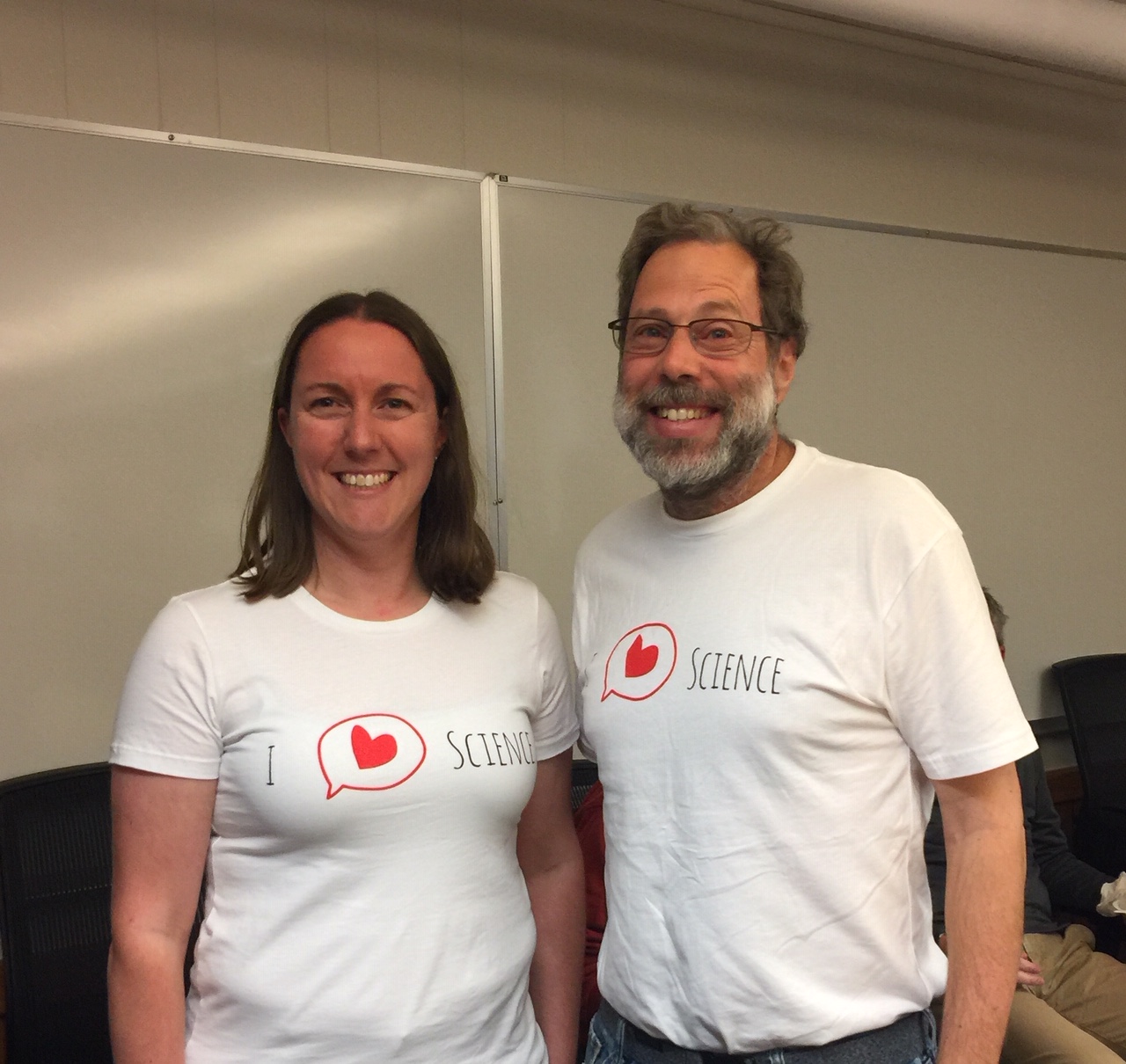
Figure: CIMSS scientist Sarah Griffin and ASPB scientist Tim Schmit participated in the recent #dayofscience to help celebrate STEM. Credit: CIMSS.
 (Click image to enlarge)
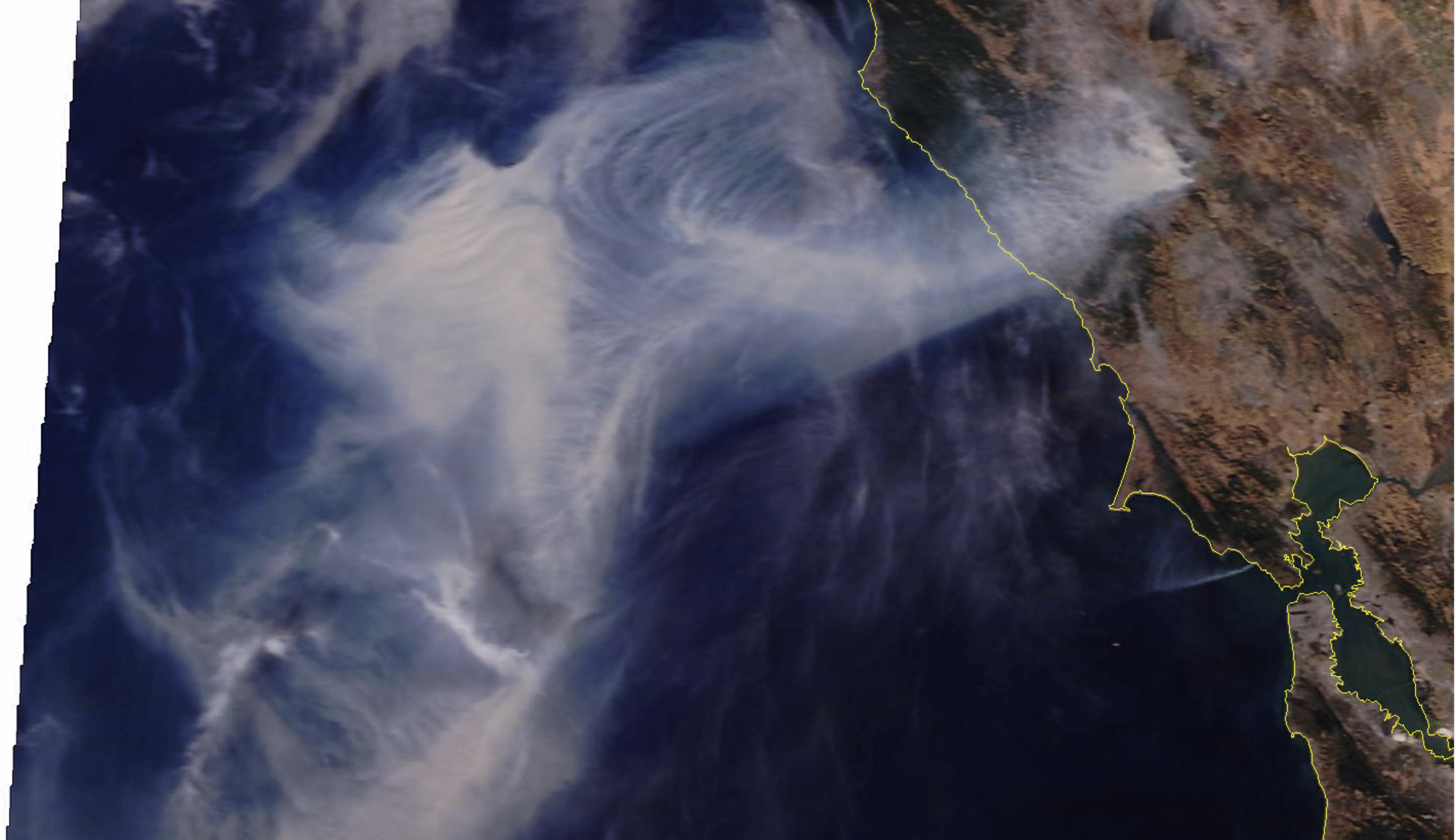
Figure: Terra MODIS true color and false color RGB images showed the smoke plume and active fire thermal anomaly (shades of pink to red) associated with the large Kincade Fire in CA as well as the smaller Muir Fire near the coast. Credit: SSEC MODIS Today.
ITEMS FOR THE ADMINISTRATOR:
ITEMS FOR THE ASSISTANT ADMINISTRATOR:
ITEMS FOR THE OFFICE DIRECTOR, STAR:
Manuscript Published on Improving ABI Radiance Assimilation over Land: A manuscript titled "ABI Water Vapor Radiance Assimilation in a Regional NWP Model by Accounting for the Surface Impact", has been published in Earth and Space Science, and it is online for free access (https://agupubs.onlinelibrary.wiley.com/doi/full/10.1029/2019EA000711). Co-authors are Jung-Rim Lee (KMA) and Jun Li (CIMSS) et al. (Jun Li, CIMSS, 608-262-3755, Jun.Li@ssec.wisc.edu).
Presentations to the Technology Maturation Program: Three presentations from Wisconsin were given at the Science Support to the Technology Maturation Program (TMP) Annual Review Meeting in College Park, Maryland on October 21, 2019. This program run by the NOAA/NESDIS Office of Projects, Planning, and Analysis. The presentations were entitled “Exploit TropOMI Sensor”, “Cooperative Institute for Meteorological Satellite Studies (CIMSS) Support to Demonstrating the Potential Benefits of a Tundra Orbit” and “Impact of Satellite Data Latency on Local Severe Storm Forecasts in Regional NWP (Numerical Weather Prediction)”. (T. Schmit, E/RA2, 608-263-0291; J. Li, CIMSS, 608-262-3755; R.B. Pierce, SSEC)
 (Click image to enlarge)
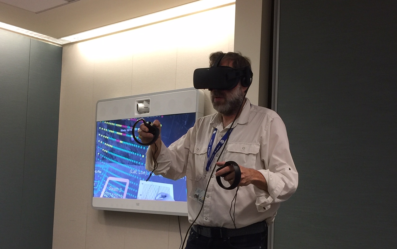
Figure: Viewing NOAA-Unique Combined Atmospheric Processing System (NUCAPS) retrievals using Virtual Reality, after a presentation by S. Rudlosky and others at the Technology Maturation Program (TMP) Annual Review Meeting.
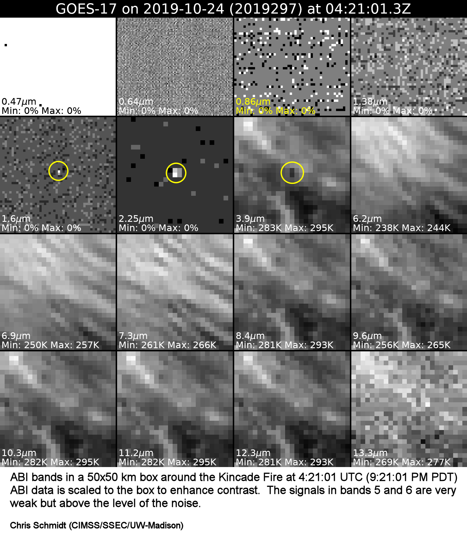
GOES-17 Detection of the Kincade Fire: At 4:21:01 UTC on October 24, 2019 (9:21:01 PM Pacific Daylight Time [PDT] on October 23, 2019), the Geostationary Operational Environmental Satellite (GOES)-17 mesoscale 2 (M2) Advanced Baseline Imager (ABI) scan positioned over California first detected heat in bands 5, 6, and 7, indicating a fire. The fire intensified rapidly and the Fire Detection and Characterization Algorithm (FDCA), NOAA's operational geostationary fire algorithm, run on GOES-17 data at the Space Science Engineering Center (SSEC) picked up the fire in the 4:24:57 UTC (9:24:57 PDT) M2 scan. The attached figure shows the 16 ABI bands, each scaled to the data in the 50 by 50 kilometer region centered on the Kincade Fire to maximize contrast (as a result noise, when dominant, is extremely amplified as well) at 4:21:01 UTC, with the fire circled in yellow. Initial reports from the California Department of Forestry and Fire Protection (Cal Fire) put the ignition time at 4:26 UTC on October 24, 2019 (9:26 PDT on October 23, 2019). (C. Schmidt, CIMSS, 608-239-0940)
 (Click image to enlarge)
ITEMS FOR THE DIVISION CHIEF, CoRP:
Satellite Training at the National Weather Service Office in Buffalo: Scott Lindstrom, Cooperative Institute for Meteorological Satellite Studies (CIMSS), provided in-person training at the National Weather Service Forecast Office in Buffalo NY, as part of that office's Winter Weather Preparedness training event. He discussed how NOAA-Unique Combined Atmospheric Processing System (NUCAPS) profiles could be used in wintertime decision support (and covered the new horizontally-gridded format of those fields available in AWIPS Build 19.2.1). He also covered topics such as the GOES-R and JPSS River Flood Products, and microwave Detection of Lake Ice. (S. Lindstrom, CIMSS, 608 263 4425)
Marquette NWS WFO Winter Weather Workshop Presentations: Cooperative Institute for Meteorological Satellite Studies (CIMSS) scientist Claire Pettersen and University of Wisconsin-Madison Department of Atmospheric and Oceanic Sciences researcher Marian Mateling gave invited talks at the 2019 Winter Weather Workshop held at the Marquette, MI National Weather Service (NWS) Weather Forecast Office (WFO). Both talks highlighted results from ongoing collaborative snowfall-related projects with the Marquette NWS WFO. The collaborative research efforts support satellite quantitative precipitation estimation product development and assessment for both geostationary and polar orbiting platforms. (C. Pettersen, CIMSS, 608-772-6270, M. Kulie, E/RA2, 608-263-6583).
NWS Sullivan Site Visit: Scott Lindstrom from the Cooperative Institute for Meteorological Satellite Studies (CIMSS) and Tim Schmit from the NESDIS STAR Advanced Satellite Products Branch (ASPB) visited the National Weather Service (NWS) Milwaukee/Sullivan office on October 24, 2019. The purpose was to provide on-site satellite training to four new hires. Topics of discussion included Geostationary Operational Environmental Satellite R-Series (GOES-R) imagery, band differences, red-green-blue composites and quantitative products. It was learned that the forecast office routines uses the GOES-R derived surface temperature product in their inland lake wave forecasts (https://www.weather.gov/mkx/inland-lake-waves). Also covered were a number of satellite products from the Joint Polar Satellite System (JPSS), including NOAA-Unique Combined Atmospheric Processing System (NUCAPS) retrievals. (S. Lindstrom, CIMSS; T. Schmit, E/RA2, 608-263-0291)
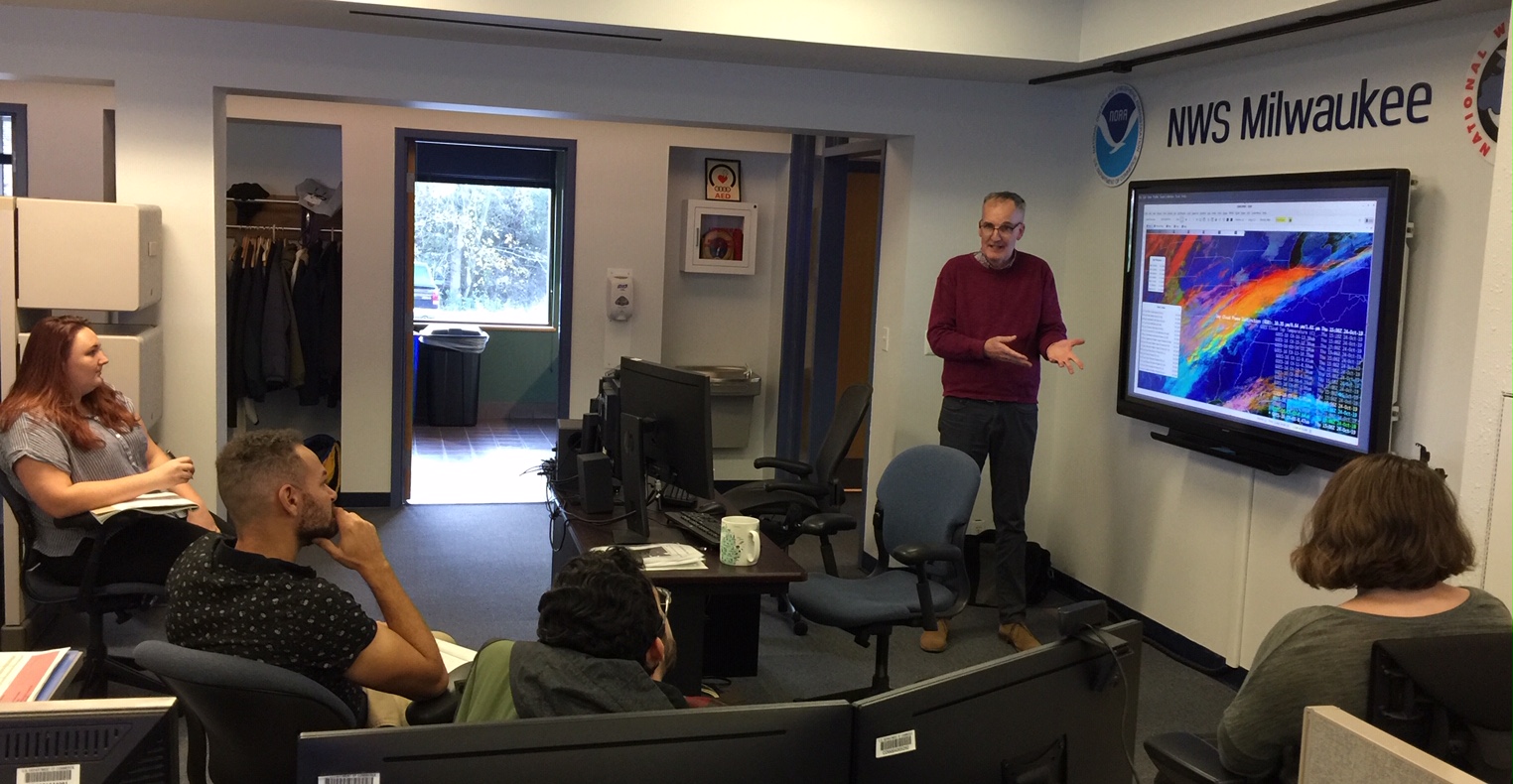 (Click image to enlarge)
Figure: Scott Lindstrom, CIMSS, explaining a GOES-16 ABI Red-Green-Blue composite at the NWS Sullivan office (Wisconsin).
VISITORS:
NEXT WEEK:
LOOKING AHEAD:
| Archived Weeklies Page | Submit a report item |