[ Archive ]
| CIMSS-NOAA Weekly Report [ Archive ] |
ASPB AND CIMSS WEEKLY HIGHLIGHTS FOR THE WEEK ENDING DECEMBER 6, 2019
IN THE PRESS:
SSEC and CIMSS Scientists in the News: Scientists at the University of Wisconsin-Madison (UW) Space Science and Engineering Center (SSEC) and the Cooperative Institute for Meteorological Satellite Studies (CIMSS) provide expert commentary, interviews, and imagery to news media and participate in events to promote science. In the news this week: 1) CIMSS Honorary Fellow Jordan Gerth spoke with National Geographic about the need to separate communications uses of the electromagnetic spectrum from weather and climate science work to avoid interference: https://www.nationalgeographic.com/science/2019/11/will-5g-wreck-out-weather-forecasts/. 2) CIMSS scientists Scott Bachmeier and William Straka III reported on the coldest cloud-top temperature on record using VIIRS infrared imagery. Their analysis of Typhoon Kammuri was picked up by WeatherUnderground: https://www.wunderground.com/cat6/Kammuri-Sweeps-Through-Philippines-Coldest-Cloud-Tops-On-Record. 3) CIMSS Satellite Blog contributor Scott Bachmeier published posts on "Typhoon Kammuri makes landfall in the Philippines" (Dec. 2), "Typhoon Kammuri in the West Pacific Ocean" (Nov. 30), "Bomb cyclone makes landfall along the Oregon/California coast" (Nov. 26), and "Pyrocumulonimbus cloud in eastern Australia" (Nov. 22). Read more at the CIMSS Satellite Blog: http://cimss.ssec.wisc.edu/goes/blog/. (J. Gerth, S. Bachmeier, CIMSS, W. Straka III, CIMSS, J. Phillips, SSEC, 608-262-8164)
 (Click image to enlarge)
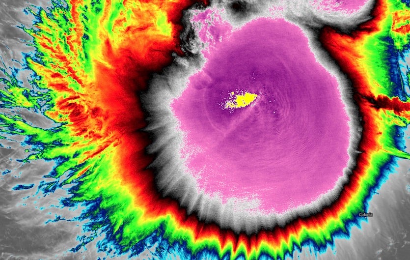
Figure: VIIRS infrared image of Typhoon Kammuri from the NOAA-20 satellite at 0420Z Saturday, Nov. 30, 2019. The yellow color just west of the center denotes the location of coldest cloud tops, which were beyond those automatically generated, that is, “off the scale.” Credit: CIMSS and SSEC RealEarth.
ITEMS FOR THE ADMINISTRATOR:
ITEMS FOR THE ASSISTANT ADMINISTRATOR:
ITEMS FOR THE OFFICE DIRECTOR, STAR:
Manuscript on hyperspectral IR sounder observation error impact on data assimilation in cloudy skies published: A manuscript titled "Impacts of Observation Errors on Hurricane Forecasts when Assimilating Hyperspectral Infrared Sounder Radiances in Partially Cloudy Skies" has been published in the Journal of Geophysical Research - Atmospheres (https://agupubs.onlinelibrary.wiley.com/doi/full/10.1029/2019JD031029, Volume 124, Issue 20, Pages 10802-10813). Co-authors are Pei Wang, Jun Li, Zhenglong Li, Agnes H. N. Lim, Jinlong Li (CIMSS), and Mitchell D. Goldberg (JPSS). (Jun Li, CIMSS, 608-262-3755, Jun.Li@ssec.wisc.edu)
CIMSS Particpation in the Tenth Asia-Oceania Meteorological Satellite Users’ Conference (AOMSUC-10): The Tenth Asia-Oceania Meteorological Satellite Users’ Conference (AOMSUC-10) was held in Melbourne, Australia from 4-6 December 2019. The conference was hosted and sponsored by the Australian Bureau of Meteorology and was co-sponsored by the China Meteorological Administration (CMA), the Japan Meteorological Agency (JMA), the Korea Meteorological Administration (KMA), Roshydromet of the Russian Federation, and the World Meteorological Organization (WMO). A training event was conducted prior to the conference that brought together participants from WMO Regions II and V. Over 130 scientists, users, and satellite operators representing over 20 countries participated. Noting that the successful launch and operation of the Korean GK2A in the past year offered welcome new capabilities (e.g. stereo in conjunction with Himawari-8) to Asia-Oceania as well as to the Space-Based Component of the WMO Integrated Global Observing System (WIGOS), the participants welcomed the efforts being undertaken to introduce and utilize these new data. AOMSUC-10 was focused on coordination in the generation of new products and services and the preparation for their utilization by the worldwide user community. Scott Lindstrom conducted training sessions. Sam Batzli introduced RealEarth looks at floods and fires. Geoff Cureton and Liam Gumley gave presentations on the utilization of the CSPP and data access through the NOAA Direct Broadcast Real-Time Network. Allen Huang spoke about exploiting AI for weather and environmental monitoring. Paul Menzel gave a talk on fusing LEO sounder and GEO imager data. The AOMSUC-10 agenda and other information are available at http://www.bom.gov.au/research/aomsuc-10/program.shtml. (A. Huang, CIMSS, allenh@ssec.wisc.edu)
 (Click image to enlarge)
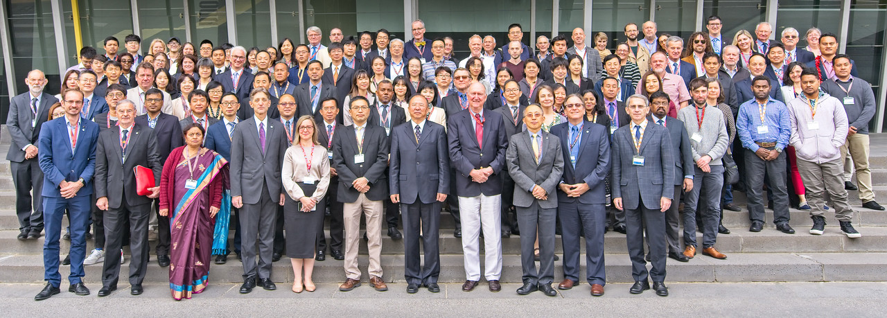
Figure: AOSMUC-10 group photo, Melbourne Australia, December 4, 2019.
ITEMS FOR THE DIVISION CHIEF, CoRP:
Presentation on GOES-R given to Aerospace and Mechanical Engineering class: A seminar on the history of geostationary weather satellites and the GOES-R program was given to a Capstone class in the Aerospace and Mechanical Engineering Department at the University of Oklahoma, Norman OK on 04 December 2019 (R.Rabin, NOAA/NSSL and CIMSS, 405-325-6336).
Presentations at the GRB Monitoring Workshop: There were two presentations from Wisconsin at the Geostationary Operational Environmental Satellite (GOES) Rebroadcast (GRB) Monitoring (virtual) Workshop that was held on December 3. They were entitled “Product Monitoring at Space Science and Engineering Center (SSEC)” and “Known Advanced Baseline Imager (ABI) Data Anomalies”; presented by Jerrold Robaidek and Tim Schmit, respectively. The University of Wisconsin-Madison SSEC utilizes several locally developed tools in conjunction with access to other institutions’ datasets to monitor GRB and specifically ABI data. The SSEC/Cooperative Institute for Meteorological Satellite Studies (CIMSS) Satellite Data Services focuses its monitoring on verifying that all data sent was ingested, provided in real-time, and safely makes it to the archive. The UW-Madison CIMSS Algorithm Working Group (AWG) imagery team focuses on calibration. The lead of the international GRB working group is James McNitt. The presentations are located here: ftp://ftp.ssec.wisc.edu/pub/ssec/grb_monitoring/GOES%20Rebroadcast%20GRB%20Monitoring%20Workshop%20120319_120419_Revised.pptx. (J. Robaidek, SSEC; T. Schmit, E/RA2, 608-263-0291)
 (Click image to enlarge)
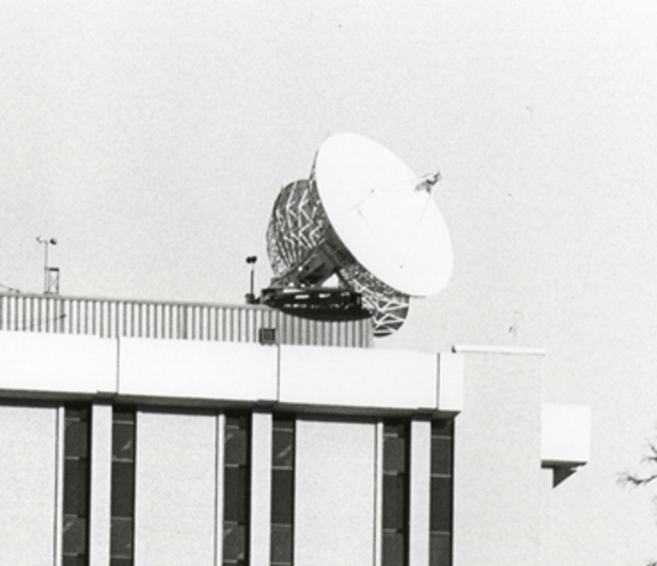
Figure: 7.3 m antennas shortly after installation at the University of Wisconsin-Madison in 1974. These same antennas now support the acquisition of the GOES-R series GRB data.
CIMSS Training Presentation at AOMSUC-10: Scott Lindstrom, Cooperative Institute for Meteorological Satellite Studies (CIMSS), attended a 2-day training event prior to the 10th Asia-Oceania Meteorological Satellite Users' Conference (AOMSUC-10) in Melbourne Australia. He helped students understand how Level 2 GOES-R Products can be accessed, and how some python-based software packages (such as Satpy) can be used to display satellite information. In addition, he presented (during the Conference) a talk that outlined accessible on-line training materials that are relevant for meteorologists who work in the countries bordering the western Pacific and Indian Oceans -- that is, those who use data from the geostationary Himawari-8, GOES-17 and GK2A data, in addition to data from polar-orbiting NOAA-20 and Suomi-NPP. (Scott Lindstrom, CIMSS, 608 263 4425)
VISITORS:
GOES-R Visitor: On December 3rd and 4th, Alicia Moore visited the Advanced Satellite Products Branch (ASPB) at the Cooperative Institute for Meteorological Satellite Studies (CIMSS). Alicia is the Geostationary Operational Environmental Satellite (GOES)-R series Mission Operations Support Team (MOST) Lead Instrument Systems Engineer. A wide range of topics were discussed, including Level 0 through Level 2 Advanced Baseline Imager (ABI) data processing, satellite history, etc. (T. Schmit, E/RA2, 608-263-0291)
 (Click image to enlarge)
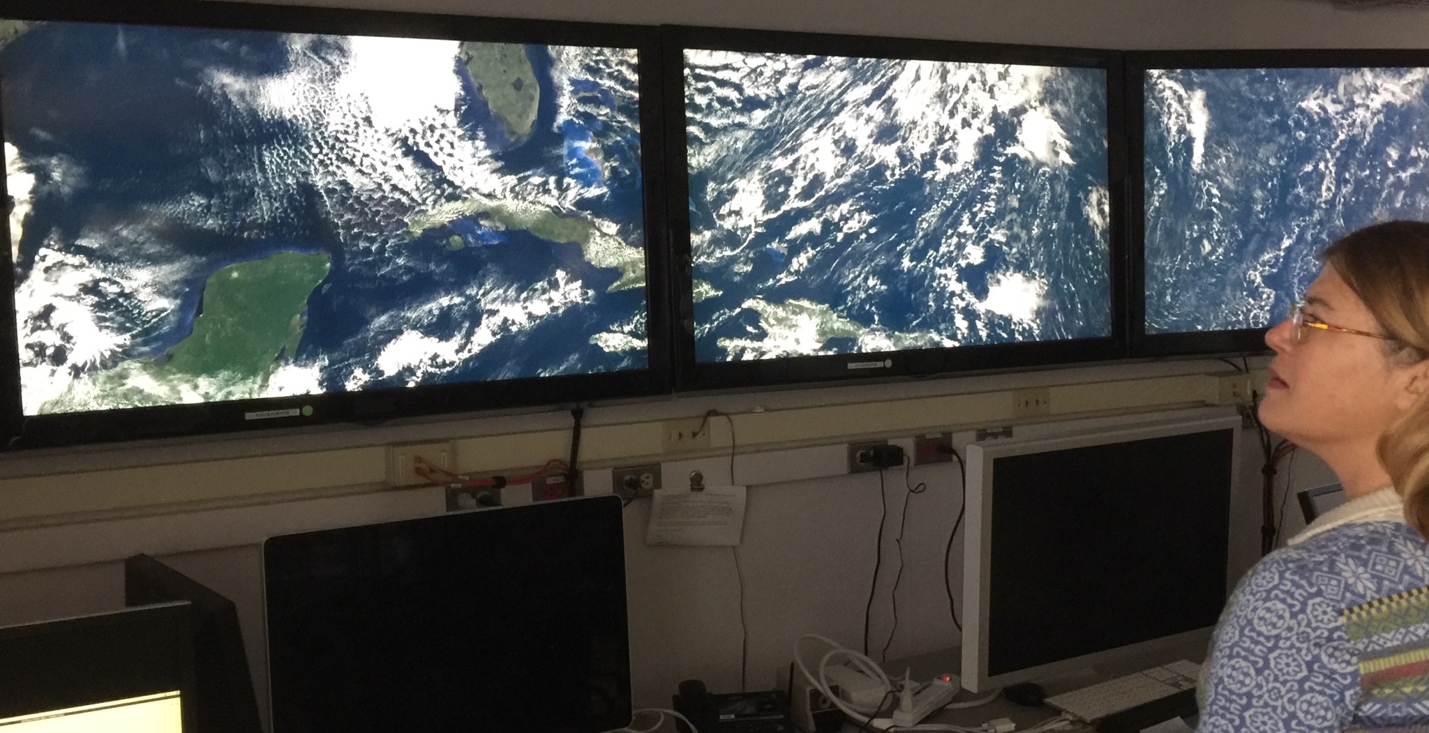
Figure: GOES-16 imagery and Alicia Moore during a tour of the Space Science and Engineering Center (SSEC) Data Services center.
NEXT WEEK:
LOOKING AHEAD:
| Archived Weeklies Page | Submit a report item |