[ Archive ]
| CIMSS-NOAA Weekly Report [ Archive ] |
ASPB AND CIMSS WEEKLY HIGHLIGHTS FOR THE WEEK ENDING DECEMBER 20, 2019
IN THE PRESS:
SSEC and CIMSS Scientists in the News: Scientists at the University of Wisconsin-Madison (UW) Space Science and Engineering Center (SSEC) and the Cooperative Institute for Meteorological Satellite Studies (CIMSS) provide expert commentary, interviews, and imagery to news media and participate in events to promote science. In the news this week: 1) SSEC News published a selection of 2019 stories that reflect the center's ongoing commitment to research, education and outreach: https://www.ssec.wisc.edu/news/articles/12412/. 2) CIMSS Satellite Blog contributor Scott Bachmeier published posts on "Stratus clouds affecting surface temperatures in Alaska" (Dec. 17), "Severe weather across the Deep South" (Dec. 16), and "Moderate to Severe Turbulence over the High Plains" (Dec. 13). Read more at the CIMSS Satellite Blog: http://cimss.ssec.wisc.edu/goes/blog/. (S. Bachmeier, CIMSS, E. Verbeten, SSEC, J. Phillips, SSEC, 608-262-8164)
 (Click image to enlarge)
Figure: One-minute mesoscale imagery from GOES-16 on Dec. 16, 2019 showed thunderstorms that produced severe weather and in some cases, overshooting tops, across the Deep South. Credit: CIMSS.
ITEMS FOR THE ADMINISTRATOR:
ITEMS FOR THE ASSISTANT ADMINISTRATOR:
ITEMS FOR THE OFFICE DIRECTOR, STAR:
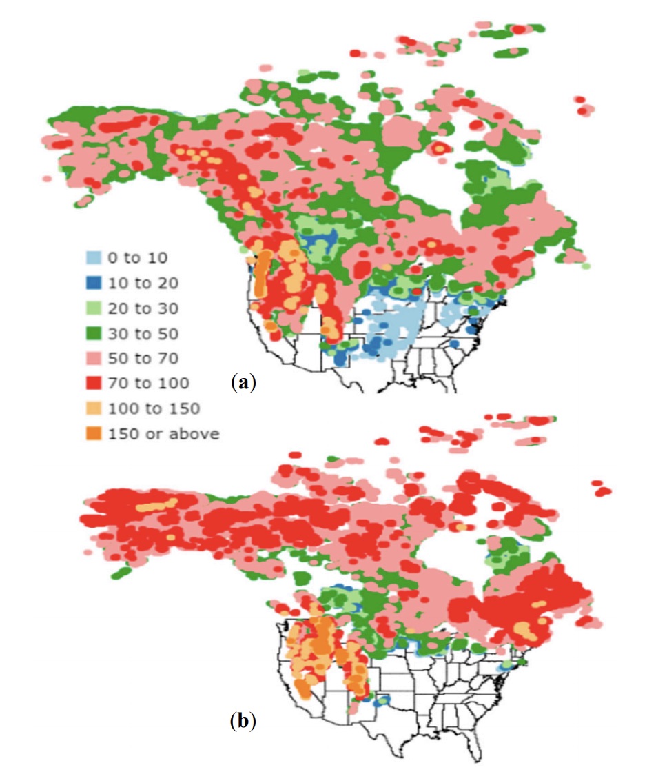
Paper on Blended Snow Depth: The development of a snow depth product over North America is described in a new paper titled, "Mapping of snow depth by blending satellite and in-situ data using two-dimensional optimal interpolation - Application to AMSR2" (Kongoli, C. J. Key, and T. Smith, 2019, Remote Sensing, 11, 3049, doi:10.3390/rs11243049). The product was developed by applying two-dimensional optimal interpolation to passive microwave satellite-derived and in-situ measured snow depth. The results over North America during January–February 2017 indicate that the technique greatly enhances the performance of the satellite estimates, especially over mountain terrain. Moreover, the technique generates more accurate output compared to that from NOAA’s Global Forecast System, with implications for improving the utilization of satellite data in snow assessments and numerical weather prediction. (J. Key, E/RA2, 608-263-2605, jeff.key@noaa.gov)
 (Click image to enlarge)
Figure: Optimal interpolation (OI)-based snow depth (cm) over North America on (a) 7 January 2017 and (b)15 February 2017.
ITEMS FOR THE DIVISION CHIEF, CoRP:
VISITORS:
NEXT WEEK:
LOOKING AHEAD:
| Archived Weeklies Page | Submit a report item |