[ Archive ]
| CIMSS-NOAA Weekly Report [ Archive ] |
ASPB AND CIMSS WEEKLY HIGHLIGHTS FOR THE WEEK ENDING APRIL 10, 2020
PRODUCTS AND APPLICATIONS:
AWARDS AND RECOGNITION:
PUBLICATIONS:
WORKSHOPS, CONFERENCES, AND MEETINGS:
GEO Extended Orbits Presentation on the Tundra Orbit: On April 7, T. Schmit gave a presentation to the GEO XO (Geostationary and. Extended Orbits) Weather subgroup led by D. Lindsey. The topic was "A High-eccentricity Geosynchronous Polar Orbit: Tundra" which compared the pros and cons of polar-orbiting, geostationary, and high-eccentricity orbits with respect to coverage and spatial resolutions. (T. Schmit, E/RA2, 608-263-0291, tim.j.schmit@noaa.gov; J. Li, CIMSS, 608-262-3755; Z. Li, CIMSS, 608-890-1982)
TRAINING AND EDUCATION:
Training Video created for Deep Learning Turbulence Detection Product: Scott Lindstrom and Tony Wimmers, Cooperative Institute for Meteorological Satellite Studies (CIMSS), have created a training video on Wimmers' Deep Learning work on turbulence detection for commercial aircraft. The product uses GOES-17's Advanced Baseline Imager (ABI) and Himawari-8's Advanced Himawari Imager (AHI) water vapor (Band 8) and window channel (Band 13) data and was developed using on-board observations of turbulence. The training is available at http://cimss.ssec.wisc.edu/training/YouTube_TurbulenceTraining.html. The product is being distributed to Pacific Region forecast and aviation offices. (Scott Lindstrom, CIMSS; Tony Wimmers, CIMSS)
VISIT Training on Mesoscale Convective Vortices: Scott Lindstrom from the Cooperative Institute for Meteorological Satellite Studies (CIMSS) gave Virtual Institute for Satellite Integration Studies (VISIT) training on Mesoscale Convectively-Generated Vortices (MCVs) to forecasters at the Detroit Forecast Office in White Lake, MI and at the Denver Central Weather Service Unit (CWSU). This remotely-given live training, originally created in 2004, was updated in 2019 by Scott Bachmeier, CIMSS. (Scott Lindstrom, CIMSS, 608 263 4425)
 (Click image to enlarge)
MEDIA AND OUTREACH:
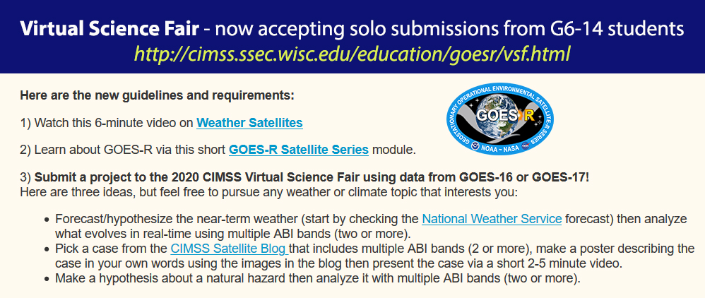
Revised GOES Virtual Science Fair aims to Maximize Student Engagement: NOAA’s Cooperative Institute for Meteorological Satellite Studies (CIMSS) has streamlined the spring 2020 GOES-16/17 Virtual Science Fair (VSF) in response to the COVID-19 pandemic to maximize on-line student participation. In this time of universal distance learning, CIMSS has revised the VSF so G6-14 students can participate without in-person interaction with their teachers. New content and guidelines have been developed, including a short module on GOES-R Series Satellites (http://cimss.ssec.wisc.edu/education/goesr/goesr1.html)along with fewer requirements to encourage solo project submissions. Visit http://cimss.ssec.wisc.edu/education/goesr/vsf.html for more details. (M. Mooney, CIMSS, margaret.mooney@ssec.wisc.edu)
SSEC and CIMSS Scientists in the News: Scientists at the University of Wisconsin-Madison (UW) Space Science and Engineering Center (SSEC) and the Cooperative Institute for Meteorological Satellite Studies (CIMSS) provide expert commentary, interviews, and imagery to news media and participate in events to promote science. In the news this week: 1) A recent study led by CIMSS researcher Pei Wang investigated the impacts of missing data for predicting local severe weather and confirmed the importance of the most up-to-date conditional data prior to model runs. SSEC News published, "Reduced latency for improved forecasts." (https://www.ssec.wisc.edu/news/articles/12652/) 2) CIMSS Satellite Blog contributors Scott Bachmeier and Scott Lindstrom published posts on "Snow squalls across the Upper Midwest" (Apr. 9), "Cutoff low off the Southern California coast" (Apr. 8), "Tropical Cyclone Harold makes landfall on Vanuatu" (Apr. 5), "Thunderstorm with abundant hail over southwest Oregon" (Apr. 5), and "Signature of ice accrual across the Upper Midwest" (Apr. 4). Read more at the CIMSS Satellite Blog (https://cimss.ssec.wisc.edu/satellite-blog/). (P. Wang, CIMSS, E. Verbeten, SSEC, S. Bachmeier, CIMSS, S. Lindstrom, CIMSS, J. Phillips, SSEC, 608-262-8164)
 (Click image to enlarge)
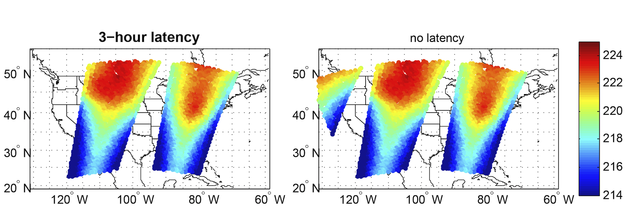
Figure: Data from METOP-A weather satellite shows differences in data coverage between 3-hour latency and no latency. Color bar represents temperature brightness in degrees Kelvin. Credit: Pei Wang, CIMSS
 (Click image to enlarge)
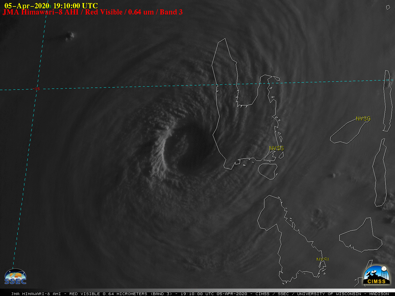
Figure: Tropical Cyclone Harold made landfall on the island of Espiritu Santo as a Category 4 storm on Apr. 5, 2020. Himawari-8 “Red” Visible (0.64 µm) images indicated deterioration of the eye after landfall. Credit: SSEC, CIMSS.
OTHER:
| Archived Weeklies Page | Submit a report item |