[ Archive ]
| CIMSS-NOAA Weekly Report [ Archive ] |
ASPB AND CIMSS WEEKLY HIGHLIGHTS FOR THE WEEK ENDING MAY 1, 2020
PRODUCTS AND APPLICATIONS:
AWARDS AND RECOGNITION:
PUBLICATIONS:
WORKSHOPS, CONFERENCES, AND MEETINGS:
TRAINING AND EDUCATION:
VISIT Training on NUCAPS Profiles: Scott Lindstrom from the Cooperative Institute for Meteorological Satellite Studies (CIMSS) gave Virtual Institute for Satellite Integration Studies (VISIT) training on NUCAPS (NOAA-Unique Combined Atmospheric Processing System) Profiles that are available in AWIPS at National Weather Service forecast offices. The training includes information on individual profiles, how they can be modified in AWIPS, and on gridded thermodynamic fields that are derived from the NUCAPS profiles. This live training was given to Ohio River Forecast Center Hydrologists. (Scott Lindstrom, CIMSS, 608 263 4425)
VISIT Training on Above-Anvil Cirrus Plumes: Scott Lindstrom from the Cooperative Institute for Meteorological Satellite Studies (CIMSS) gave Virtual Institute for Satellite Integration Studies (VISIT) training on Above-Anvil Cirrus Plumes (AACPs), features of strong convective storms. The presence of an AACP is very well-correlated with severe weather. AACPs can be identified in both visible and infrared imagery. This live training was given to Ohio River Forecast Center Hydrologists. (Scott Lindstrom, CIMSS, 608 263 4425)
MEDIA AND OUTREACH:
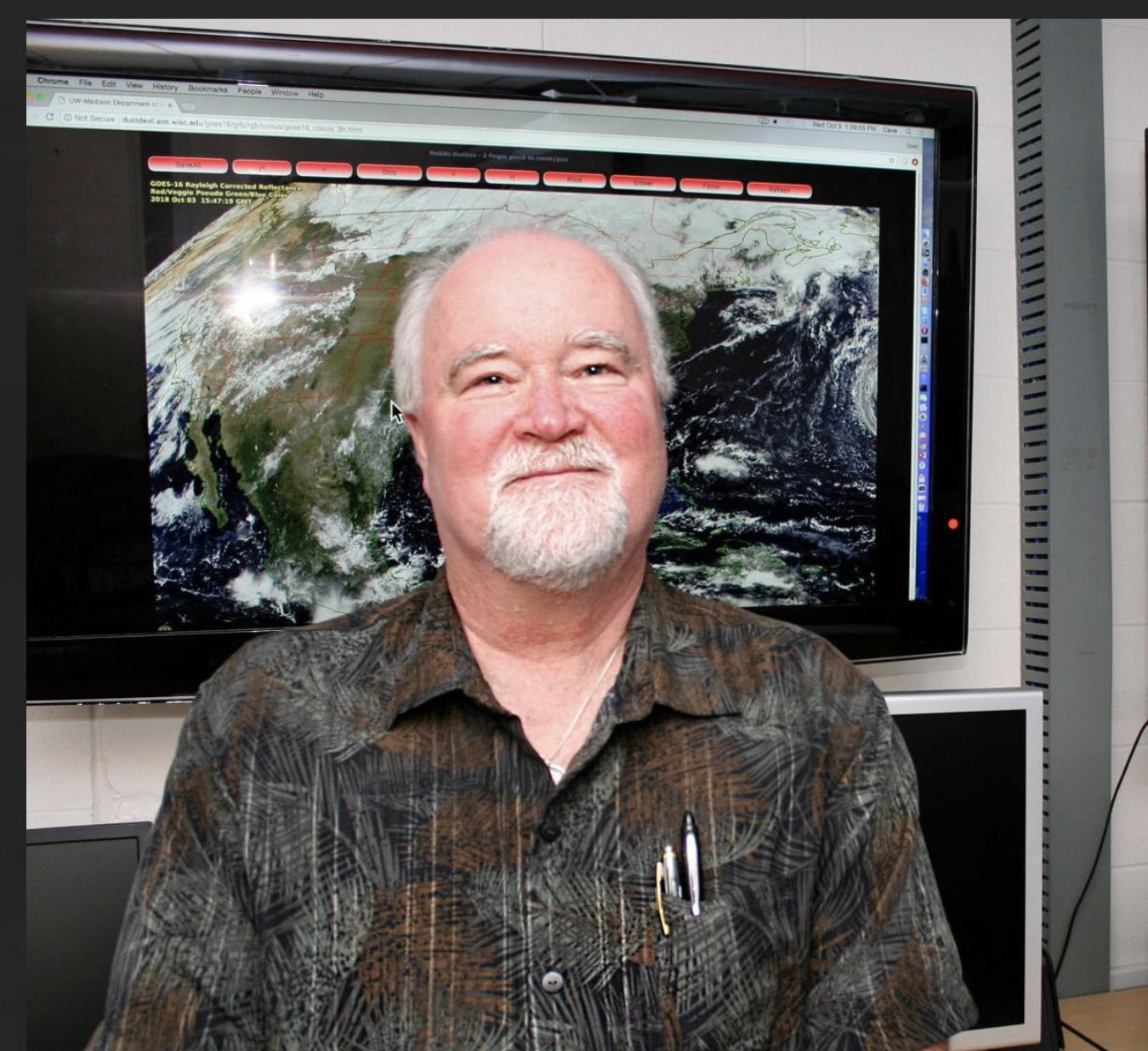
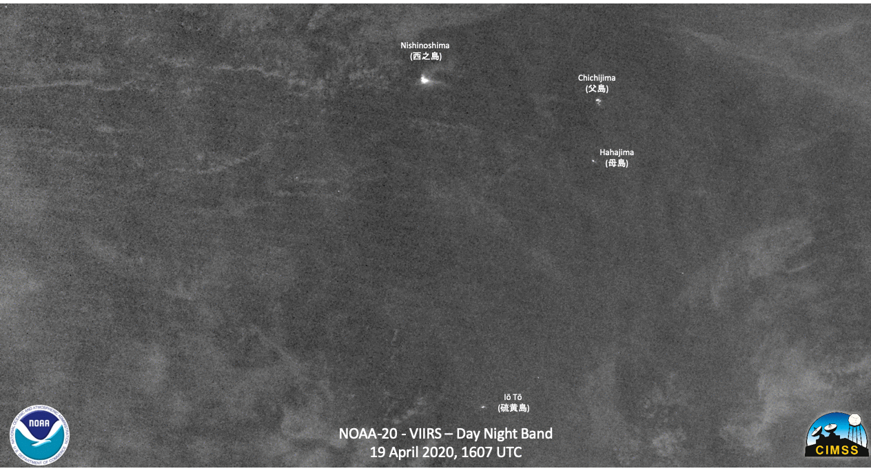
SSEC and CIMSS Scientists in the News: Scientists at the University of Wisconsin-Madison (UW) Space Science and Engineering Center (SSEC) and the Cooperative Institute for Meteorological Satellite Studies (CIMSS) provide expert commentary, interviews, and imagery to news media and participate in events to promote science. In the news this week: 1) SSEC Director Brad Pierce talked with Madison's Cap Times about global air quality improvements during the COVID-19 pandemic. (https://go.wisc.edu/p2cr2f) 2) CIMSS Satellite Blog contributors Scott Bachmeier and Scott Lindstrom published posts on "30-second GOES-17 imagery of thunderstorms over Idaho" (Apr. 30), "30-second GOES-16 imagery of rapidly-developing severe thunderstorms" (Apr. 28), "Damaging winds from a severe thunderstorm in Texas" (Apr. 27), "VIIRS views volcanic activity at Nishinoshima in the western Pacific" (Apr. 27), "Prolific lightning-producing MCS in eastern Mexico" (Apr. 26)"Oil refinery fire in Venezuela" (Apr. 25), "Tropical Depression One-E forms in the East Pacific Ocean" (Apr. 24), and "GOES-17 Scanning designed to reduce heating-caused data outages" (Apr. 24). Read more at the CIMSS Satellite Blog: https://cimss.ssec.wisc.edu/satellite-blog/. (B. Pierce, SSEC, S. Bachmeier, CIMSS, S. Lindstrom, CIMSS, J. Phillips, SSEC, 608-262-8164)
 (Click image to enlarge)
Figure: SSEC Director Brad Pierce. Credit: SSEC.
 (Click image to enlarge)
Figure: NOAA-20 VIIRS data, along with the VIIRS Active Fire Product, showing a hot spot over a volcano on Nishinoshima, a small volcanic island (at 27.2471° N, 140.8779° E) about 150 km west of Chichijima. Credit: NOAA, CIMSS.
OTHER:
| Archived Weeklies Page | Submit a report item |