[ Archive ]
| CIMSS-NOAA Weekly Report [ Archive ] |
CIMSS AND ASPB WEEKLY HIGHLIGHTS FOR THE WEEK ENDING FEBRUARY 19, 2021
PRODUCTS AND APPLICATIONS:
AWARDS AND RECOGNITION:
PUBLICATIONS:
Paper on VIIRS Fusion Moisture Retrievals Published: A manuscript on “Improvement in tropospheric moisture retrievals from VIIRS through the use of infrared absorption bands constructed from VIIRS and CrIS data fusion” by E. Eva Borbas, Elisabeth Weisz, Chris Moeller, W. Paul Menzel, and Bryan A. Baum has been published in Atmospheric Measurement Techniques (https://doi.org/10.5194/amt-14-1191-2021). This paper investigates the use of these VIIRS plus CrIS fusion IR radiances, centered at 4.5, 6.7, 7.3, 9.7, 13.3, 13.6, 13.9, and 14.2 µm, to construct atmospheric moisture products (e.g., total precipitable water vapor, TPW, and upper tropospheric humidity, UTH) and evaluates their accuracy. TPW and UTH retrieved from hyperspectral sounder CrIS radiances are provided at the associated VIIRS sensor’s high spatial resolution (750m) and are compared subsequently to collocated operational Aqua MODIS and Suomi-NPP VIIRS moisture products. This study suggests that the use of these fusion IR absorption band radiances will provide continuity with Aqua MODIS and overcomes one of the major deficiencies in the VIIRS determinations of atmospheric moisture. (POC: E. Borbas, CIMSS, 608-263-0228).
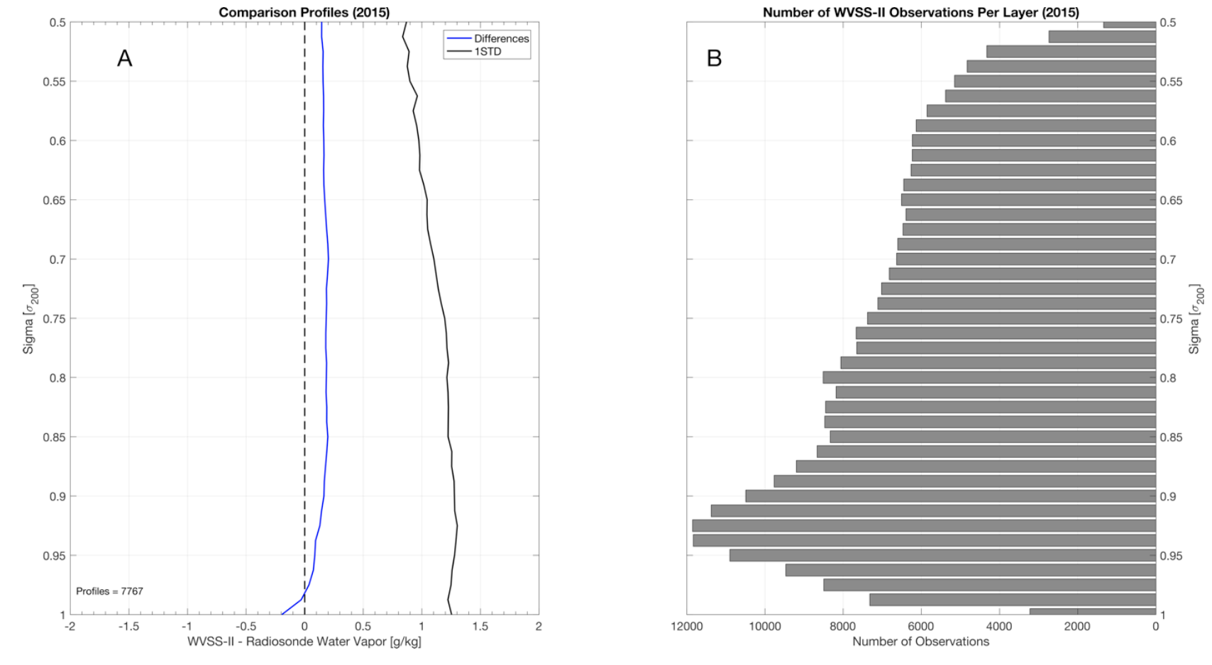
Paper on Aircraft Humidity Observations Accepted for Publication: Recent work performed by Cooperative Institute for Meteorological Satellite Studies (CIMSS) scientists in evaluating the quality of aircraft-based observations of humidity has been accepted for publication in the Journal of Atmospheric and Oceanic Technology. This work investigated the Water Vapor Sensing System -II (WVSS-II), a sensor jointly developed by NOAA and the private sector to augment existing aircraft observations with measurements of specific humidity. WVSS-II systems are deployed on approximately 100 Southwest Airlines and UPS aircraft across the United States. WVSS-II observations were found to be slightly moist compared to radiosondes, with a mean difference of only 0.2 g/kg and random differences randing from 1.3 g/kg near the surface to 0.9 g/kg at cruise level. More details can be found in the paper, available in early online release at: https://journals.ametsoc.org/view/journals/atot/aop/JTECH-D-20-0053.1/JTECH-D-20-0053.1.xml. (T. Wagner, CIMSS, 608-890-1980, R. Petersen, CIMSS, 608-263-4030).
 (Click image to enlarge)
Figure: (a) CONUS composite of all comparison profiles for 2015 with the average of the differences of WVSS-II minus radiosondes (blue) and standard deviation (STD, black) and (b) the number of WVSS-II observations per level.
WORKSHOPS, CONFERENCES, AND MEETINGS:
TRAINING AND EDUCATION:
MEDIA AND OUTREACH:
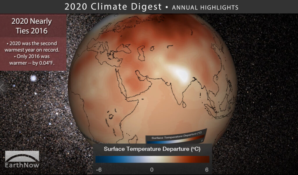
2020 Climate Digest for NOAA Science On a Sphere: The 2020 Climate Digest helps visualize how wildfire smoke and reduced human activity due to the pandemic affected global temperatures, featuring data from NOAA's National Centers for Environmental Information (NCEI) and ample satellite imagery, plus 100-years of global temperature anomaly. A legacy product from a NOAA Education grant awarded to the Cooperative Institute for Meteorological Satellite Studies (CIMSS), the 2020 Climate Digest consists of a short movie (3:51 minutes) made for Science On a Sphere® (SOS) exhibits and an MP4 video accessible through YouTube. More information is available at https://sphere.ssec.wisc.edu/2020-climate-digest/. (M. Mooney, CIMSS, margaret.mooney@ssec.wisc.edu, R. Kohrs, SSEC, C. Suplinski, SSEC)
 (Click image to enlarge)
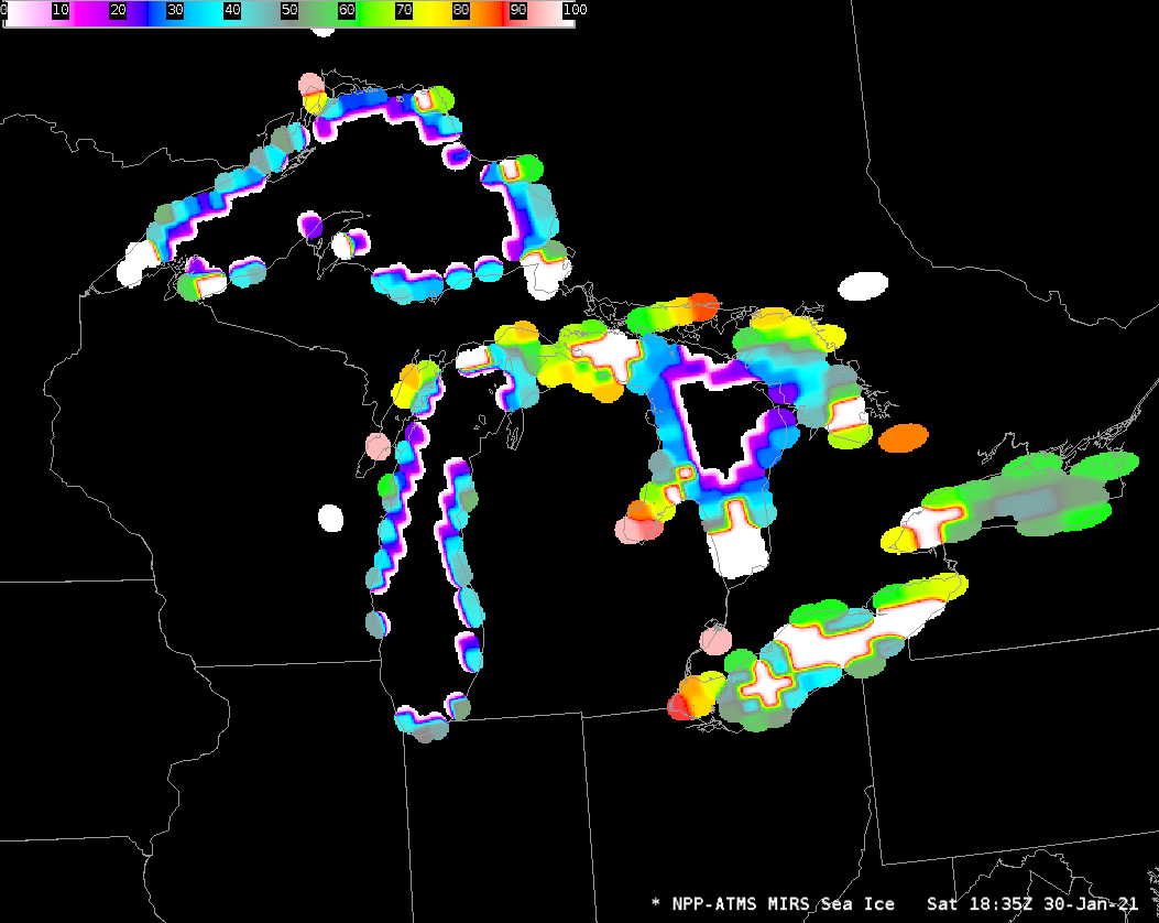
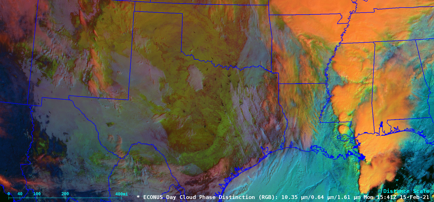
SSEC and CIMSS Scientists in the News: Scientists at the University of Wisconsin-Madison (UW) Space Science and Engineering Center (SSEC) and the Cooperative Institute for Meteorological Satellite Studies (CIMSS) provide expert interviews, imagery and case studies to promote science. This week: 1) CIMSS Satellite Blog contributors Scott Bachmeier and Scott Lindstrom published case studies on: "East Pacific storm, as viewed by GOES-17 and GOES-15" (Feb. 18), "Using ATMS data to observe lake ice coverage over the Great Lakes" (Feb. 16), "Arctic outbreak with snow cover extending to South Texas" (Feb. 15-16), "Comparing SAR wind data to GOES-16 ABI imagery" (Feb 15), and "Lake Michigan mesovortex" (Feb. 12). Read more: https://cimss.ssec.wisc.edu/satellite-blog/. (J. Phillips, SSEC, 608-262-8164, S. Bachmeier, CIMSS, S. Lindstrom, CIMSS)
 (Click image to enlarge)
Figure: Advanced Technology Microwave Sounder ice concentration over the Great Lakes derived from overlapping ascending Suomi-NPP passes on Jan. 30, 2021 and Feb. 15, 2021 in a CIMSS-produced format that can be used in AWIPS. Read more: https://cimss.ssec.wisc.edu/satellite-blog/archives/39935. Credit: CIMSS.
 (Click image to enlarge)
Figure: Following a surge of arctic air across the central US, GOES-16 Day Cloud Phase Distinction RGB images showed the extent of snow cover (brighter shades of green) across Oklahoma, New Mexico and Texas on Feb. 15, 2021. Read more: https://cimss.ssec.wisc.edu/satellite-blog/archives/39941. Credit: CIMSS, NOAA.
OTHER:
| Archived Weeklies Page | Submit a report item |