[ Archive ]
| CIMSS-NOAA Weekly Report [ Archive ] |
CIMSS AND ASPB WEEKLY HIGHLIGHTS FOR THE WEEK ENDING JULY 23, 2021
PRODUCTS AND APPLICATIONS:
AWARDS AND RECOGNITION:
PUBLICATIONS:
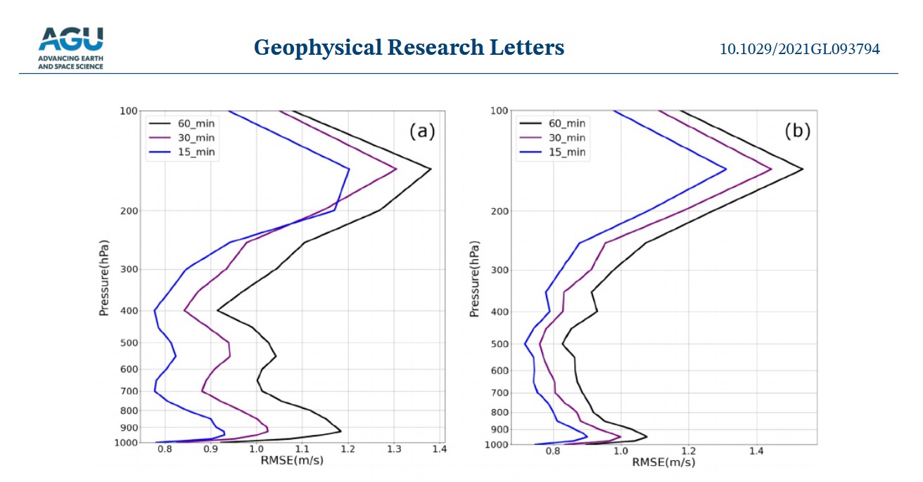
Paper Published on Deriving Winds from Hyperspectral Infrared Data: The manuscript "4-Dimensional Wind Fields From Geostationary Hyperspectral Infrared Sounder Radiance Measurements With High Temporal Resolution" for Typhoon Maria has been published in the Geophysical Research Letters (https://agupubs.onlinelibrary.wiley.com/doi/10.1029/2021GL093794). Using 15-min Geosynchronous Interferometric Infrared Sounder (GIIRS) observations, an algorithm has been developed for deriving atmospheric four-dimensional (4D) horizontal wind fields. The impacts were studied of cloudiness, temporal resolution, and temporal information on the 4D wind fields, respectively. Results indicate that both the temporal and spatial information contributes to the 4D wind fields, and higher temporal resolution provides better 4D wind fields than the lower temporal resolution. CIMSS co-authors are Jun Li (the corresponding author), Zhenglong Li and W. Paul Menzel, STAR co-author is Timothy J. Schmit. (T. Schmit, E/RA2, 608-263-0291)
 (Click image to enlarge)
Figure: JGR Figure 4 (top panels, (a) for Root Mean Square Error (RMSE) of U-component, (b) for RMSE of V-component) showing the 15-min cadence most improves the wind field for Typhoon Maria.
WORKSHOPS, CONFERENCES, AND MEETINGS:
TRAINING AND EDUCATION:
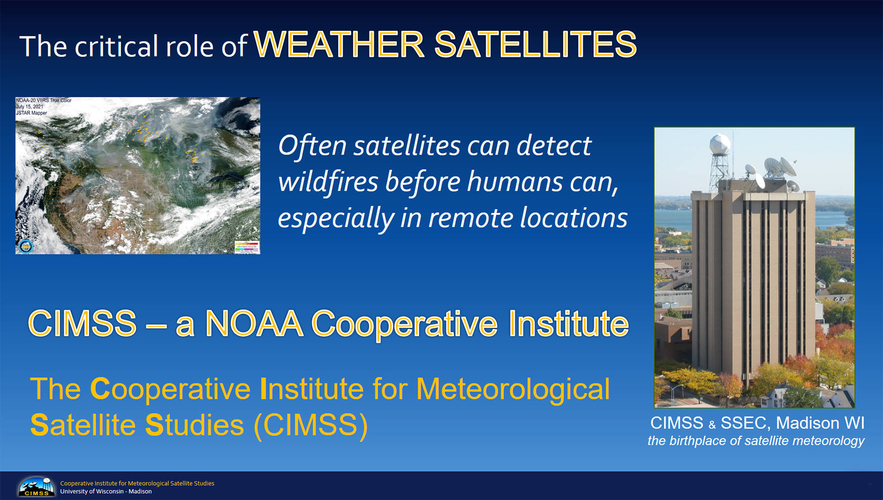
New Virtual Science Fair announced at the ESIP Teacher Workshop: Margaret Mooney from NOAA’s Cooperative Institute for Meteorological Satellite Studies (CIMSS) presented an interactive session on “Wildfires and Air Quality” at the annual Teacher Workshop held during the summer meeting of the Earth Science Information Partners (ESIP) July 20th and 21st. Over 40 educators attended the virtual event. Tools included the JSTAR Mapper and the VIIRS Today web site. Mooney also unveiled a new Virtual Science Fair for fall 2021 to engage students in grades 7-12 using data and imagery from the Visible Infrared Imaging Radiometer Suite (VIIRS). For more information see http://cimss.ssec.wisc.edu/education/jpss/. (M. Mooney, CIMSS, margaret.mooney@ssec.wisc.edu)
 (Click image to enlarge)
MEDIA AND OUTREACH:
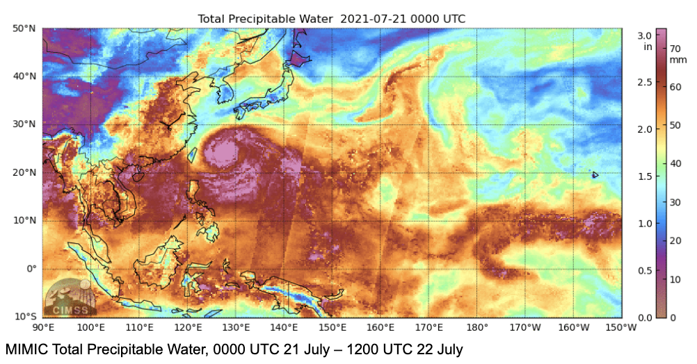
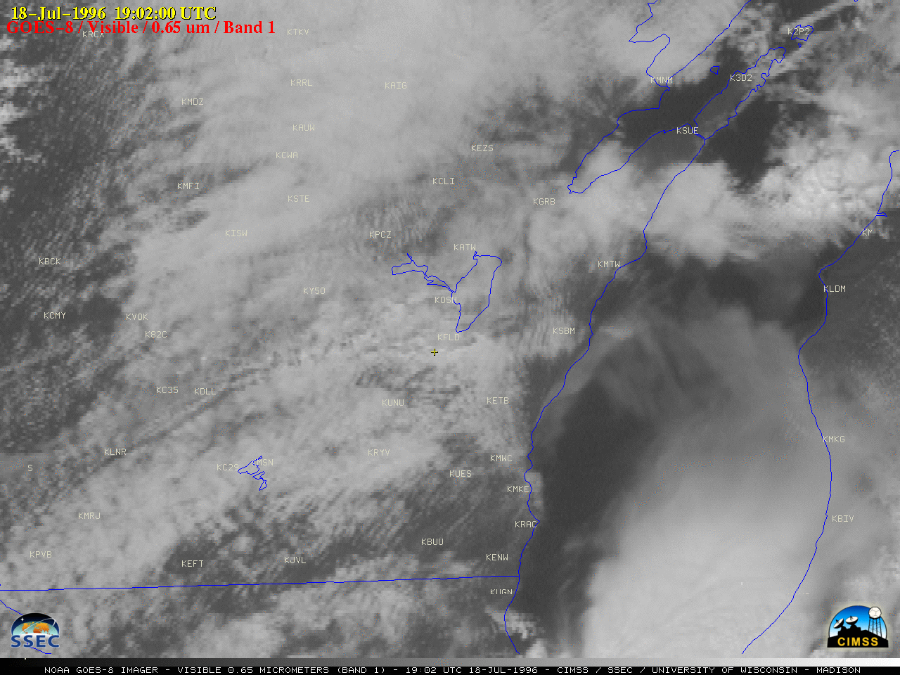
SSEC and CIMSS Scientists in the News: Scientists at the University of Wisconsin-Madison (UW) Space Science and Engineering Center (SSEC) and the Cooperative Institute for Meteorological Satellite Studies (CIMSS) provide expert interviews, imagery and case studies to promote science. This week: CIMSS Satellite Blog contributors Scott Linstrom and Scott Bachmeier published case studies on "Moist air over the tropical western Pacific Ocean" (July 22), "Aerosol Optical Depth and surface visibility" (July 22), "Pyrocumulonimbus clouds produced by the Dixie Fire in California" (July 19), "25th Anniversary of the Oakfield, Wisconsin F5 tornado" (July 18). (J. Phillips, SSEC, 608-262-8164, S. Lindstrom, CIMSS, S. Bachmeier, CIMSS)
 (Click image to enlarge)
Figure: Microwave estimates of total precipitable water over the Western Pacific Ocean on July 21-22, 2021 show a moist airmass — out of which Typhoon In-Fa emerged — over the western Pacific Ocean. Read more at the CIMSS Satellite Blog: https://cimss.ssec.wisc.edu/satellite-blog/archives/41617. Credit: MIMIC-TPW (Morphed Integrated Microwave Imagery at CIMSS - Total Precipitable Water), CIMSS.
 (Click image to enlarge)
Figure: An F5 tornado struck the village of Oakfield, WI on July 18, 1996. GOES-8 imagery showed the development of supercell thunderstorms as they moved east-southeastward across the area. Read the 25th anniversary post in the CIMSS Satellite Blog: https://cimss.ssec.wisc.edu/satellite-blog/archives/41526. Credit: CIMSS.
OTHER:
| Archived Weeklies Page | Submit a report item |