[ Archive ]
| CIMSS-NOAA Weekly Report [ Archive ] |
CIMSS AND ASPB WEEKLY HIGHLIGHTS FOR THE WEEK ENDING JANUARY 14, 2022
PRODUCTS AND APPLICATIONS:
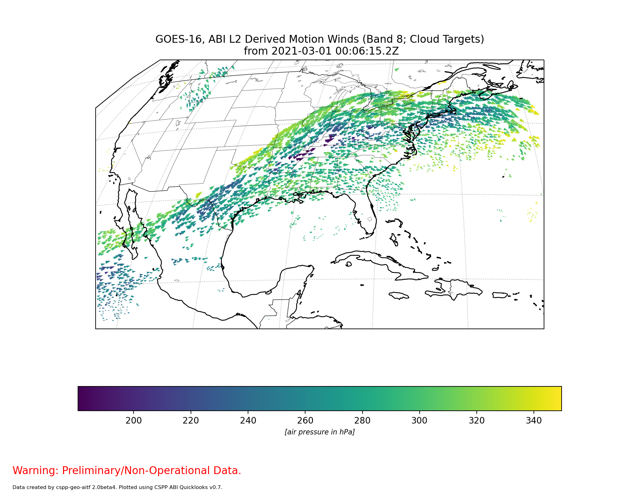
CSPP Geo ABI Level 2 Software Package Released: An initial beta version of the Community Satellite Processing Package for Geostationary Data (CSPP Geo) AIT Framework Version 2 software package was released. The software allows direct broadcast users to process data from the Advanced Baseline Imager (ABI) on GOES-R series satellites, generating Level 2 geophysical products in near real-time. Major new capabilities include Derived Motion Winds and Low Cloud and Fog products, science upgrades from baseline to enterprise algorithm versions, and GOES-17 support for a subset of products. The package was developed at the Cooperative Institute for Meteorological Satellite Studies (CIMSS), and incorporates product algorithms developed by the GOES-R Algorithm Working Group and a core processing system developed by the ASSISTT group at NOAA NESDIS. (G. Martin, CIMSS, 608-263-6794)
 (Click image to enlarge)
Figure: Quicklook image generated with CSPP Geo software, visualizing the GOES-16 Derived Motion Winds product.
AWARDS AND RECOGNITION:
PUBLICATIONS:
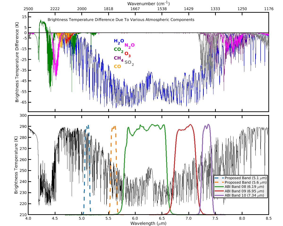
Paper Published Exploring Imaging using New Water Vapor Bands: A paper titled "Imaging considerations from a geostationary orbit using the short wavelength side of the mid-infrared water vapor absorption band" was published in Earth and Space Science (Miller, N. B., Gunshor, M. M., Merrelli, A. J., L'Ecuyer, T. S., Schmit, T. J., Gerth, J. J., & Gordillo, N. J. (2022), 9, e2021EA002080, https://doi.org/10.1029/2021EA002080). Current Advanced Baseline Imager bands 8-10 utilize the long wavelength side of the mid-infrared water vapor band for imaging water vapor in the troposphere. This paper explores two proposed bands at 5.6 and 5.1 micrometers. The weighting function of the proposed 5.6 micrometer band is very similar to the current Advanced Baseline Imager band 9, while offering the possibility of finer spatial resolution imagery. The proposed 5.1 micrometer band offers unique imagery of low-level water vapor useful to operational meteorologists that produce short-term forecasts. The paper simulates water vapor images for a case study on December 7, 2020 and considers the possible effects of solar reflection and surface temperature variability on observed brightness temperatures. (N. Miller, CIMSS)
 (Click image to enlarge)
Figure: The top panel indicates the spectral impacts (in brightness temperature difference) of seven gases of interest (colored lines) as measured in the U.S. standard atmosphere spectrum, caused by removing these atmospheric components individually in a forward model. The lower panel shows modeled brightness temperatures using the U.S. standard atmosphere and the spectral response functions of three GOES-16 Advanced Baseline Imager infrared bands and the two proposed bands at 5.1 and 5.6 micrometers. The short wavelength side of the water vapor band has fewer additional absorbing gases that could interfere with the detection of lower tropospheric water vapor.
WORKSHOPS, CONFERENCES, AND MEETINGS:
TRAINING AND EDUCATION:
VISIT Trainig on NUCAPS Profiles: Scott Lindstrom from the Cooperative Institute for Meteorological Satellite Studies (CIMSS) gave a Virtual Institute for Satellite Integration Training (VISIT) session on NUCAPS (NOAA-Unique Combined Atmospheric Processing System) Profiles that are available in AWIPS at National Weather Service forecast offices. The training includes information on how individual profiles are created and displayed, how they can be modified in AWIPS, and on gridded thermodynamic fields that are derived from the NUCAPS profiles, and on their use in the tropics. This live training was given to forecasters at the Key West FL Office (WFO KEY). (Scott Lindstrom, CIMSS, 608 263 4425)
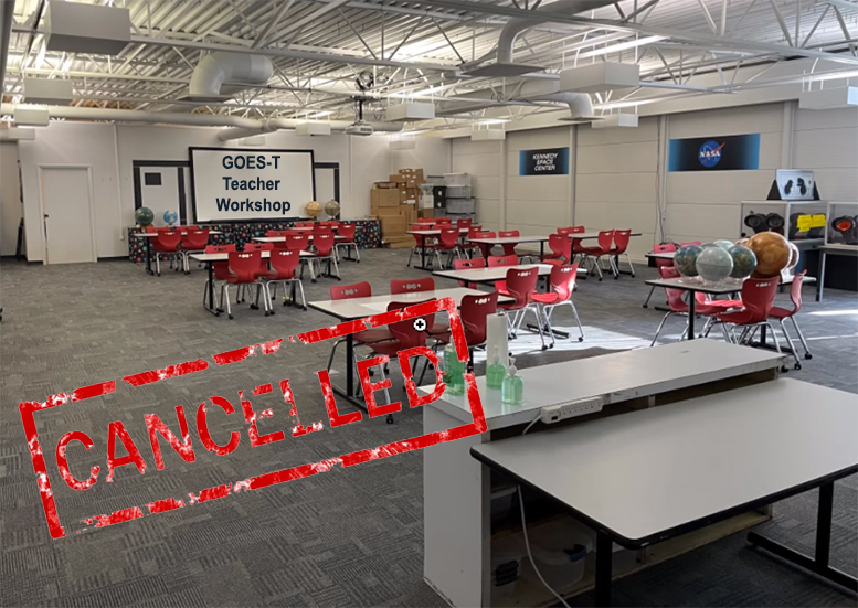
GOES-T Teacher Workshop at KSC converts to a Countdown to Launch Webinar : The GOES-T Teacher Workshop scheduled to take place at Kennedy Space Center the day before launch joins a long list of events cancelled due to the COVID19 pandemic. Twenty-two educators from eleven different states registered to attend. The new plan is a “Countdown to Launch” webinar on January 31st to support student engagement with GOES data for these teachers and potentially many more. Educators can register for the webinar via http://cimss.ssec.wisc.edu/education/goesr/GOES-T.html. (M. Mooney, CIMSS, margaret.mooney@ssec.wisc.edu)
 (Click image to enlarge)
MEDIA AND OUTREACH:
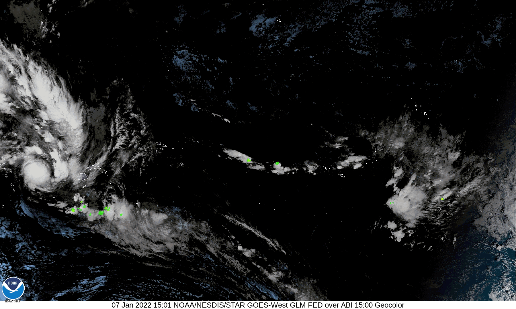
SSEC and CIMSS Scientists in the News: Scientists at the University of Wisconsin-Madison (UW) Space Science and Engineering Center (SSEC) and the Cooperative Institute for Meteorological Satellite Studies (CIMSS) provide expert interviews, imagery and case studies to promote science. This week: 1) "Hunga Tonga erupts again" (Jan. 13), "Potential “neutercane” in the Southeast Pacific Ocean" (Jan.12), "Sensing the surface in GOES-16 Water Vapor imagery" (Jan. 10), "SAR data for winds and ice over the Great Lakes" (Jan. 10), "Typhoon Tiffany makes landfall in Australia" (Jan. 9), "Eruption of Volcán Wolf in the Galápagos Islands" (Jan. 7), and "Tropical disturbance near Fiji" (Jan. 7). Read more at the CIMSS Satellite Blog: https://cimss.ssec.wisc.edu/satellite-blog/. (J. Phillips, SSEC, 608-262-8164, S. Bachmeier, CIMSS, S. Lindstrom, CIMSS)
 (Click image to enlarge)
Figure: GOES-16 Ash RGB images captured the expansion of two volcanic clouds following the eruption of Wolf Volcano in the Galápagos Islands on Jan. 7, 2022. More at the CIMSS Satellite Blog: https://cimss.ssec.wisc.edu/satellite-blog/archives/44140. Credit: CIMSS, Geo2Grid, NOAA.
 (Click image to enlarge)
Figure: GOES-17 Advanced Baseline Imager (ABI) and Geostationary Lightning Mapper (GLM) imagery over the Southern Pacific Ocean showing a region of potential tropical cyclogenesis to the west of Fiji on Jan. 7, 2022. More at the CIMSS Satellite Blog: https://cimss.ssec.wisc.edu/satellite-blog/archives/44120. Credit: NOAA.
OTHER:
| Archived Weeklies Page | Submit a report item |