[ Archive ]
| CIMSS-NOAA Weekly Report [ Archive ] |
CIMSS AND ASPB WEEKLY HIGHLIGHTS FOR THE WEEK ENDING SEPTEMBER 23, 2022
DATA, INFORMATION, AND USE-INSPIRED SCIENCE:
New Website Displays AMSR2 Winds for Pacific Regions: A new website was created by Alexa Ross of the Cooperative Institute for Meteorological Satellite Studies (CIMSS) that animates Advanced Microwave Scanning Radiometer 2 (AMSR2) windspeeds over three regions in the Pacific: Guam, American Samoa, and Hawaii. The site displays the past seven days of AMSR2 windspeed data and can be used as a quick reference to show recent animations over these areas. You can find the animations here: https://www.ssec.wisc.edu/~aross/Windspeed/PacificRegionWinds.html. (A. Ross, CIMSS, 608-263-6765)
FUTURE OUTLOOK:
AWARDS AND RECOGNITION:
TRAVEL AND MEETINGS:
TRAINING AND EDUCATION:
MEDIA INTERACTIONS AND REQUESTS:
SOCIAL MEDIA AND BLOG Posts:
SSEC and CIMSS Scientists in the News: Scientists at the University of Wisconsin-Madison (UW) Space Science and Engineering Center (SSEC) and the Cooperative Institute for Meteorological Satellite Studies (CIMSS) provide expert interviews, imagery and case studies to promote science. This week: 1. CIMSS Satellite Blog contributors Scott Bachmeier and Scott Lindstrom published these case studies: "Fiona intensifies to a Category 4 hurricane" (Sept. 21), "Atmospheric Bore structure over Wisconsin" (Sept. 20), "SAR data over Hurricane Fiona" (Sept. 19), "Parallax shifts in VIIRS views of Fiona" (Sept. 19), "Fiona becomes a Hurricane near Puerto Rico" (Sept. 18), "Ex-typhoon Merbok enters the Bering Sea" (Sept. 16) and "The extratropical transition of Typhoon Merbok" (Sept. 16). Read more at the CIMSS Satellite Blog: https://cimss.ssec.wisc.edu/satellite-blog/. (S. Bachmeier, CIMSS, S. Lindstrom, CIMSS, J. Phillips, SSEC, 608-262-8164)
 (Click image to enlarge)
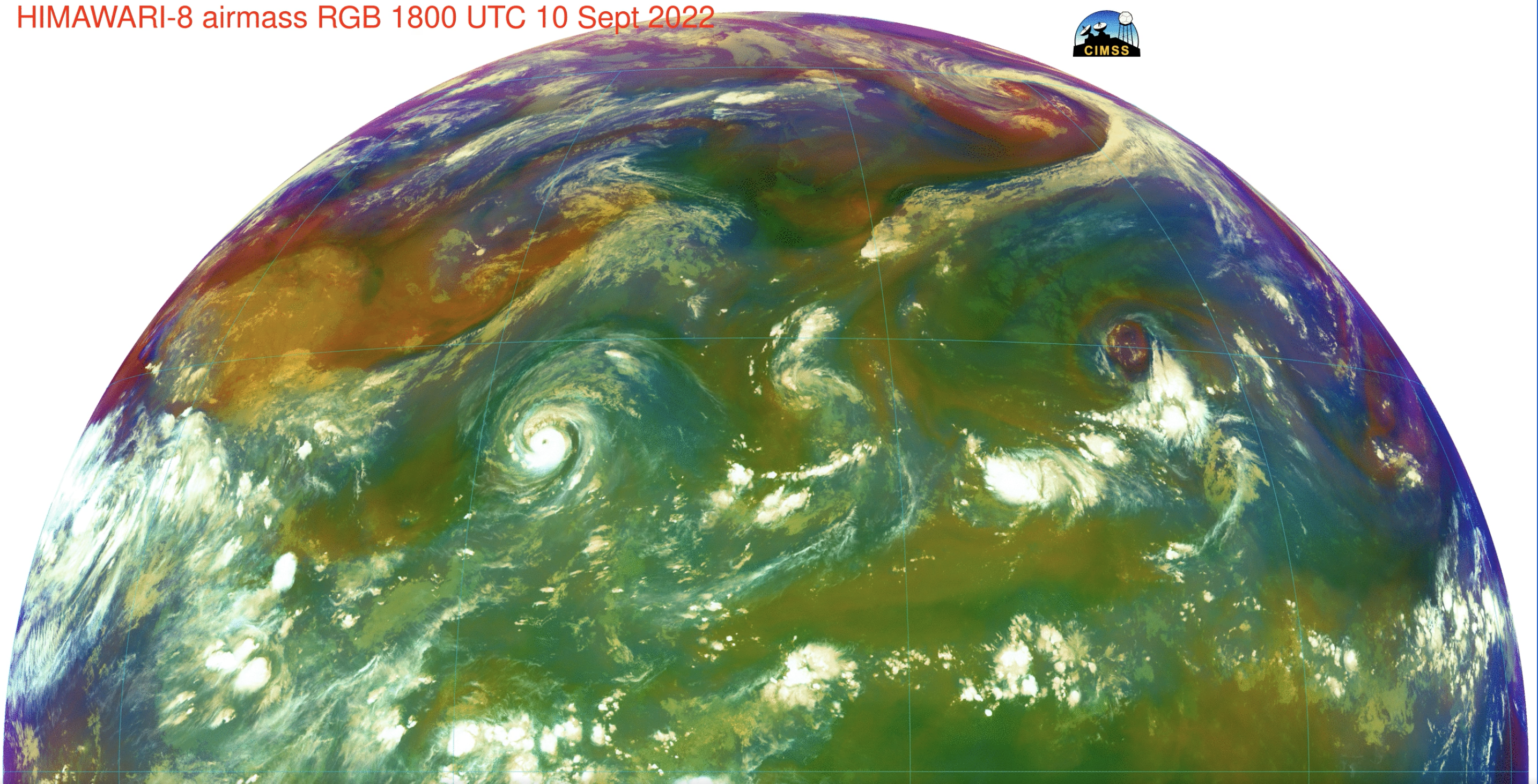
Figure: Typhoon Merbok became a very strong extratropical storm as it moved through the Bering Sea on Sept. 15-16, 2022. Himawari-8 images showed the development (in the eastern third of the domain) of the tropical cyclone and later, its subsequent interaction and merger with a mid-latitude system that moved out over the Pacific Ocean from Asia. Read more at the CIMSS Satellite Blog: https://cimss.ssec.wisc.edu/satellite-blog/archives/47922. Credit: JMA, CIMSS.
 (Click image to enlarge)
Figure: One-minute, visible and infrared imagery from GOES-16 showed Fiona as it intensified to a Category 4 Hurricane just east of The Bahamas on Sept. 21, 2022. Read more at the CIMSS Satellite Blog: https://cimss.ssec.wisc.edu/satellite-blog/archives/48009. Credit: NOAA, CIMSS.
PUBLICATIONS:
Geo Hyperspectral Sounder Paper Published: A paper titled “Applications of geostationary hyperspectral infrared sounder observations – progress, challenges, and future perspectives” by Jun Li et al. has been accepted for publication in the Bulletin of the American Meteorological Society. The focus of the paper is to provide direction on utilization of the current and assist preparation for the upcoming GeoHIS observations for nowcasting, NWP and other applications. The early version is online: https://journals.ametsoc.org/view/journals/bams/aop/BAMS-D-21-0328.1/BAMS-D-21-0328.1.xml. Citation: Li, J., W.P. Menzel, T.J. Schmit, and J. Schmetz, 2022, Applications of geostationary hyperspectral infrared sounder observations – progress, challenges, and future perspectives, Bull. Amer. Meteorol. Soc., early release, https://doi.org/10.1175/BAMS-D-21-0328.1. (W.P. Menzel, CIMSS, 608-263-4930)
OTHER:
| Archived Weeklies Page | Submit a report item |