[ Archive ]
| CIMSS-NOAA Weekly Report [ Archive ] |
CIMSS-NOAA WEEKLY HIGHLIGHTS FOR THE WEEK ENDING APRIL 4, 2025
DATA, INFORMATION, AND USE-INSPIRED SCIENCE:
FUTURE OUTLOOK:
AWARDS AND RECOGNITION:
TRAVEL AND MEETINGS:
TRAINING AND EDUCATION:
MEDIA INTERACTIONS AND REQUESTS:
SOCIAL MEDIA AND BLOG Posts:
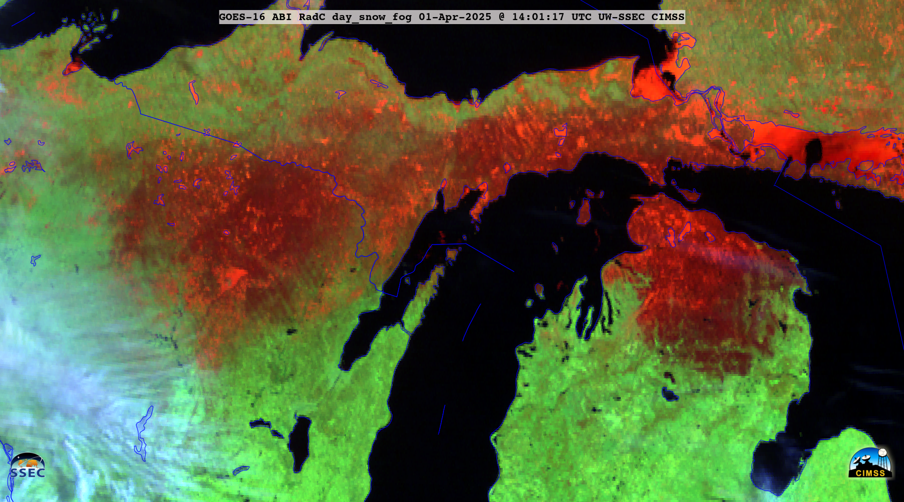
CIMSS Satellite Blog Updates: The Cooperative Institute for Meteorological Satellite Studies (CIMSS) Satellite Blog was updated with the following posts: "The Evolution of a Wisconsin Winter" (Mar. 28), "Strong solar flare captured by GOES-16 SUVI" (Mar. 28), "Eclipse over the northeast United States" (Mar. 29), "Satellite signature of ice accretion across parts of Minnesota, Wisconsin and Michigan" (Apr. 1), "GOES-19 is on station at the GOES-East location" (Apr 2), "Comparisons of 1-minute GOES-16 and GOES-19 imagery during a severe weather outbreak" (Apr. 2) and "Tornado Outbreak in South Central United States" Apr. 3). (S. Bachmeier, S. Lindstrom, CIMSS, 608.263.4425, T. Wagner, SSEC)
 (Click image to enlarge)
Figure: GOES-16 Day Snow-Fog RGB image at 1401 UTC on 01 April 2025, showing the signature of ice accretion (darker shades of red) from freezing rain/drizzle that had occurred across parts of Wisconsin and Michigan.
PUBLICATIONS:
OTHER:
| Archived Weeklies Page | Submit a report item |