[ Archive ]
| CIMSS-NOAA Weekly Report [ Archive ] |
CIMSS-NOAA WEEKLY HIGHLIGHTS FOR THE WEEK ENDING APRIL 11, 2025
DATA, INFORMATION, AND USE-INSPIRED SCIENCE:
FUTURE OUTLOOK:
AWARDS AND RECOGNITION:
TRAVEL AND MEETINGS:
TRAINING AND EDUCATION:
MEDIA INTERACTIONS AND REQUESTS:
SOCIAL MEDIA AND BLOG Posts:
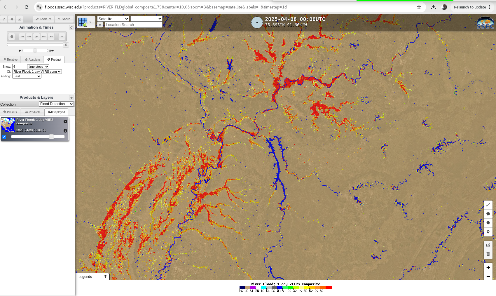
CIMSS Satellite Blog Entries for the week: Each week, scientists at the Cooperative Institute for Meteorological Satellite Studies (CIMSS) highlight meteorological events that have been captured by NOAA's fleet of Geostationary and Polar-orbiting satellites, showing how the satellite data and derived products can be used to describe the state of the atmosphere and ocean. For the week ending 11 April, those entries included "When you have an isolated thunderstorm, how can you tell that it’s not a volcanic eruption?" (created in collaboration with WFO Guam), "Warm patch of water in Lake Michigan", "Thermal signatures of prescribed burn activity in the Flint Hills of Kansas, as viewed from GOES-16 and GOES-19", "GOES-19 is now the operational GOES-East satellite", "Resuspended volcanic ash from the 1912 Novarupta-Katmai eruption", "Flooding along the Ohio River", "Standing wave south of the Aleutian Islands" (created in collaboration with WFO Juneau), and "Strong winds in the Gulf of Tehuantepec". (S. Bachmeier, S. Lindstrom, CIMSS; 608 263 4425)
 (Click image to enlarge)
Figure: VIIRS 1-day composite (8 April 2025) of the NOAA Flood Product.
PUBLICATIONS:
OTHER:
| Archived Weeklies Page | Submit a report item |