[ Archive ]
| CIMSS-NOAA Weekly Report [ Archive ] |
CIMSS-NOAA WEEKLY HIGHLIGHTS FOR THE WEEK ENDING APRIL 18, 2025
DATA, INFORMATION, AND USE-INSPIRED SCIENCE:
FUTURE OUTLOOK:
AWARDS AND RECOGNITION:
TRAVEL AND MEETINGS:
TRAINING AND EDUCATION:
MEDIA INTERACTIONS AND REQUESTS:
SOCIAL MEDIA AND BLOG Posts:
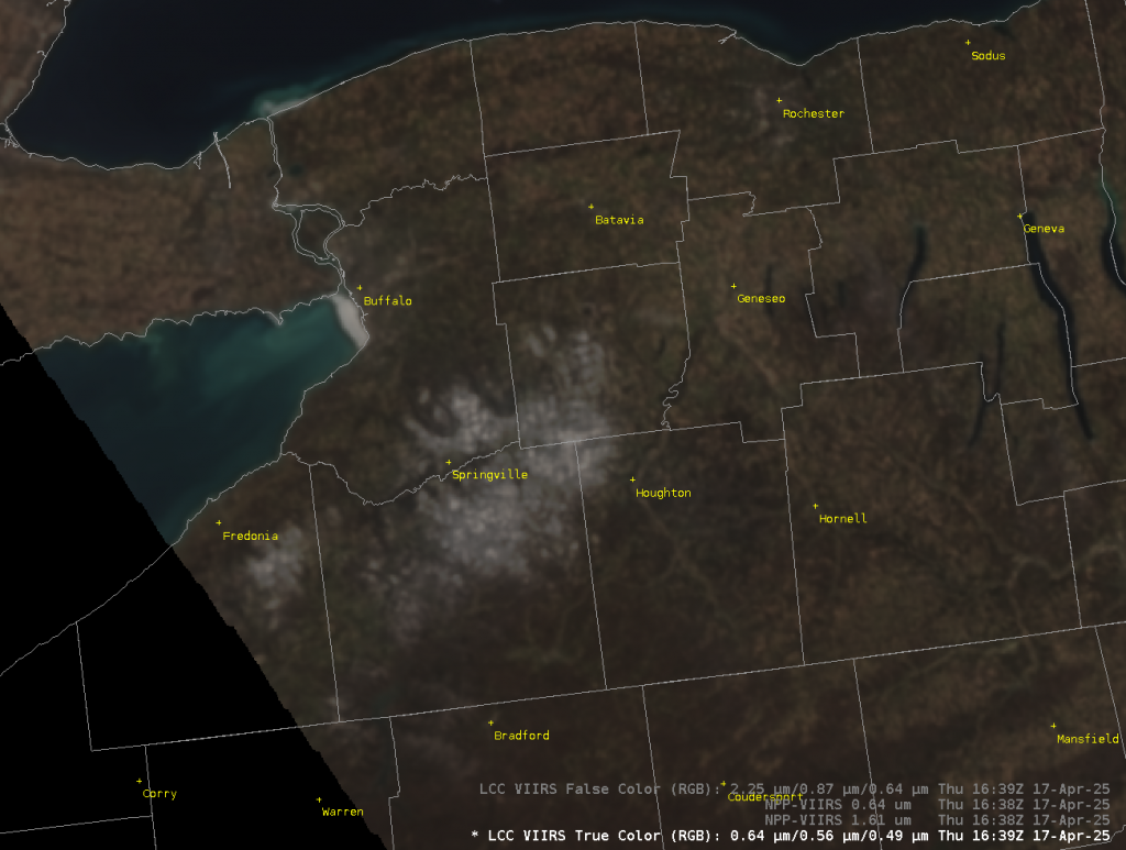
CIMSS Satellite Blog Updates: The Cooperative Institute for Meteorological Satellite Studies (CIMSS) Satellite Blog (https://cimss.ssec.wisc.edu/satellite-blog/) was updated with the following posts: "Detection of a prescribed burn near Flagstaff, Arizona using GOES-18 and GOES-19: NGFS vs FDCA" (April 9), "Direct Broadcast views of strong convection in the western Pacific Ocean" (April 10), "Forecasting for Flag Day Activities on American Samoa" (April 15), "Using NUCAPS profiles in lieu of missing upper air soundings" (April 15), "Cyclone Errol rapidly intensifies to Category 5 intensity off the coast of Western Australia" (April 16), "Timely VIIRS imagery at the CIMSS DBPS website" (April 16) and "Ice clings to life in the lower Great Lakes" (April 17). (S. Bachmeier, S. Lindstrom, CIMSS, 608.263.4425)
 (Click image to enlarge)
Figure: VIIRS True-Color imagery at 1639 UTC on 17 April 2025, showing ice in the far eastern end of Lake Erie.
 (Click image to enlarge)
Figure: JMA Himawari-9 Red Visible (0.64 µm, left) and Clean Infrared Window (10.4 µm, right) images at 0734 UTC on 16 April, displaying the pinhole eye of Cyclone Errol off the coast of Western Australia.
PUBLICATIONS:
OTHER:
| Archived Weeklies Page | Submit a report item |