[ Archive ]
| CIMSS-NOAA Weekly Report [ Archive ] |
CIMSS-NOAA WEEKLY HIGHLIGHTS FOR THE WEEK ENDING JULY 25, 2025
DATA, INFORMATION, AND USE-INSPIRED SCIENCE:
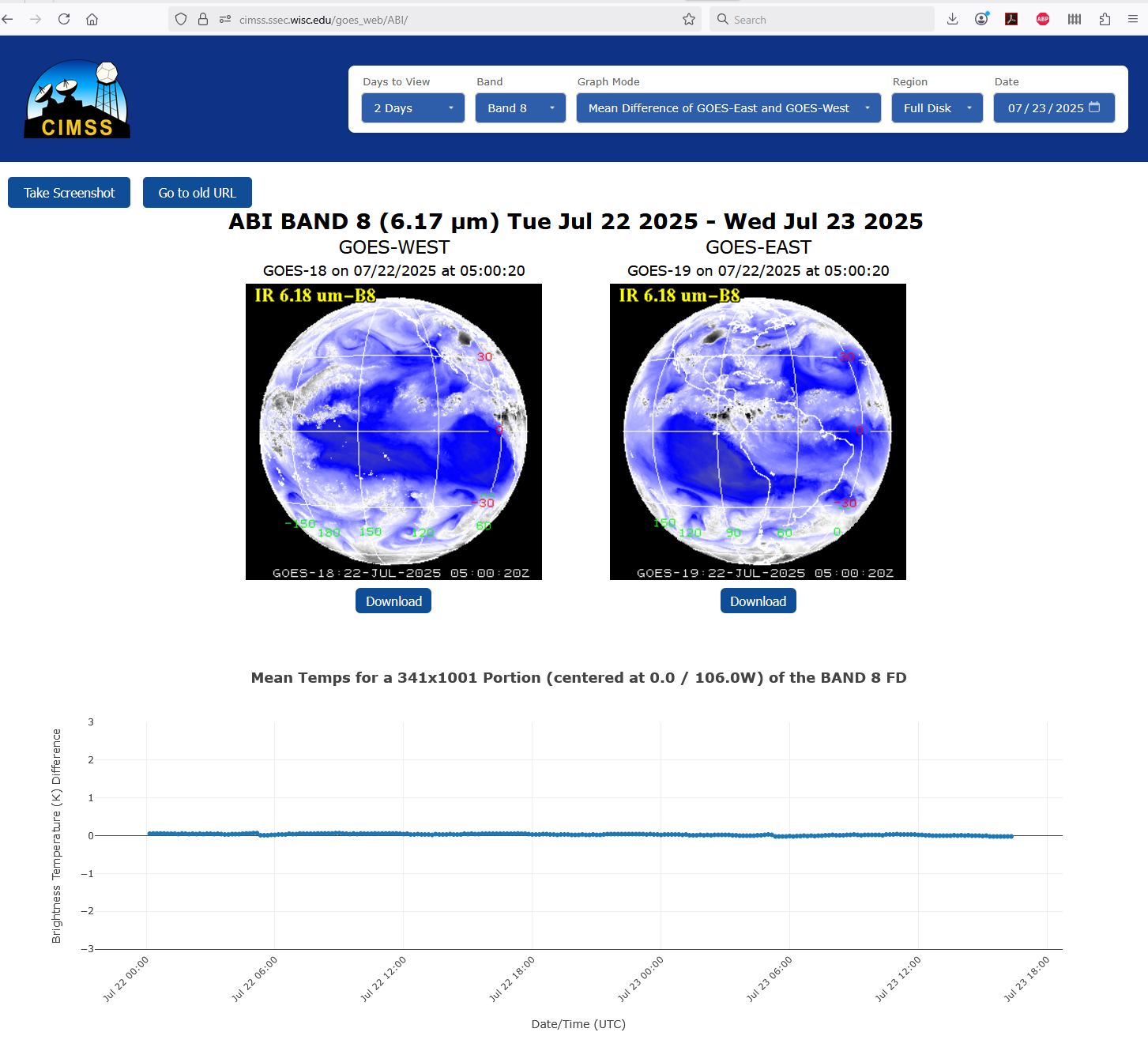
GOES-R Imagery Team Updates GEO-GEO Comparison Website: The GOES-R Imagery Team at the Cooperative Institute for Meteorological Satellite Studies (CIMSS) updated the near real-time GEO-GEO differences website with an interactive version that gives users more flexibility. GEO-GEO differences are used to monitor the relative calibration stability of the GOES-R Series Advanced Baseline Imagers (ABIs) and include statistics for CONUS and Full Disk sectors of all 16 bands of the ABI. The new site, developed by a student under the SSEC summer internship program, allows users to pick date ranges up to 7 days, zoom in on the timeseries, save figures as a png, and includes a tooltip readout. https://cimss.ssec.wisc.edu/goes_web/ABI/ (M. Gunshor, CIMSS, 608-263-1146, Clayton Suplinski, and ZamZam Haji)
 (Click image to enlarge)
Figure: Screenshot of the new GEO-GEO difference statistics web site for monitoring ABI calibration stability. The plot shows GOES-19 minus GOES-18 brightness temperature differences at the midpoint between the satellites, in this case for band 8 (6.17um) for July 22-23, 2025.
PEOPLE, AWARDS AND RECOGNITION:
TRAVEL AND MEETINGS:
TRAINING AND EDUCATION:
MEDIA INTERACTIONS AND REQUESTS:
SOCIAL MEDIA AND BLOG Posts:
CIMSS Satellite Blog Updates: The Cooperative Institute for Meteorological Satellite Studies (CIMSS) Satellite Blog (https://cimss.ssec.wisc.edu/satellite-blog/) was updated with the following posts: "Mesoscale Convective Vortex migrates from southern Arizona to southeast California" (July 18), "Tropical Convection to Bring Heavy Rainfall to Guam" (July 23) and "Severe thunderstorms cause ground stops at Chicago’s Midway and O’Hare airports" (July 24). (S. Bachmeier, 608-263-3958, T. Wagner, 608-890-1980, CIMSS)
 (Click image to enlarge)
Figure: MIMIC Total Precipitable Water image at 1300 UTC on 23 July 2025, showing the moisture distribution associated with Tropical Storm Francisco and Invest 98W in the West Pacific Ocean.
 (Click image to enlarge)
Figure: GOES-19 Visible image (with an overlay of GLM Flash Points and Peak Wind Gusts) at 2002 UTC on 24 July 2025, showing the severe thunderstorm that forced ground stops to aircraft operations at Chicago's Midway and O'Hare airports.
PUBLICATIONS:
OTHER:
| Archived Weeklies Page | Submit a report item |