Atmospheric winds
Measurements of atmospheric winds are of primary importance to weather forecasting, and as a variable in the study of global climate change as well as in a number of applications such as aviation flight planning. Horizontal wind may be inferred by motion vectors or by humidity tracers in geostationary imagery. While substantial information can be derived by these methods the quality is not homogeneous and vertical resolution is poor. Planned instruments for geostationary satellites promise improved information, but the limited vertical resolution and the problems of accurate height assignment of winds will remain areas to be improved.
For global NWP models, wind profile information - mostly overland - is available mainly from radiosondes. Doppler wind lidar technology is being developed to provide 3D winds of acceptable coverage and vertical resolution, but there are significant technical problems and thick cloud is a limitation. Geostationary imagers offer wind profile information by cloud tracking and in cloud-free areas through tracking of highly-resolved features in the water vapour channels. In the lower atmosphere, coverage may be supplemented in future by tracking ozone features in satellite imagery. Regional NWP models also rely heavily on radiosondes (overland) and aircraft (over ocean and over the poles) for atmospheric wind profile measurements, but would benefit from improved satellite data. In nowcasting, single level satellite wind information is sufficiently available over low and mid-latitudes to provide acceptable horizontal and temporal coverage, but vertical coverage is marginal and accuracy is acceptable to marginal.
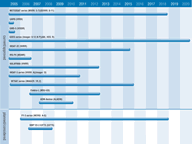
At present, geostationary multi-channel visible and infrared imagers such as IMAGER, MVIRI and VISSR are used to measure cloud and water vapour motion vectors from which tropospheric wind estimates may be derived. Atmospheric motion vectors generated from SEVIRI imagery on MSG provide improved data in terms of coverage, spatial and temporal resolution, and accuracy of both wind vectors and height assignment. Though valuable, because they offer wind information in areas of the world where otherwise there would be none, atmospheric wind vectors are only single level observations and are only available where there are suitable image features to be tracked. NASA will be demonstrating the technology for an advanced sounder generating wind information with GIFTS in 2006.
In the longer term, laser instruments such as Doppler lidars offer the promise of directly measuring clear air winds. Although such active instruments will provide high accuracy and vertical resolution, the coverage offered by polar missions such as that planned for ALADIN is likely to be limited.

