Landscape topography
Many modelling activities in Earth and environmental sciences, telecommunications and civil engineering increasingly require accurate, high-resolution and comprehensive topographical databases with, where relevant, indication of changes over time. The information is also used by, amongst others, land-use planners for civil planning and development; by hydrologists to predict the drainage of water and where floods are likely, especially in coastal areas. In their Third Assessment Report, ‘Climate Change 2001’, the IPCC predicts that global mean sea level may rise as much as 88cm by the end of the 21st century, compared to a rise of between 10 and 25cm, estimated during the 20th century. Potentially, sea level rise will have disastrous impacts on large, populous, low-lying coastal cities and deltaic areas such as Bangladesh - which may suffer severe flooding.
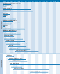
Satellite techniques offer a unique, cost-effective and comprehensive source of landscape topography data. At present, most information is obtained primarily from multi-band optical imagers and synthetic aperture radar (SAR) instruments with stereo image capabilities. The pointing capability of some optical instruments allows the production of stereo images from data gathered on single (eg by ASTER) or multiple (eg by SPOT series) orbits - which are then used to create digital elevation maps which give a more accurate depiction of terrain.
SARs can also be used in interferometric mode to detect very small changes in topography and have important applications in monitoring of volcanoes, landslides, earthquake displacements, and urban subsidence. Current missions include Envisat and RADARSAT-1. JAXA's ALOS mission planned for 2005 is significant since it carries both high precision optical and SAR topographic mapping instruments.
Radar altimeters can also provide coarse topographic mapping over land, and have been supplemented by a new generation of laser altimeters - such as GLAS (ICESat) which can provide landscape topography products with height accuracies of order 50-100cm, depending on slope.
The role of these satellites, and their importance in mitigating geo-hazards such as earthquakes, landslides, and volcanic eruptions, is the focus of the IGOS Geo-hazards Theme. The Geo-hazards Theme report is available from www.igospartners.org.

