Ocean topography/currents
Ocean surface topography data contains information that has significant practical applications in such fields as the study of worldwide weather and climate patterns, the monitoring of shoreline evolution, and the protection of ocean fisheries. Ocean circulation is of critical importance to the Earth’s climate system. Ocean currents transport a significant amount of energy from the tropics towards the poles leading to a moderation of the climate at high latitudes. Thus knowledge of ocean circulation is central to understanding the global climate. Circulation can be deduced from ocean surface topography, which may be readily measured using satellite altimetry. However, altimeters will only provide the geostrophic part of ocean currents unless the geoid is known more accurately, in which case it is then possible to measure large scale permanent ocean currents.
Using satellite altimetry, large scale changes in ocean topography, such as those in the tropical Pacific, may be observed. During an El Niño event, the westward trade winds weaken and warm, nutrient-poor water occupies the entire tropical Pacific Ocean. During the following La Niña the trade winds are stronger and cold, and nutrient-rich water occupies much of the tropical Pacific Ocean.
On a local scale, topographic information from satellites may be used in support of off-shore exploration for resources, oil spill detection and for optimising pipeline routing on the sea floor.
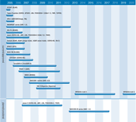
The TOPEX/POSEIDON and ERS missions have demonstrated that satellite altimetry may be utilised in a wide range of ocean research such as planetary waves, tides, global sea level change, seasonal-to-interannual climate prediction, defence, environmental prediction and commercial applications. TOPEX/POSEIDON can measure the height of ocean surface directly under the satellite with an accuracy of 4-5cms. The Jason-1 mission, launched in late 2001, is a follow-on to TOPEX/POSEIDON and aims to:
- provide a 5-year view of global ocean topography;
- increase understanding of ocean circulation and seasonal changes;
- improve forecasting of climate events like El Niño;
- measure global sea-level change;
- improve open ocean tide models;
- provide estimates of significant wave height and wind speeds over the ocean.
Information on ocean circulation may also be obtained indirectly from features such as current and frontal boundaries in SAR imagery, and by using differences in ocean temperature or ocean colour as observed by visible and infrared imagers.
In their Final Report, in early 2001, the IGOS Ocean Theme Team identified a long-term need for continuity of a high-precision mission (eg the JASON series) and a polar-orbiting altimeter (eg the ERS and Envisat series) to enhance temporal/spatial coverage of the global ocean. Planning of Jason-2 and of an altimeter on selected satellites of the NPOESS series will contribute to this objective.

