Snow cover, edge and depth
Regular measurements of terrestrial snow are important because snow dramatically influences surface albedo, thereby making a significant impact on the global climate; as well as influencing hydrological properties and the regulation of ecosystem biological activity. In its Third Assessment Report, ‘Climate Change 2001’, the IPCC found that - on the evidence of satellite data - there was likely to have been a decrease of about 10% in the extent of snow cover since the late 1960’s.
Snow forms a vital component of the water cycle. In order to make efficient use of meltwater run-off, resource agencies must be able to make early predictions of the amount of water stored in the form of snow. Coverage area, snow water equivalent, and snowpack wetness are the key parameters to be determined in this process.
Snow cover information has a range of additional applications such as in agriculture for detecting areas of winterkill, resulting from lack of snow cover to insulate plants from freezing temperatures. Locally, monitoring of snow parameters is important for meteorology, and for enabling warnings of when melting is about to occur - which is crucial for hydrological research and for forecasting the risk of flooding.
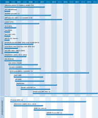
A range of different instrument types can contribute to measurements of snow. Visible/near-infrared satellite imagery provides information of good horizontal and temporal resolution and accuracy on snow cover in the day-time in cloud-free areas. AVHRR provides snow cover information and this will be continued in the future by VIIRS. MODIS data are being used to monitor the dynamics of large area (greater than 10km2) snow and ice cover and, on a weekly basis, to report the maximum area covered by both. The resulting snow maps should be available within 48 hours of MODIS data collection.
Passive microwave instruments such as SSM/I, AMSR, and CMIS will have all-weather and day/night monitoring capability and will be able to estimate the thickness of dry snow up to about 80cm deep.
Data from RADARSAT and ERS-2 have shown the usefulness of SAR remote sensing techniques to determine snow area extent and to monitor the physical conditions of snow. RADARSAT 2, Envisat, and ALOS will provide continuity of such snow information.

