Surface temperature (land)
As one of the key parameters in the physics of land surface dynamics, land surface temperature (LST) is a good indicator of the energy balance at the Earth’s surface. On a global scale, data on LST are used in conjunction with measurements of albedo as an input to climate change models, and to validate the surface physics elements of NWP models. On a local scale, surface temperature imagery may be used to refine techniques for predicting ground frost and to determine the warming effect of urban areas (urban heat islands) on night-time temperatures. In agriculture, temperature information may be used, together with models, to optimize planting times and to provide timely warnings of frost.
Measurements of surface temperature patterns may also be used in studies of volcanic and geothermal areas, and for forest fire detection and resource exploration.
Land surface temperature measurements are made using the thermal infra-red channel of medium/high resolution multi-spectral imagers in low Earth orbit. In addition, visible/infra-red imagers on geostationary satellites also provide useful information (with the advantage of very high temporal resolution). However, difficulties remain in converting the apparent temperatures as measured by these instruments into actual surface temperatures - variations due to atmospheric effects, and vegetation cover, for example, require compensation using additional imagery/information.
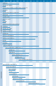
A number of capable sensors are currently operating or planned which will provide land surface temperature data including advanced sounders (IASI, HIRS/4) on operational meteorological platforms. On the NPOESS missions, VIIRS will combine the radiometric accuracy of AVHRR with the high spatial resolution of the DMSP’s OLS instrument, and the CMIS imager/sounder will measure thermal microwave emissions from land surfaces.
The Hot Spot Recognition Sensors (HSRS) on BIRD (launched 2001) has already demonstrated its value as a purpose-built fire detection instrument.

