Vegetation
Changes in land cover are important sources of global environmental change and have implications for ecosystems, biogeochemical fluxes and the global climate. Land cover change affects climate through a range of factors from albedo through to emissions of greenhouse gases from the burning of biomass.
Deforestation inter alia increases the amount of carbon dioxide (CO2) and other trace gases in the atmosphere. When a forest is cut and burned to establish cropland and pastures, the stored carbon joins with oxygen and is released into the atmosphere as CO2. The IPCC notes that about three-quarters of the anthropogenic emissions of CO2 to the atmosphere during the past 20 years was due to fossil fuel burning. The rest was predominantly due to land use change, especially deforestation.
IGOS has set up an Integrated Global Carbon Observation (IGCO) Theme (report available from www.igospartners.org) to develop a flexible, robust strategy for international global carbon observations over the next decade. A key component of IGCO is terrestrial carbon observations aimed at the determination of terrestrial carbon sources and sinks with increasing accuracy and spatial resolution. The IPCC has highlighted an improved understanding of carbon dynamics as vital in tackling one of the biggest environmental problems facing humanity. The IGCO work will be an essential input to the implementation of of the United Nations Framework Convention on Climate Change (UNFCCC), particularly on the role of natural sinks in meeting targets under the UNFCCC Kyoto Protocol.
Satellite observations allow scientists to track two key elements of Earth’s vegetation - the ‘Leaf Area Index’ (LAI) and the ‘Fraction of absorbed Photosynthetically Active Radiation’ (FPAR). LAI is defined as the one-sided green leaf area per unit ground area in broadleaf canopies, or as the projected needleleaf area per ground unit in needle canopies, and FPAR is the fraction of photosynthetically active radiation absorbed by vegetation canopies. Both LAI and FPAR are data necessary for understanding how sunlight interacts with the Earth’s vegetated surfaces.
Multiple types of satellite observations are used in agricultural applications. Satellite imagery provides information which can be used to monitor quotas and to examine and assess crop characteristics and planting practice - information on crop condition, for example, may also be used for irrigation management. In addition, data may be used to generate yield forecasts which in turn may be used to optimize the planning of storage, transport and processing facilities. Classification and seasonal monitoring of vegetation types on a global basis allows the modelling of primary production - the growth of vegetation that is the base of the food chain - which is of great value in monitoring global food security.
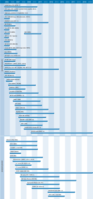
A number of radiometers provide measurements of vegetation cover, including AVHRR/3,MODIS, MERIS and the purpose-designed VEGETATION instrument. These instruments are helping production of global maps of surface vegetation for modelling of the exchange of trace gases, water and energy between vegetation and the atmosphere. Multi-directional and polarimetric instruments (such as MISR and POLDER) will provide more insights into corrections of land-surface images for atmospheric scattering and absorption and sun-sensor geometry, which will allow better calculation of vegetation properties.
Synthetic aperture radars (SARs) are used extensively to monitor deforestation and surface hydrological states and processes. The ability of SARs to penetrate cloud cover and dense plant canopies make them particularly valuable in rainforest and high-latitude boreal forest studies.
Instruments such as ASAR, SAR (RADARSAT), and PALSAR will provide data for applications in agriculture, forestry, land cover classification, hydrology and cartography amongst others.

