Wave height and spectrum
The state of the sea and surface pressure are two features of the weather that are important to commercial use of the sea (eg ship routing, warnings of hazards to shipping, marine construction, off-shore drilling installations and fisheries). Information on surge height at the coast is key to the protection of life and property in coastal habitats.
Measurements of wave height and spectrum are also used by oceanographers to investigate large-scale ocean features such as fronts and eddies and to construct and verify models of these phenomena. The processes behind these phenomena are complex and detailed measurements are vital to improving understanding. These data are also important for climate purposes as they are needed for the correct representation of turbulent air-sea fluxes.
Wave height is influenced by wind speed and direction over water. In the nowcasting context, ocean wave models are driven by NWP predictions of surface wind. However, errors in waves generated at large distances can accumulate. Improvements in forecasts, especially of long wavelength swell, can be achieved by assimilating observations from different sources. These are currently available from isolated buoys and from satellite altimeter and scatterometer data. In the absence of direct observations, initial wave state is deduced from the wind history. This is currently available over the sea from isolated buoys and from low-Earth-orbiting satellite scatterometer and microwave instruments.
For global NWP, ships and buoys provide observations of acceptable frequency and acceptable to marginal accuracy, but coverage is marginal or absent over large areas of the ocean. Altimeters on polar satellites provide information on significant wave height with global coverage and good accuracy, but horizontal/temporal coverage is marginal. Information on the 2D wave spectrum is provided by SAR instruments with good accuracy, but marginal horizontal/temporal resolution.
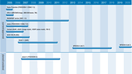
SAR instruments can accurately measure changes in ocean waves and winds, including wavelength and the direction of wave fronts, regardless of cloud, fog or darkness. The AMI SAR on ERS-2 has been operating in both wave and image mode, and the ASAR on Envisat continues to provide the ERS wave mode products, but with improved quality. PALSAR on JAXA’s ALOS mission will provide data on sea surface wind and wave spectrum required for oil spill analysis and for studies of coastal topography-air-sea interaction. The ScanSAR wave data supplied by RADARSAT will continue to be provided by RADARSAT 2.
Information from radar altimeters is limited to data on significant wave height. The altimeter on the Jason 1 mission, for example, provides such information.
In their January 2001 Report, the IGOS Ocean Theme Team recognized that SAR instruments currently provide information about the properties of the sea surface and the wave spectrum. Nevertheless the Team noted limitations to its use operationally and called for further development of these capabilities.

