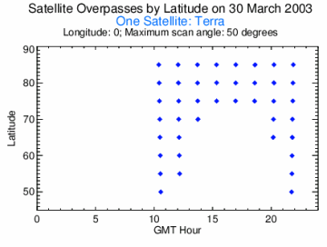
How often can we obtain wind vectors from a polar-orbiting satellite? Not surprisingly, the answer depends on the latitude and the number of satellites. The figures below show the overpasses on a specific day at a given latitude/longitude point over a 24 hour period with NASA's Terra satellite. At 50o N/S there are no views by consecutive overpasses (approximately a 1.5 hour orbit); there are 12 and 13 hour time periods with no coverage. At 80o the coverage is better, but there is still a 13 hour gap each day.

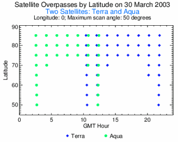
With two satellites (NASA's Terra and the future Aqua), however, the temporal coverage is much better (below). The largest time gap at 60o is 9 hours, though there are two such gaps. At 80o the largest data void is 1.5 hours, with multiple intervals of less than an hour.

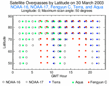
With five satellites the picture is very different. The figures below show the overpasses and the frequency of times between consecutive overpasses of Terra, Aqua, NOAA-15, NOAA-16, and the Chinese Fengyun C satellites. At 80o there are approximately 20 consecutive overpasses separated by less than 1 hour and no time gaps greater than 2 hours.

