| Download | Plots | Problems | Procedures |
The Polar Radiation Fluxes from ISCCP project involves the computation of surface and top-of-atmosphere (TOA) radiative fluxes using 3-hourly cloud, atmosphere, and surface data provided in the ISCCP (International Satellite Cloud Climatology Project) D1 data set. Coverage is for the Arctic and Antarctic, poleward of 57.5 degrees latitude, for the years of available ISCCP data (currently, 1985-1993).
Eleven flux quantities are produced. They are (W/m2):
More details on the processing procedure, including important assumptions
and approximations, can be found in the PRF Procedure
Manual.
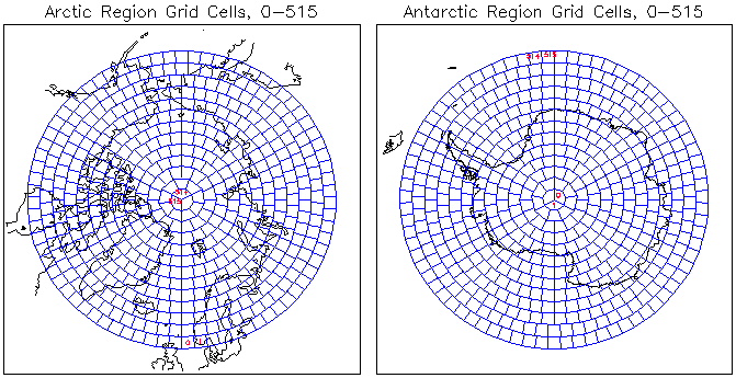
The fluxes are generated every 3 hours for 516 grid cells in each polar region, extending from each pole down to 57.5 degrees latitude. The grid structure is an equal area mapping, with cell size defined by the area of a 2.5 x 2.5 degree region at the equator, giving an equivalent square cell of side 280 km. It is the same grid used by the ISCCP; see their DX/D1/D2 data set documentation (1996) for details. The figure below shows the cell grids for each pole. Since it is not a square array grid, the output is not formatted as a square array (image) structure; rather, geographic coordinates of each of the 516 locations are provided in a separate array.
Fluxes are computed on a three-hourly time scale. However, satellite coverage limitations have left rather large holes in the 3-hourly ISCCP D1 data - generally, about one third of either polar region has no ISCCP data reported for any given 3 hour period and therefore no fluxes.
From the 3-hourly data, we have produced spatially comprehensive daily
and monthly average data sets. These data sets are currently
available online. Special requests for three-hourly data will be handled on a
case-by-case basis.